

COLUMBIA, S.C. — Scattered showers and storms are possible this afternoon and this evening. Drier air will move into the area on Wednesday. Temperatures will be a little cooler tomorrow. Mainly sunny conditions are expected Thursday and Friday.
There were a few showers and storms on Monday afternoon. High temperatures were in the lower 90s for most of the area. Heat index values were once again in the 100-degree range. Today will be a little cooler. Temperatures will be in the middle to upper 80s today.
Showers and storms are forecast to develop this afternoon. The Storm Prediction Center has the Midlands under a marginal risk for severe weather today.

A marginal risk (Level 1 out of 5) of severe weather means isolated severe thunderstorms are possible but limited in duration, coverage, and/or intensity.
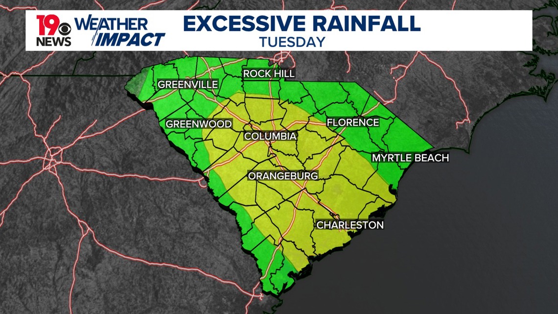
If a strong or severe thunderstorm develops, the greatest threat will be damaging wind gusts. The Weather Prediction Center also has most of the Midlands at a slight risk of excessive rainfall.
This means scattered flash flooding is possible. Mainly localized. Most vulnerable are urban areas, roads, small streams, and washes. Isolated significant flash floods are possible.

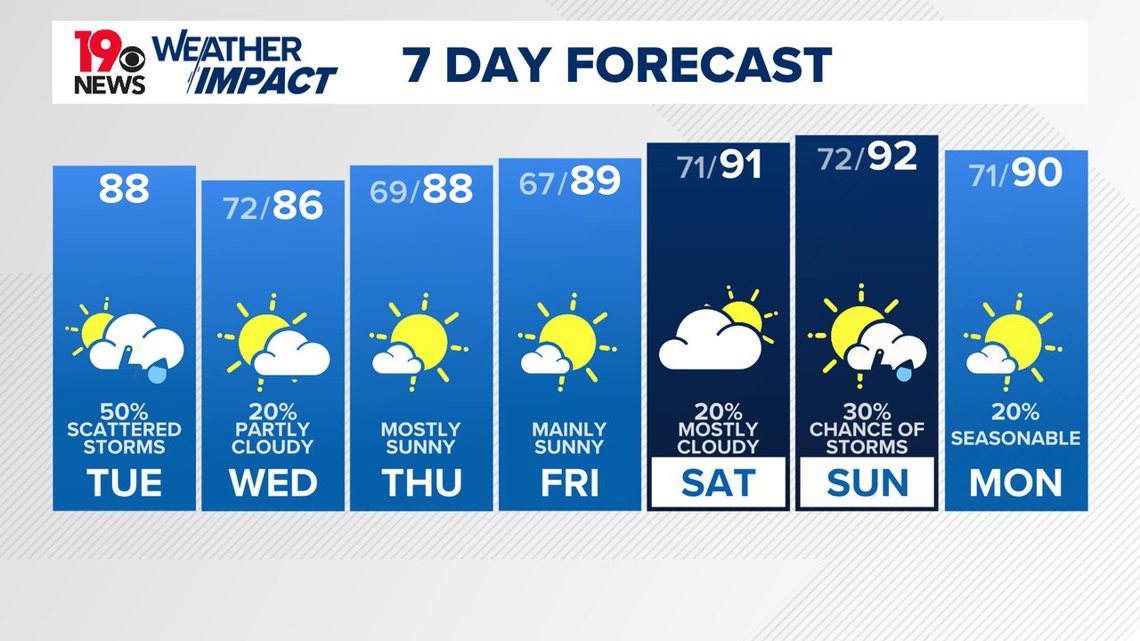
On Wednesday, a front will move towards the coast. This means there will be a small chance of showers and thunderstorms, mainly along and south of I-20, with a slight chance elsewhere. Drier air will move in, reducing the risk of heavy rainfall.
The potential for severe thunderstorms is low due to stable mid-level temperatures. Highs on Wednesday will be in the middle 80s.
Mainly sunny skies are forecast Thursday through Friday. High temperatures will be in the upper 80s. Low temperatures are expected to drop into the middle to upper 60s.