
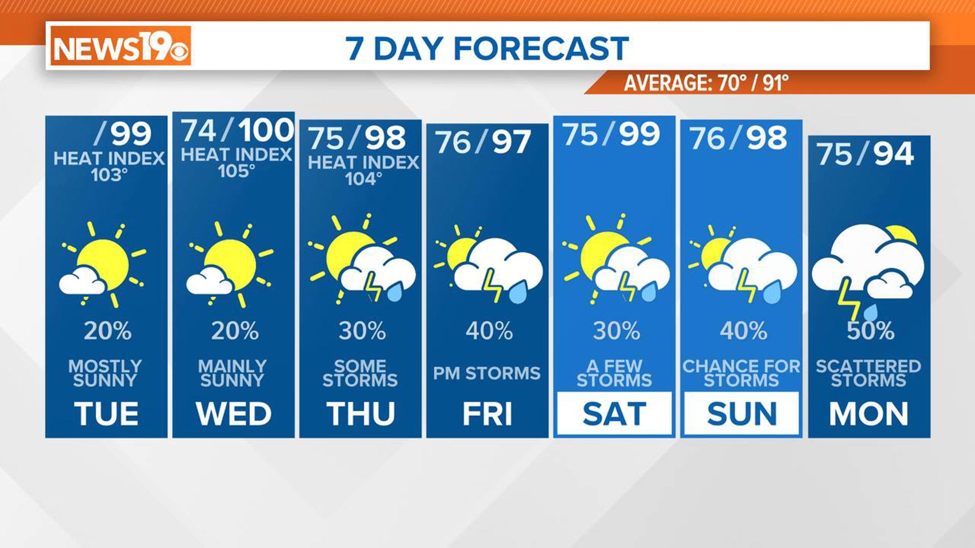
COLUMBIA, S.C. — Very hot temperatures and high humidity will continue to dominate the weather. Here is what you can expect over the next few days, along with some important details to help you prepare for the unseasonably hot conditions.
Temperatures are set to climb into the upper 90s, potentially reaching around 100 degrees today. Although the air will be drier, with dew points in the mid to upper 60s, heat index values will still hit the triple digits for most areas.
While most of the Midlands will stay dry, there is a chance of isolated storms developing near a stationary front positioned in the eastern part of the area. Tonight, temperatures will remain mild, with lows in the low to mid-70s, so it will be a warm night as well.


The heat continues Wednesday, with heat index values ranging from 100 to 105. During the afternoon and early evening, expect widely scattered thunderstorms, particularly in the southeast Midlands.
By nightfall, a frontal boundary will lift north and become stationary, resulting in increased moisture along the coast and the southern Midlands. Once again, high temperatures will approach 100 degrees. Despite an upper trough moving east, storm activity will likely be limited to areas near the front and sea breeze.
Thursday is shaping up to have the highest chances for showers and thunderstorms, some of which could be severe with the potential for wind damage. The heat will persist, with high temperatures in the upper 90s.
An upper trough will move into the region, bringing increased moisture and reducing the capping effect, which could support stronger pop-up severe storms. The convergence of these conditions makes Thursday a day to stay alert for possible severe weather.
As we head into the weekend, heat impacts will intensify, with heat index values climbing to 105–110 degrees. Scattered afternoon thunderstorms are expected each day. An upper ridge will strengthen, leading to rising temperatures through the weekend.

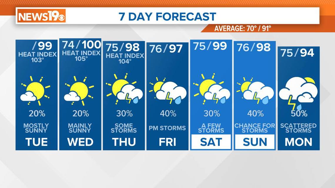
This ridge will cause subsidence, or downward air movement, which might limit storm activity until Saturday. Another front is expected to move into the area late in the weekend or early next week, potentially bringing a higher chance of showers and cooler temperatures.
It is important to take precautions during this period of intense heat. Make sure you stay hydrated, seek shade or air conditioning whenever possible, and keep an eye on the weather forecasts for updates on storm activity and heat advisories. With temperatures remaining high and the potential for severe weather, staying informed and prepared is crucial.