

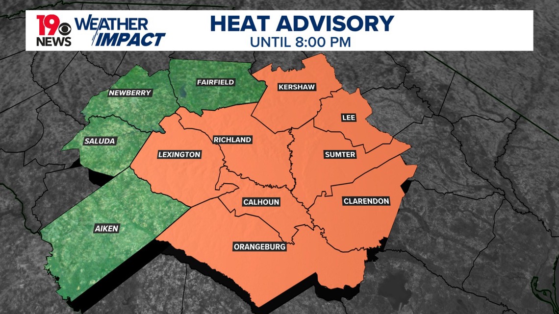
COLUMBIA, S.C. — Most of the Midlands is under a heat advisory, due to heat index values reaching 105–110° this afternoon. A few showers and thunderstorms are possible in the afternoon and evening.
The main story today is the intense heat, with a southwesterly flow maintaining high temperatures around 100° across the area. Slightly drier air from the west may move into the state, but heat index values are still expected to be in the 105–108° range, particularly east of I-26.

Heat Safety Tips
- Stay Hydrated and Cool: Drink plenty of fluids and stay in an air-conditioned room. Avoid being outside in the sun for extended periods. Check on relatives and neighbors to ensure they are safe and comfortable.
- Protect Children and Pets: Never leave young children or pets in unattended vehicles. Car interiors can reach deadly temperatures within minutes.
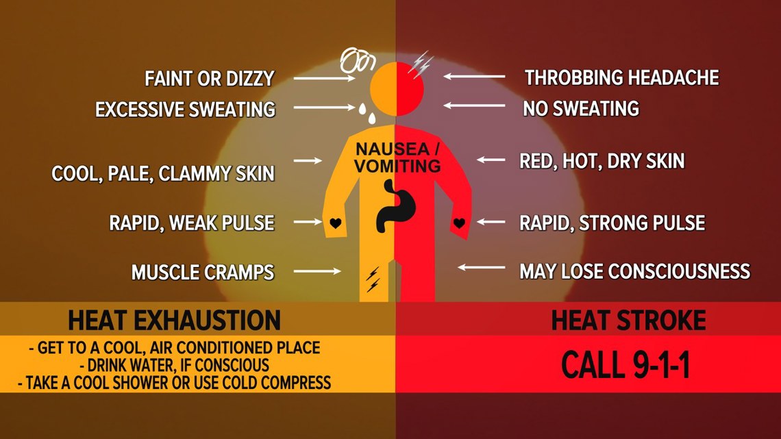
- Outdoor Precautions: When outside, wear lightweight and loose-fitting clothing. Try to limit strenuous activities to the early morning or evening. Be alert to signs of heat exhaustion and heat stroke and take action immediately if symptoms appear.
- Workplace Safety: The Occupational Safety and Health Administration (OSHA) advises taking frequent rest breaks in shaded or air-conditioned areas during outdoor work. If someone is overcome by the heat, move them to a cool, shaded location. A heat stroke is a medical emergency; call 911 immediately.

Like Sunday, isolated showers and thunderstorms are expected to develop this afternoon and evening. Some of the storms could produce gusty winds, but severe weather is not expected.
Expect increasing chances of mainly afternoon and evening showers and thunderstorms each day from Tuesday onward. High temperatures will be in the upper 90s to around 100 degrees, with the potential for another heat advisory on Tuesday.
By Tuesday and Wednesday, noticeable changes will occur as an upper-level trough begins to dig into the Upper Mississippi Valley and western Great Lakes. This will push a cold front into northern Kentucky by Wednesday. Meanwhile, the Bermuda High offshore will continue to pump moisture into the southeastern U.S., resulting in high humidity levels.

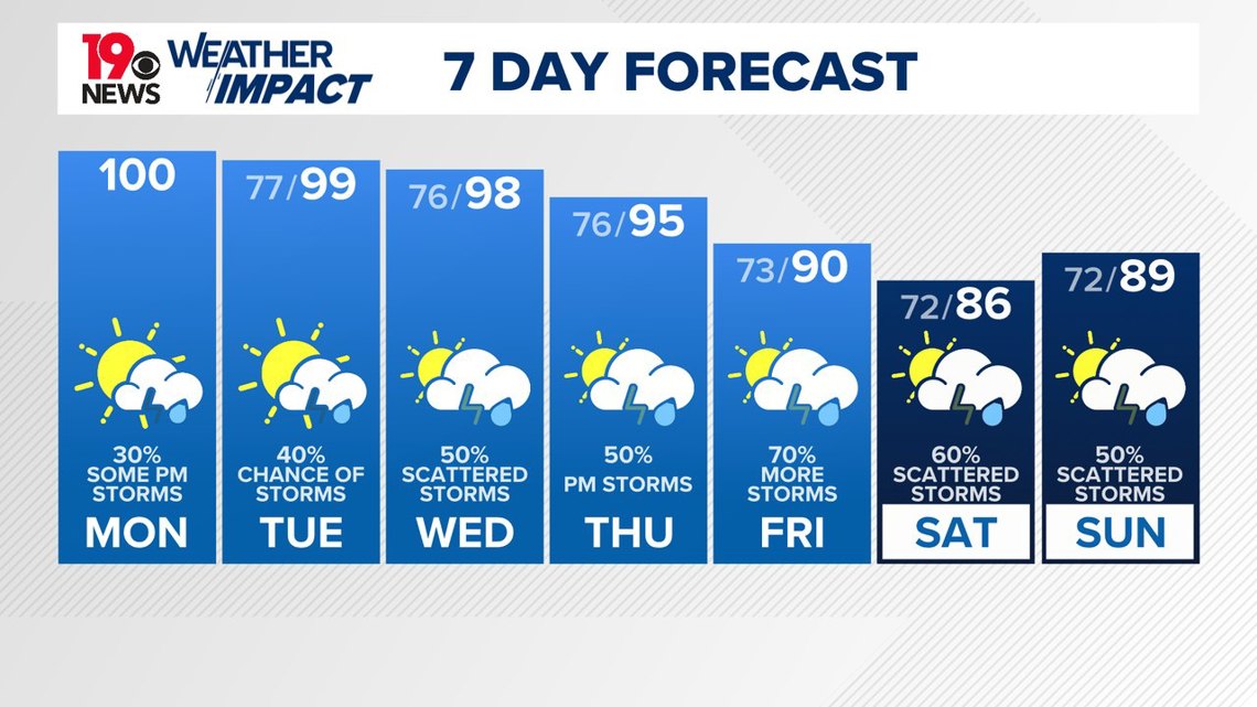
Although the atmosphere will be moderately unstable, a triggering mechanism for storms will still be lacking. Winds in the mid and upper levels will remain weak, leading to a potential for locally heavy rainfall and possible flooding with training cells.
Temperatures will stay in the upper 90s to around 100 on Tuesday, dropping to the upper-90s on Wednesday due to increasing clouds and potential showers. Heat index values will remain in the 105–108°F range on Tuesday, with overnight lows in the low to mid-70s.
A gradual cooling trend will continue into Thursday and Friday, with showers and thunderstorms expected each day. The upper-level pattern will become increasingly amplified, allowing the trough to dig further into the southeastern U.S. and linger over the eastern U.S.
The Bermuda High will stay in place, bringing moisture onshore and stalling a frontal boundary across the region. This setup will lead to daily chances of showers and thunderstorms, especially with shortwaves rotating through South Carolina.
As a result, high temperatures will lower a few degrees, with afternoon highs in the low to mid-90s on Thursday and mid-80s to around 90°F from Friday through Sunday.