COLUMBIA, S.C. — A tornado watch has been issued for the entire Midlands of South Carolina as the area is seeing severe weather that could bring some hazards to the region.
The watch is in effect until 6 p.m. and includes all of the Midlands, which are these counties: Calhoun, Clarendon, Fairfield, Kershaw, Lee, Lexington, Newberry, Orangeburg, Richland, Saluda, and Sumter.
To be clear, a watch means conditions are favorable for a tornado to form. A warning would be issued if a tornado is spotted by someone on the ground or is indicated on radar.
Already severe severe thunderstorm warnings have been issued, and more are expected as we go through the next several hours.
During the day, there will be a growing risk of severe weather as we go into and through the afternoon. Showers have already begun and there is a chance of severe thunderstorms, including heavy rainfall. High winds are expected, even without the thunderstorms.
A wind advisory is in effect until 10 p.m. for all of the Midlands and most of South Carolina. Gusty winds will blow around unsecured objects. The strong winds may cause some power outages and blow down tree limbs. Driving in such strong winds can be challenging, particularly for vehicles with a high profile. Use extra caution if you are going to be travelling today.

The cold front will cross the forecast area this afternoon and into early this evening as the storm system moves from southwest Missouri this morning into the eastern Great Lakes. There are still a lot of worries, the most important of which is the risk of tornadoes and strong to severe thunderstorms.
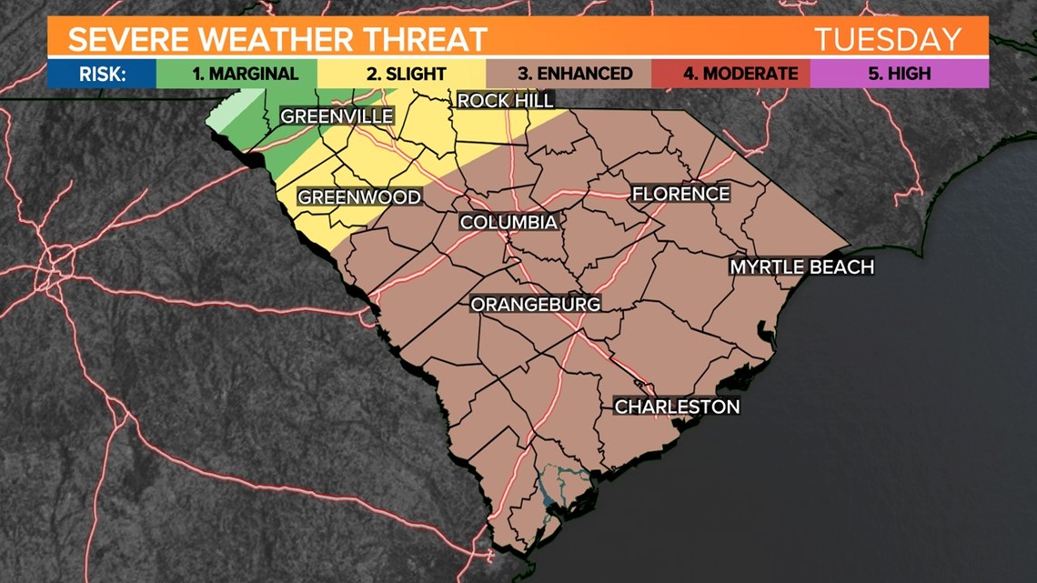
The Storm Prediction Center has most of the Midlands under an enhanced risk of severe weather today. Out of the five risk categories used by the center, this one is the third highest risk. Localized flooding may result from some of the thunderstorms, but because the storms will be moving quickly, the threat of flooding seems low.

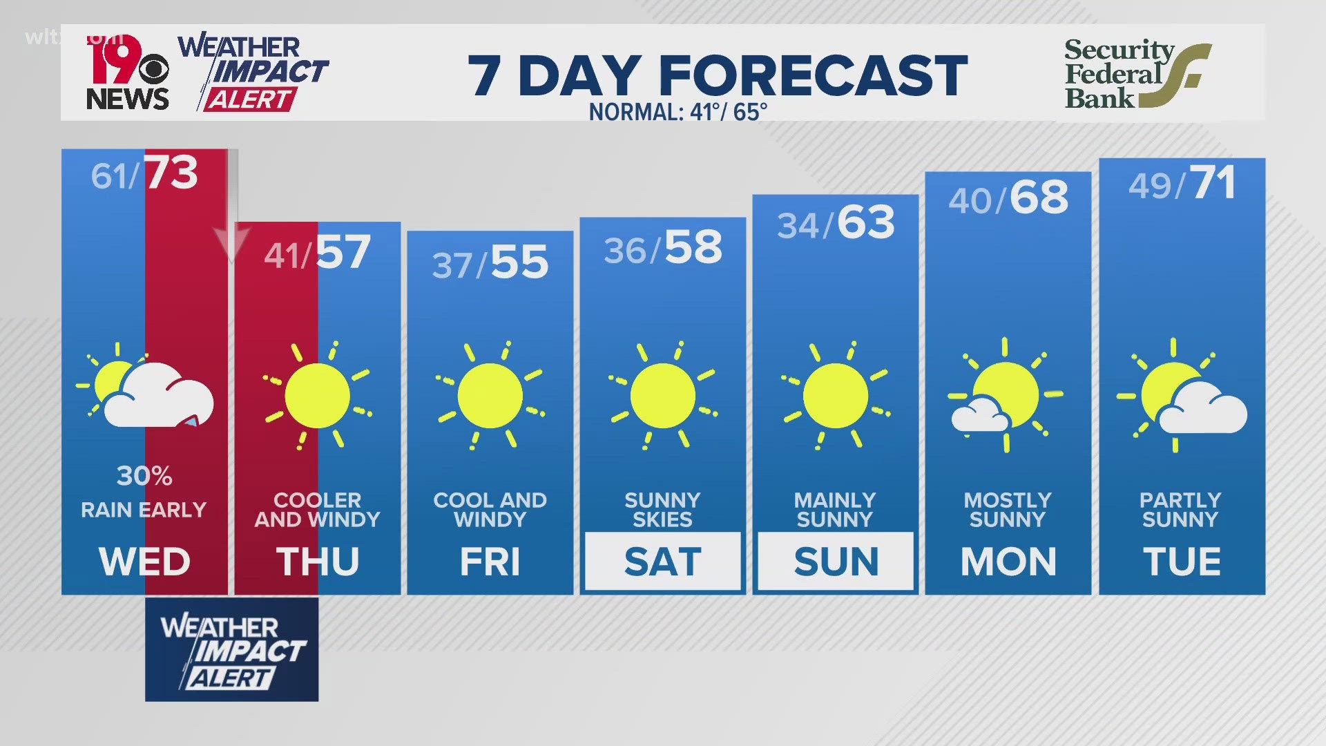
Warm air will be surging north as the winds pick up out of the south. High temperatures today will be in the middle to upper 60s, even with the clouds and rain.
The threat of severe weather will exit the Midlands by the late afternoon and early evening hours. Skies will be partly cloudy tonight, with lows in the middle to upper 30s.
Our weather will improve on Wednesday. It will still be breezy at times. High temperatures will be in the lower 50s.
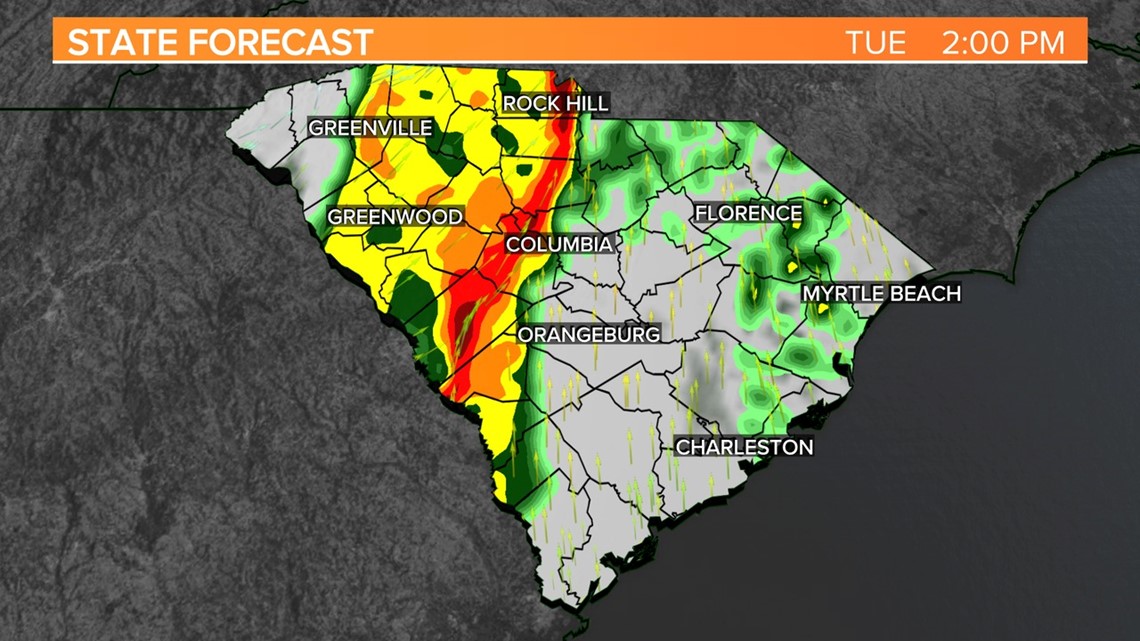
Storms move into the Midlands. The chance of severe weather begins in the eastern half of the viewing area.
Tuesday, 2 p.m.

Storms continue to move through the state. The chance of severe weather will shift eastward, along and ahead of the line of storms.
Tuesday, 3 p.m.


Storms continue to move through the state. The chance of severe weather will shift along and near I-26 and I-77, ahead of the line of storms.
Tuesday, 4 p.m.


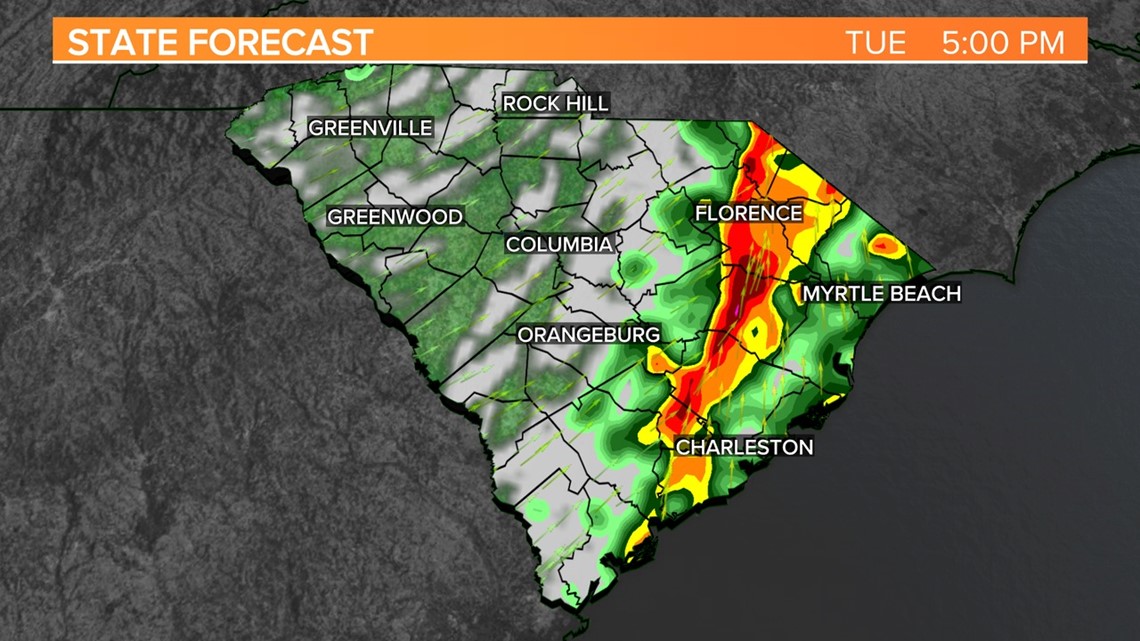
Storms continue to move through the state. The chance of severe weather will shift along and near I-95, ahead of the line of storms.
Tuesday, 5 p.m.

The storms will be near the coast. The chance of severe weather will be out of the Midlands. Our weather will improve this evening and tonight.