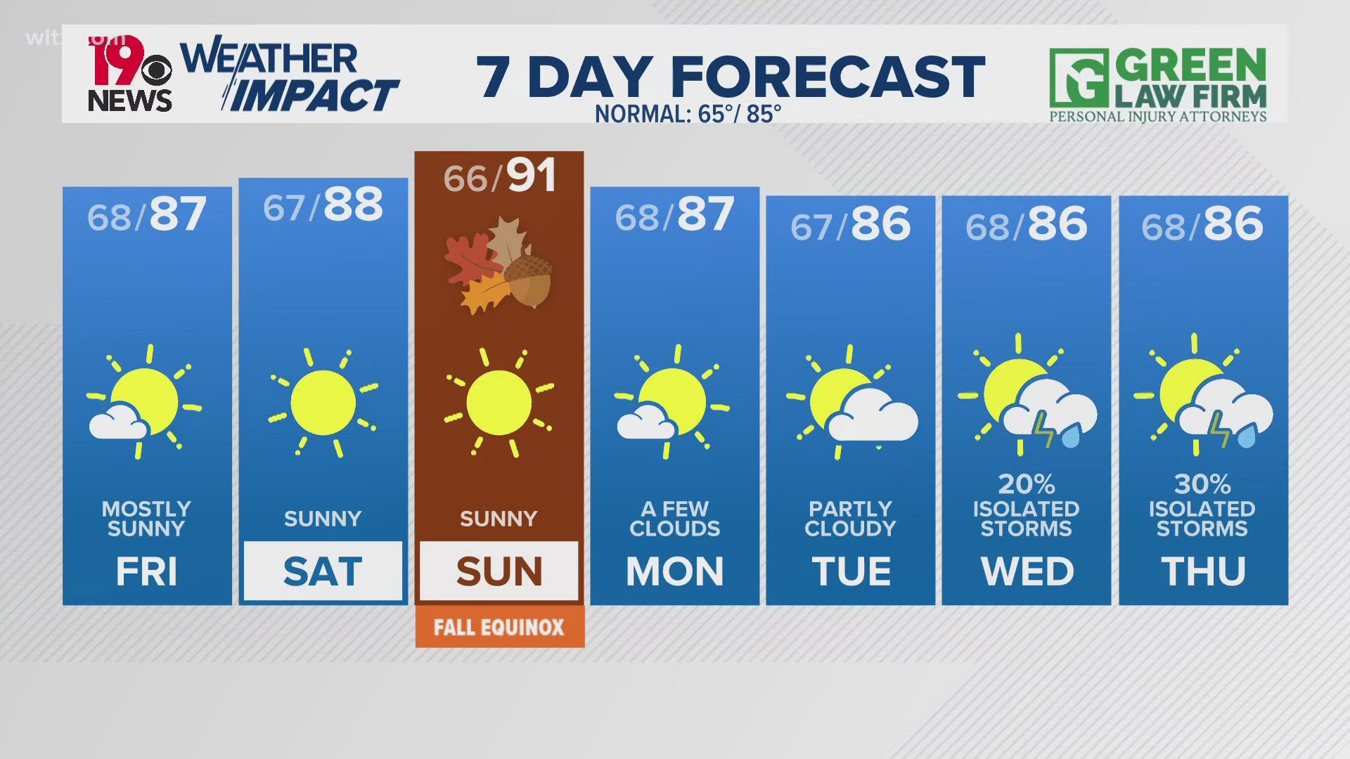
COLUMBIA, S.C. — A stationary front across the Southeast will be the focus point for showers and storms today. This boundary will be the main reason for showers and thunderstorms through Thursday. Some of these thunderstorms might become strong or severe until tonight. As we move towards the end of the week and the weekend, we can expect a more usual pattern where scattered thunderstorms occur in the afternoon.
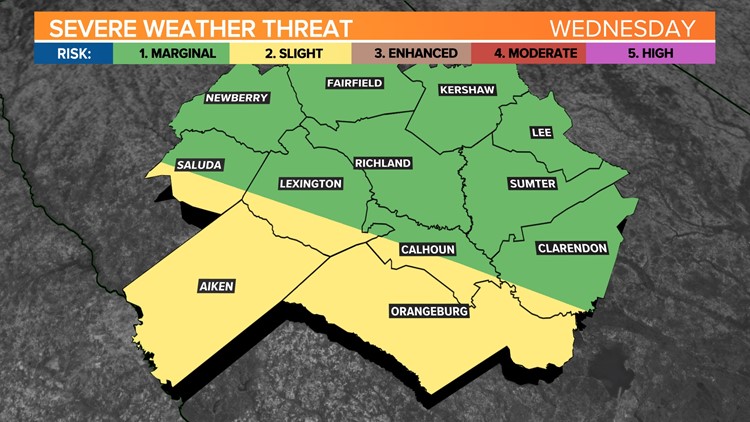
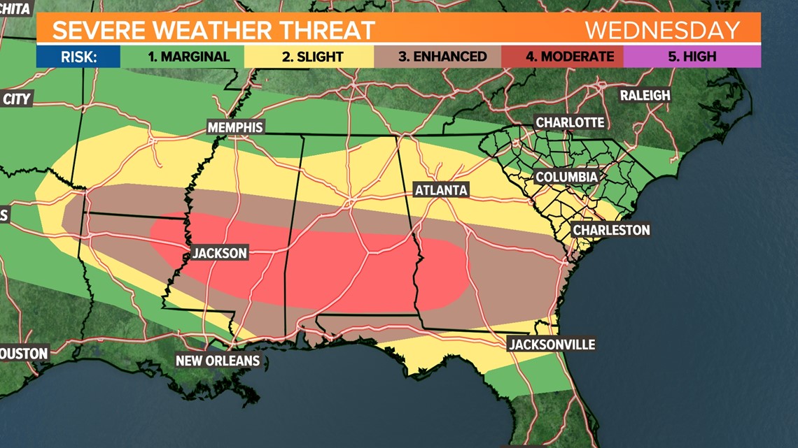
An active weather day is expected with a moderate risk of severe weather for a portion of the Gulf States, according to the Storm Prediction Center. In our forecast area, a stationary boundary positioned just south of us will slowly move northward and become the focal point for thunderstorm activity as several disturbances move across the region.

While there is some uncertainty about the exact outcome, high-resolution models predict thunderstorms moving through our area today and tonight, possibly in multiple waves.
The first round of storms is expected to pass south of our region, so our attention shifts to this afternoon and tonight as another series of disturbances move in, bringing scattered thunderstorms. There is potential for these storms to become more organized later in the day.

The greatest potential for severe weather will be closer to the frontal boundary, and there will be moderate to strong instability. With some low-level wind shear, directional shear, and upper-level divergence, all the ingredients for strong to severe thunderstorms seem to be coming together.
The areas with the highest instability will generally be over the southern and western Midlands; this aligns with the SPC's assessment of a slight risk of severe thunderstorms for that area.

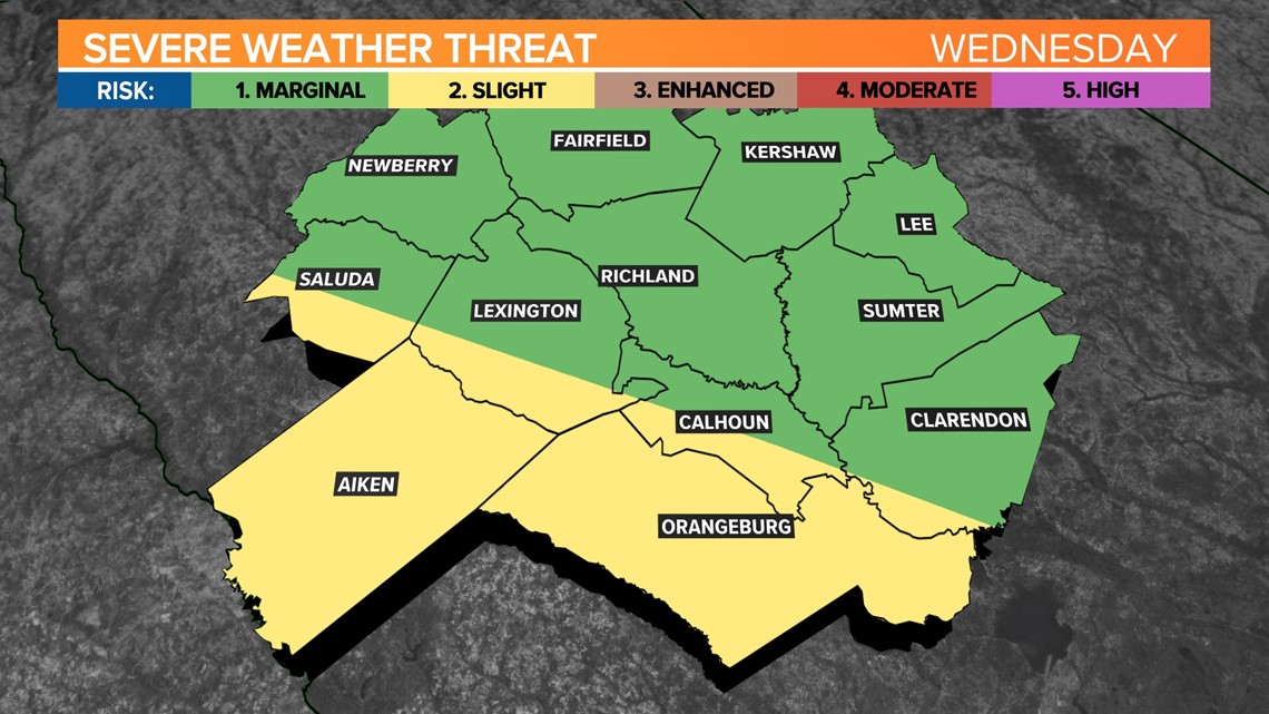
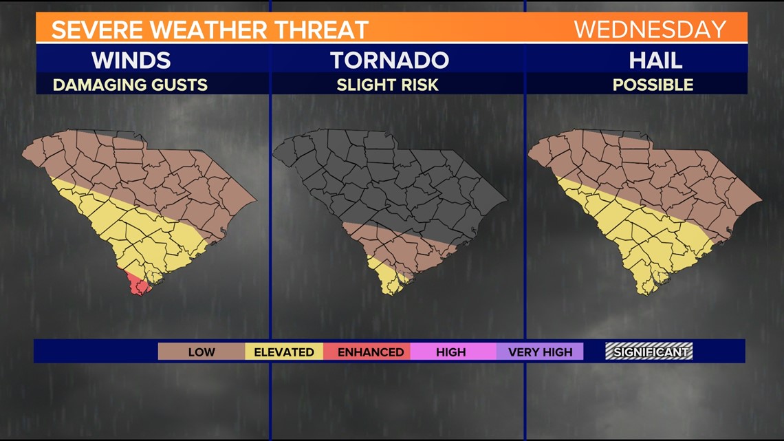
The primary threats will be damaging winds and hail, although the presence of low-level shear means that tornadoes cannot be ruled out in the southern part of South Carolina. The potential for locally heavy rain and flooding will also need to be monitored. High temperatures this afternoon will be somewhat limited due to the convection, with most areas reaching the low to mid-80s.

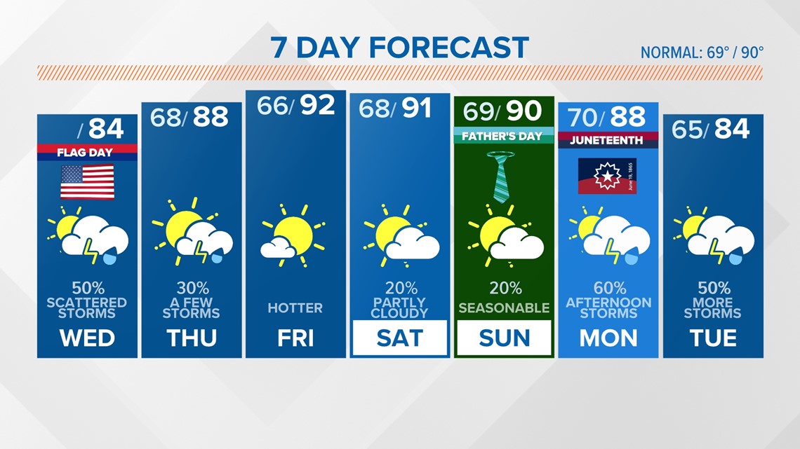
Some shower and thunderstorm activity is possible Thursday. Temperatures will warm into the upper 80s.
Friday is expected to be one of the driest days during this period as the front moves further south. The drier air will result in sunny skies and slightly warmer temperatures, reaching the low 90s and upper 80s.