COLUMBIA, S.C. — Temperatures will be a little warmer today than yesterday. The skies will be sunny. The winds will pick up tonight and tomorrow as a cold front moves through. Temperatures will be below normal Friday. Gradually, our temperatures will moderate over the weekend.
Today through Tonight
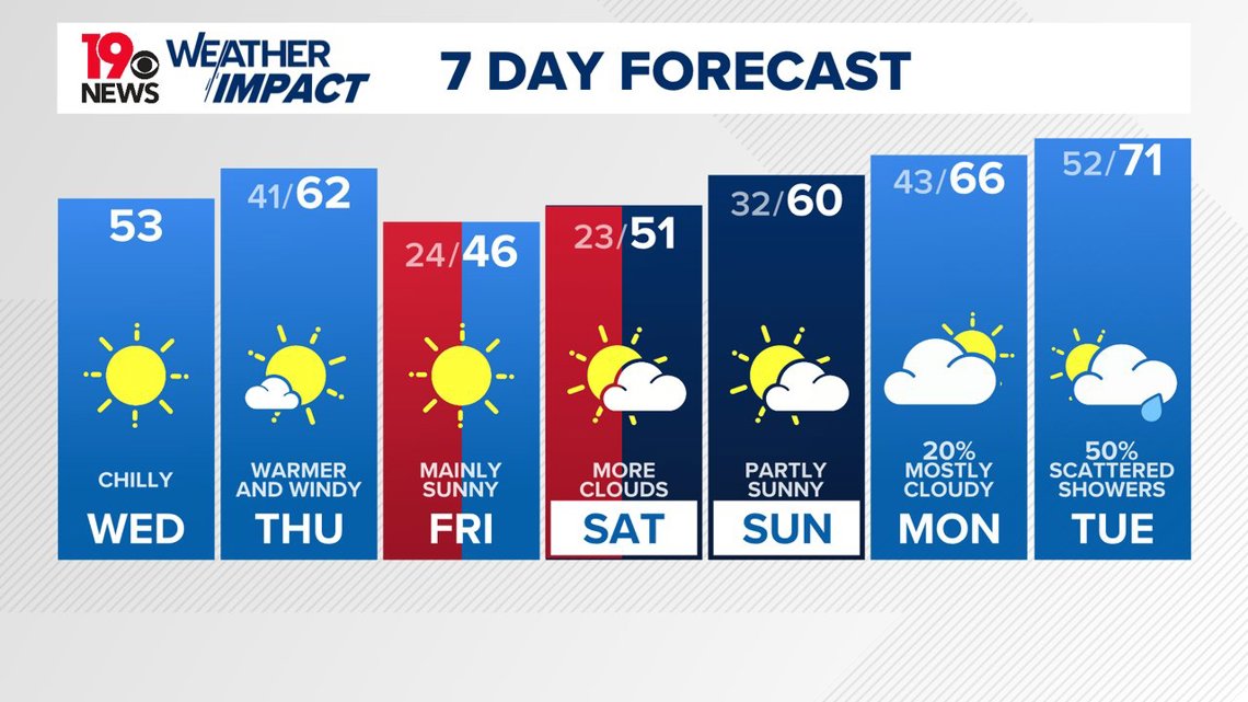
We are expecting a lot of sunshine today. Temperatures should rise into the low 50s by afternoon, still below normal for this time of year.
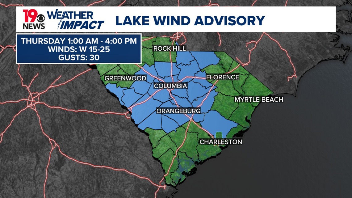
By evening, a tightening pressure gradient ahead of a cold front moving into the region will generate breezy conditions. A lake wind advisory is in effect late tonight through Thursday afternoon. Overnight temperatures will warm slightly due to increased cloud cover and warm advection, with lows remaining above freezing.


Thursday through Thursday Night
Thursday will feature breezy conditions and near-normal temperatures during the day. A strong upper trough will guide a surface cold front through the area, bringing another modified Arctic air mass behind it. Highs will range from the mid to upper 50s north and west of I-20 to the lower 60s elsewhere.
Winds will be strongest Thursday morning, gradually diminishing throughout the day. Skies will clear by late afternoon, and the lake wind advisory will expire at 4 PM as winds on area lakes fall below advisory criteria.
Thursday night will see the arrival of colder air, with lows dropping to the lower 20s in most areas and upper teens in typically colder locations. While radiational cooling is expected, some boundary layer mixing will prevent idealized cooling.


Friday and Friday Night: High pressure will dominate, keeping conditions cold and dry. Northerly winds will bring daytime highs noticeably lower than Thursday. Clear skies and calm winds overnight could lead to another opportunity for bitterly cold temperatures, potentially requiring a cold weather advisory.
Saturday and Sunday: A warming trend begins as high pressure moves east, shifting winds to the southwest. Temperatures will rise about 5 degrees on Saturday compared to Friday, with near-seasonal values expected by Sunday. Moisture increases late Sunday, resulting in growing cloudiness, though dry conditions are likely to persist through Sunday night.
Monday and Tuesday: A potential storm system early next week could bring warm and wet conditions. While models agree on the likelihood of rain, details about the system’s evolution remain uncertain. Rain chances peak Monday night, with lingering unsettled conditions possible into Tuesday.

