
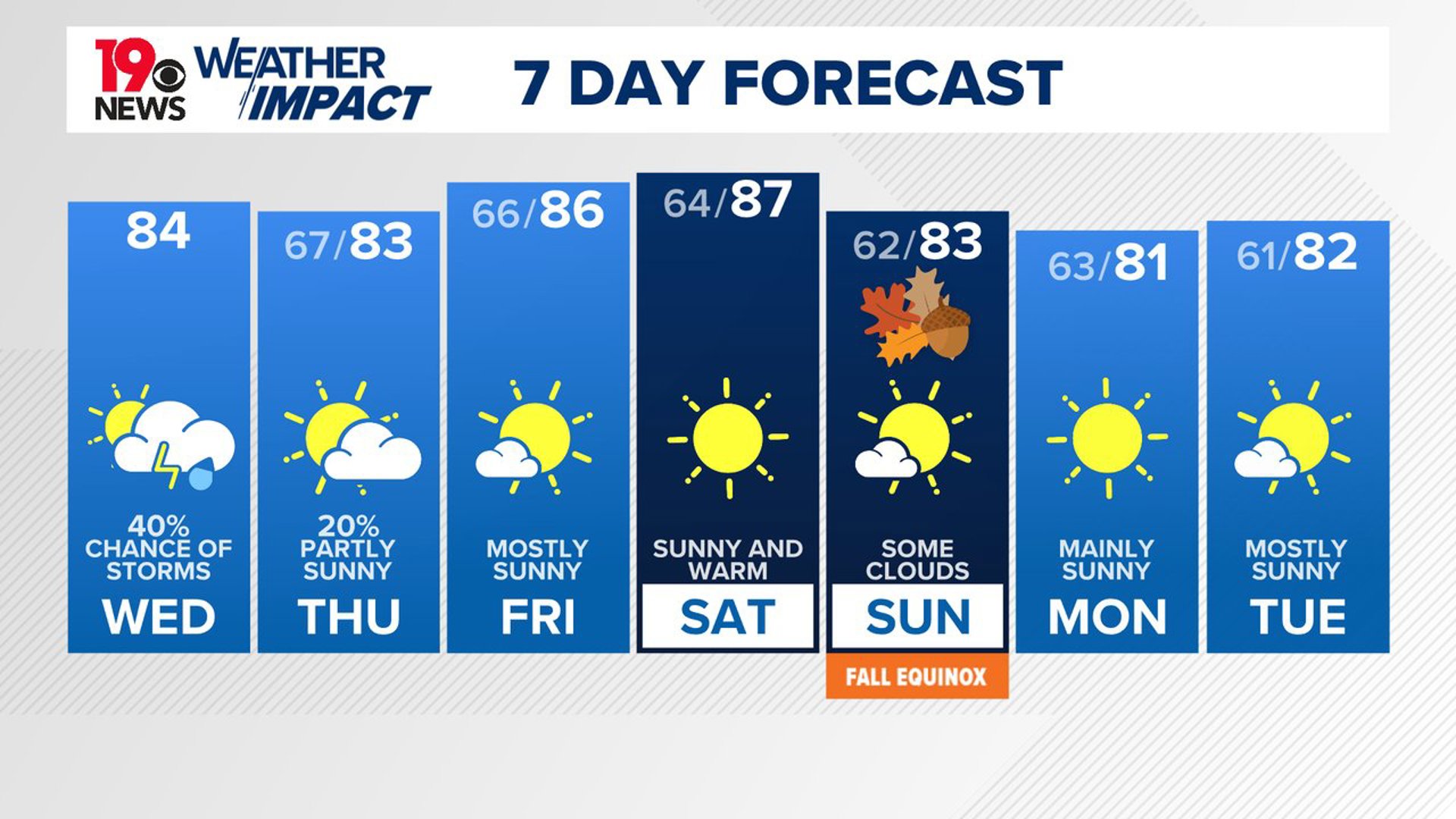
COLUMBIA, S.C. — An upper-level low will remain over the area today, leading to scattered showers and mostly cloudy skies. As this weather system lingers, it will keep conditions unsettled throughout the day. However, by the weekend and early next week, high pressure from New England is expected to build into the region, bringing drier conditions and more seasonable temperatures.
Today, the upper-level low centered over the North Carolina and South Carolina Piedmont will bring light showers in the morning. As the day warms up, the showers will increase and become more widespread in the afternoon.
Some thunderstorms may also develop, particularly along the coastal plain. Although there is a chance of thunderstorms, the threat of severe weather is low due to weaker atmospheric conditions.

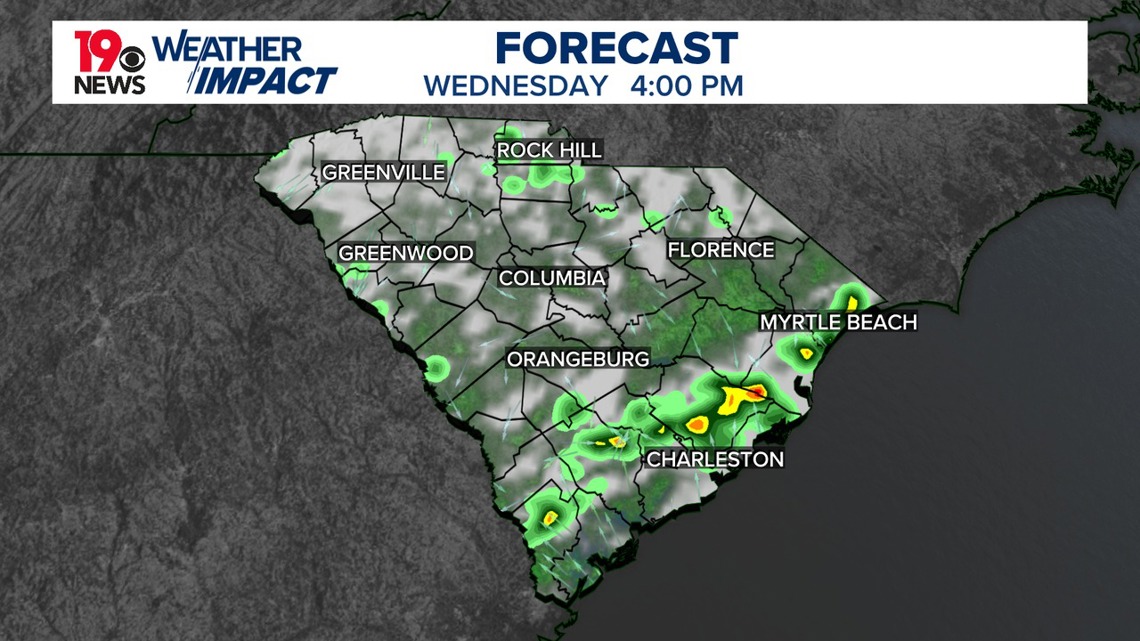
The combination of clouds, showers, and cooler air in the upper atmosphere will keep temperatures below normal for this time of year, with highs only reaching the low to mid-80s. As the evening approaches and the low-pressure system moves eastward, the showers are expected to taper off. Overnight temperatures will drop to the mid to upper 60s.
On Thursday, the upper-level low will start to move away from the region, though a few isolated showers may still develop, especially in the northeastern areas. By Friday, drier air will begin to move in as the weather system finally clears the area. This will lead to more sunshine and pleasant conditions. Temperatures will remain mild, with afternoon highs in the low to mid-80s and overnight lows in the 60s.
Looking ahead to the weekend and early next week, the weather is expected to be mostly dry and pleasant. A ridge of high pressure will build in from the west, while high pressure from New England settles over the area. This pattern will bring drier conditions and more typical fall temperatures, with highs ranging from the upper 70s to mid-80s and comfortable overnight lows in the 60s.