
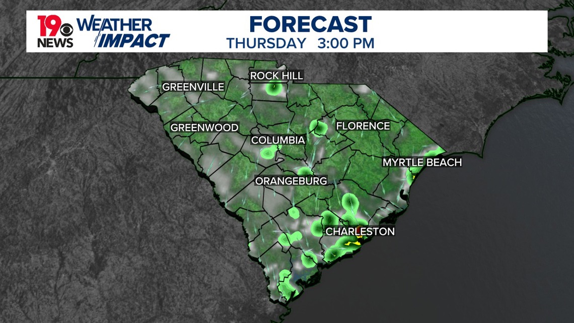
COLUMBIA, S.C. — Isolated showers and thunderstorms are expected, mainly in the eastern Midlands. Although moisture has decreased compared to earlier in the week, some rain could still develop, particularly in the afternoon.
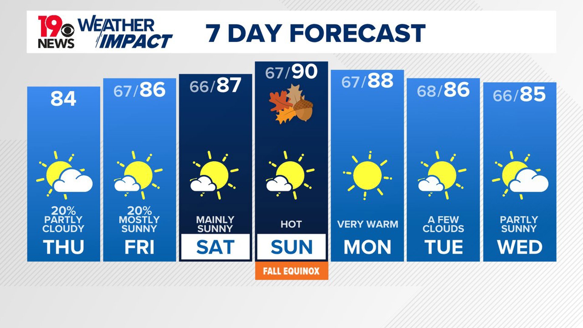
A trough moving east will bring in drier air, limiting widespread rain, though some thunderstorms may still form. By evening, most of the activity will taper off as temperatures drop, but a few isolated showers could linger overnight. Highs today will reach the low to mid-80s, with overnight lows in the mid-60s.
On Friday, the upper trough will continue moving east, with high pressure starting to build in from the west. While some isolated showers remain possible, the atmosphere will be more stable, and rainfall will be limited. Temperatures will rise slightly, reaching the mid-80s, and overnight skies will be mostly clear with lows in the 60s.

Saturday will bring warmer and drier weather as an upper ridge strengthens over the region. This ridge will keep conditions mostly clear, with highs climbing to the mid to upper 80s. The dry, seasonable weather is expected to continue into early next week, with temperatures nearing 90 degrees by Sunday.
While moisture levels may increase slightly early next week, dry conditions are expected to persist through Tuesday. Overnight lows will remain in the 60s during this period.
Tracking the Tropics:
In the central subtropical Atlantic, the remnants of Gordon are producing disorganized showers and thunderstorms. While environmental conditions are only marginally conducive, there is a chance a tropical depression or storm could re-form as the system moves slowly northward over the next few days. The chance of formation is 40% over the next 7 days.
Meanwhile, a nearby area of low pressure to the northwest of Gordon is also showing some potential for development, with a 20% chance over the next week.

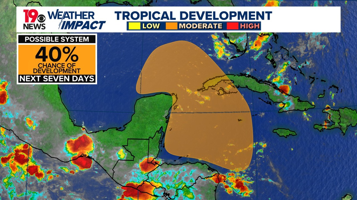
A broad area of low pressure could develop in the northwestern Caribbean Sea or southeastern Gulf of Mexico late this weekend or early next week, with a 40% chance of formation in 7 days.