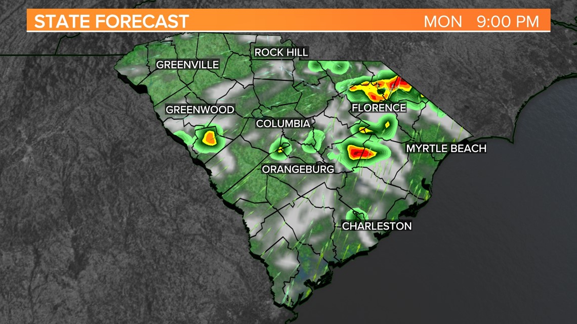
COLUMBIA, S.C. — There will be more opportunities for storms later today and some of the thunderstorms that do develop could be strong or even severe.
A cold front will move towards the area today. Ahead of the front, showers and storms are forecast to form once again.
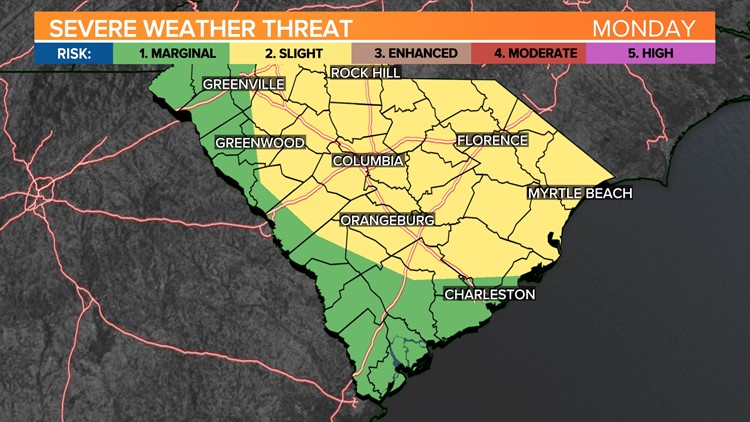
The Storm Prediction Center puts the majority of the Midlands at slight risk (Level 2 out of 5) for severe storms today. This means scattered severe storms are possible; short-lived and/or not widespread; isolated intense storms are possible.
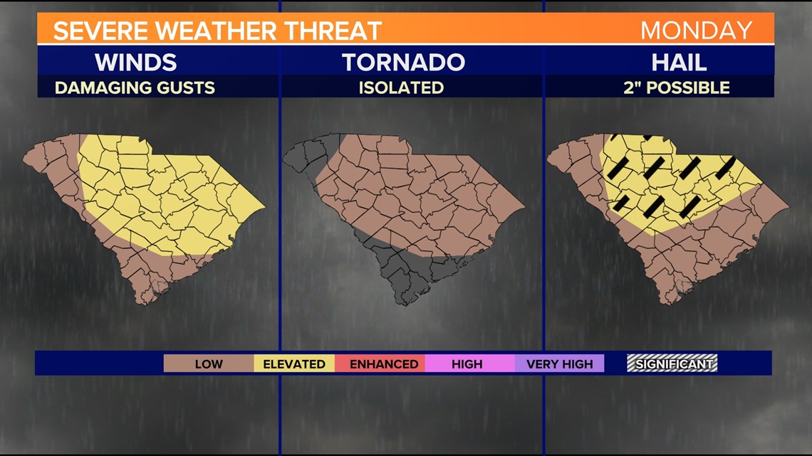
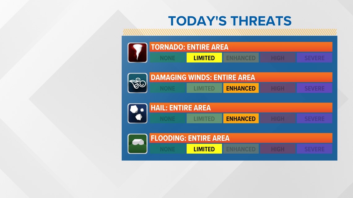
Large hail and damaging winds will be the main threats from these storms. In fact, the most recent model soundings and SPC guidance indicate a threat for very large hail, up to 2” in diameter, across the central and north Midlands. This would be uncommon this time of year. The threat of flooding and tornadoes is low but cannot be completely ruled out today and tonight.


Before the showers and storms move back into the area, temperatures should climb into the upper 80s to lower 90s. That would be seasonable for this time of the year.

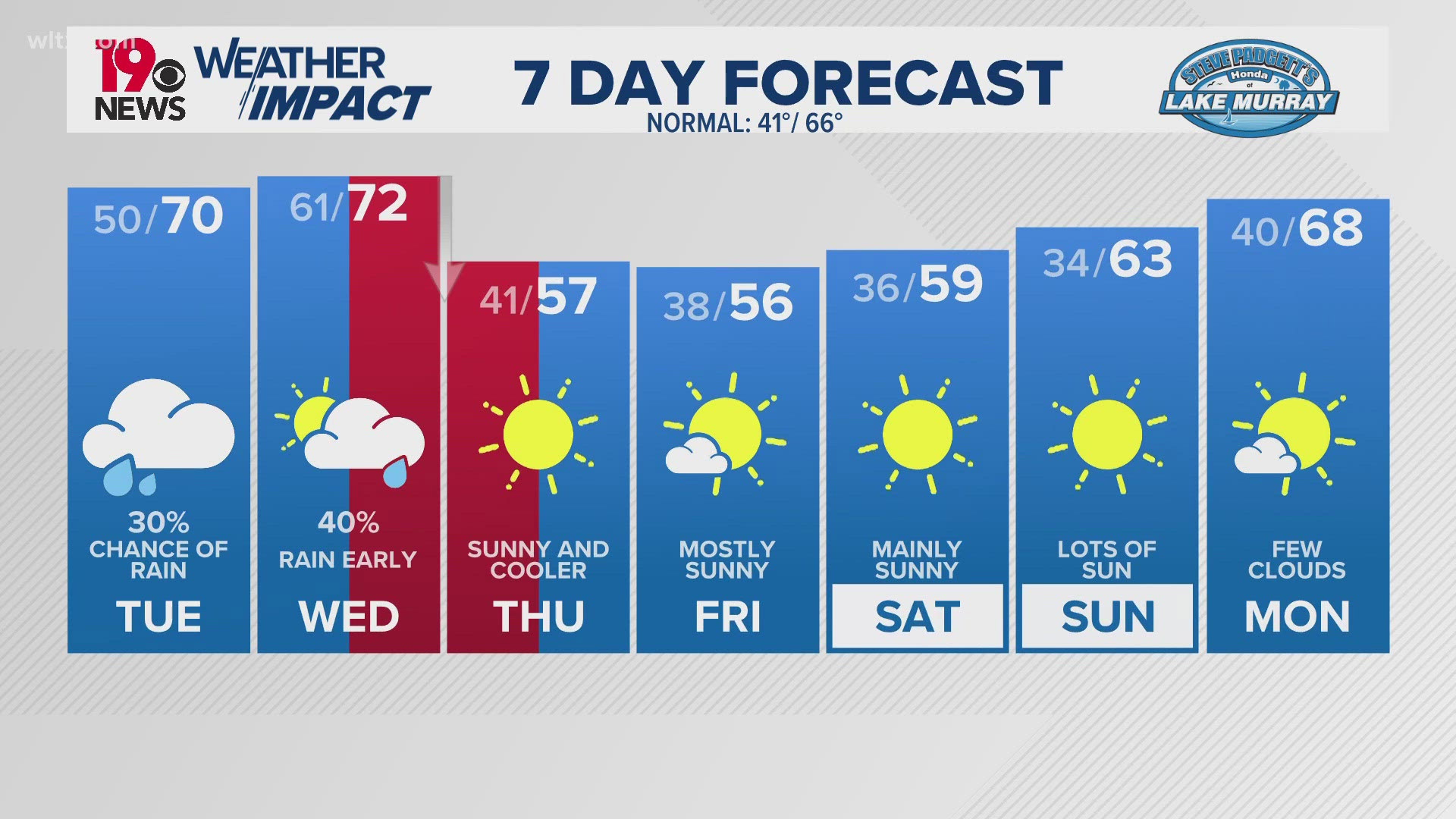
Tuesday through the end of the workweek, high pressure dominates the weather pattern, bringing a slight warming trend to the region.
Because of the easterly to southeasterly surface flow, moisture gradually increases, allowing for the typical diurnal chances for showers and thunderstorms. Forecast models indicate the chance for rain will increase over the weekend.