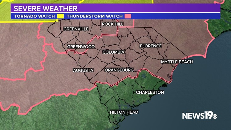
COLUMBIA, S.C. — **A Severe Thunderstorm Watch has been issued for the Midlands through Midnight**
With the exception Fairfield and Newberry Counties, severe weather is still a potential this evening, with strong to severe storms that could create destructive winds as they move towards the coast tonight.
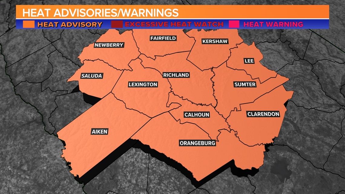
A heat advisory was in effect for a large part of the Midlands today. Temperatures were unusually hot this afternoon. A heat advisory was in effect until 7 p.m. for the Midlands. According to the National Weather Service, you should stay hydrated, stay in an air-conditioned room, avoid the sun, and check in on relatives and neighbors. Under no circumstances should young children or pets be left unattended in vehicles.
Showers and storms are expected later this afternoon and tonight. Some of the storms could be strong or even severe, with the greatest threat being damaging wind gusts.
According to the National Weather Service, you should stay hydrated, stay in an air-conditioned room, avoid the sun, and check in on relatives and neighbors. Under no circumstances should young children or pets be left unattended in vehicles.

If you work or spend time outside, take extra precautions. When possible, move strenuous activities to the early morning or evening. Understand the symptoms of heat exhaustion and heat stroke.
When possible, dress in light, loose-fitting clothing. To reduce risk while working outside, the Occupational Safety and Health Administration recommends taking frequent rest breaks in shaded or air-conditioned areas. Anyone experiencing heat exhaustion should be relocated to a cool, shaded location. If you suspect someone is having a heat stroke, this is a medical emergency. Call 911.

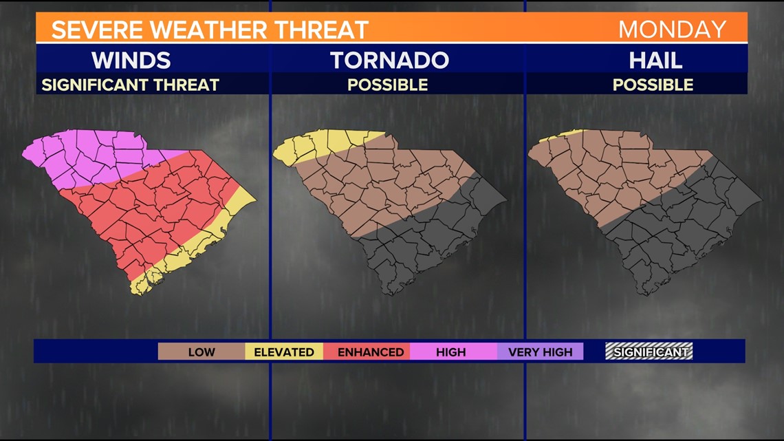
Showers and storms may continue tonight. Some of the storms could be strong or even severe, with the greatest threat being damaging wind gusts. A line of potentially severe thunderstorms will moving through the area this evening and may produce numerous damaging wind gusts across the area.
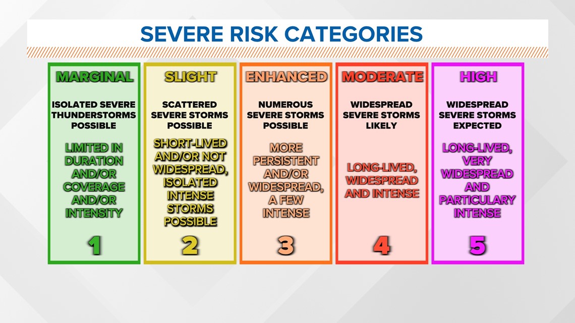
The Storm Prediction Center has most of the Midlands at an enhanced risk (Level 3 out of 5) for severe storms today. This means that numerous severe storms are possible, generally more persistent and/or widespread. A few storms could be intense.
The greatest threat for us is damaging wind gusts, but some hail will be possible, and a tornado warning cannot be ruled out. Heavy downpours will also be possible, which could lead to some isolated flooding issues.

The severe weather window appears to be between now to 11 p.m. After that, the threat of severe weather will have moved out of the Midlands.
Timeline of the Storms:
Monday, 5 PM:
Storms begin to develop in the western parts of the state.


Monday, 6 PM:
Storms continue to develop, moving from west to east.


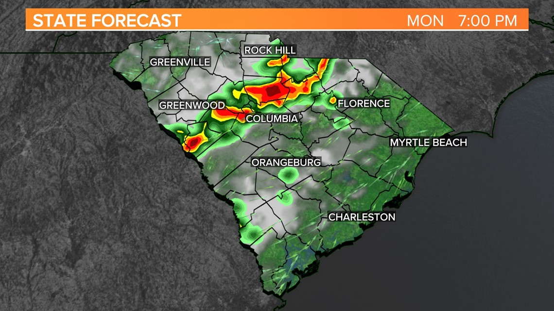
Monday, 7 PM:
Storms move into the central Midlands.

Monday, 8 PM:
Showers and storms move into the southern and eastern Midlands. The threat of severe weather moves out of the western and northern Midlands.


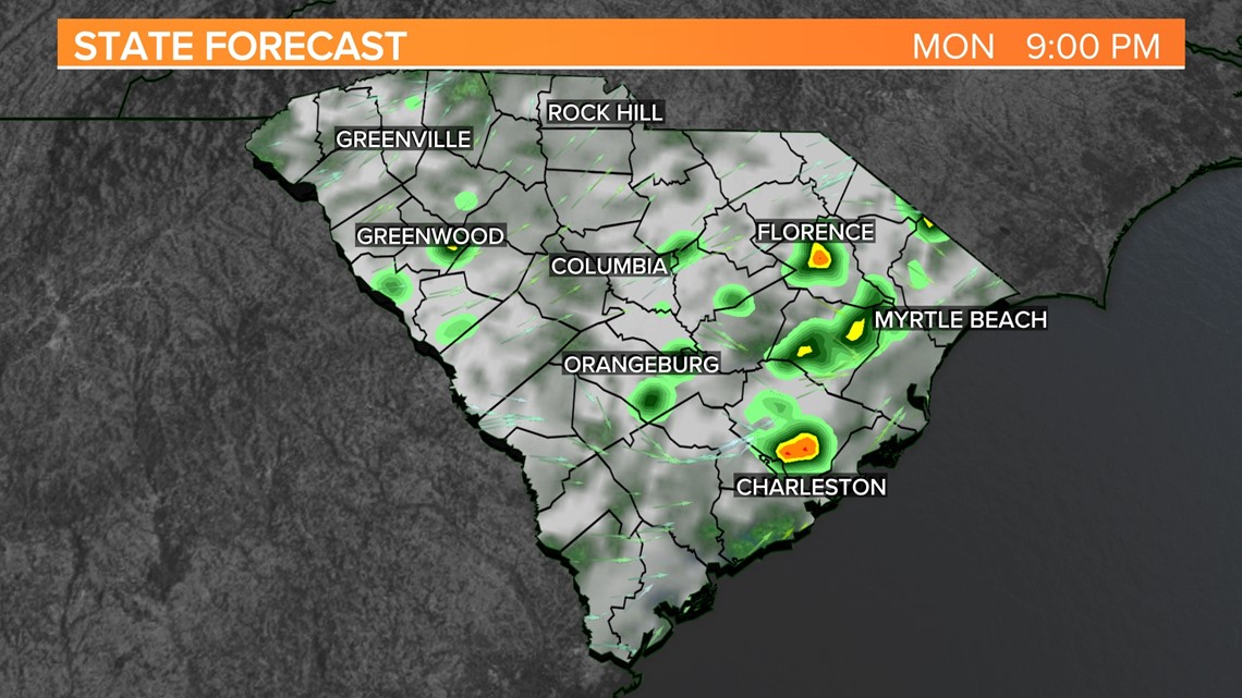
Monday, 9 PM:
The threat of severe weather for the Midlands begins to decrease as storms move into the Coastal region of the state.

As of Monday morning, there were no watches or warnings in effect, but that will likely change as we go through the day.


