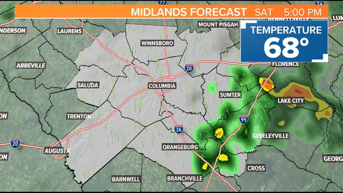
COLUMBIA, S.C. — Heavy rain is expected in parts of the Midlands through the afternoon.
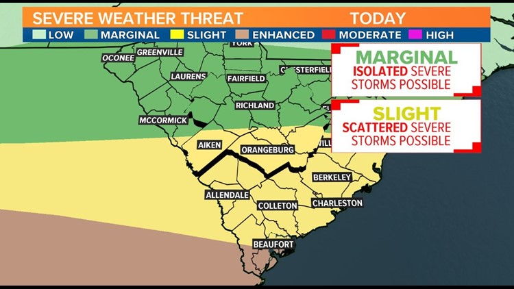
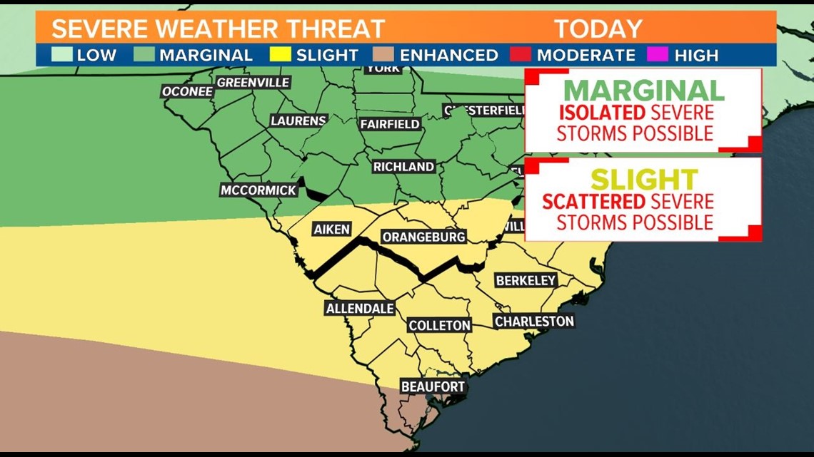
There may be breaks at times, but isolated downpours could bring more than 2 inches of rain in localized spots before the day is over. There's also a risk for severe storms capable of producing damaging wind and hail, although the greatest threat is mainly south of the Midlands.
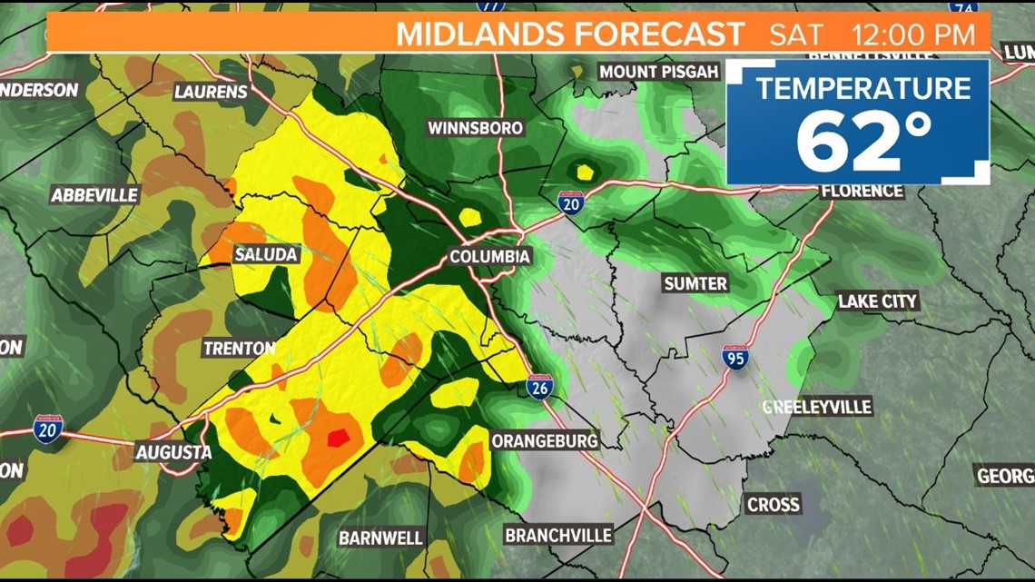
Light rain will become more steady by the early afternoon. There could be a few rumbles of thunder, but for most of the Midlands, a chilly and persistent rain will move overhead through the early afternoon. Temperatures will remain in the 60s. Up to an inch of rain is expected by 3pm.

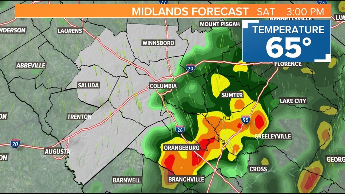
Rain will be less numerous later this afternoon and evening, but the risk for stronger storms will be highest during these hours. A break in the rain is expected at some point this afternoon, although skies will likely remain cloudy.

Cloudy skies will limit the thunderstorm risk for most of the Midlands, but farther south and west storms could fuel up where peaks of sunshine develop.

The greatest risk today is for downpours to produce localized flooding, but stronger storms late afternoon and early evening could produce frequent lightning, damaging wind, and hail. An isolated tornado cannot be ruled out. The risk is greater for the southern Midlands and the low country than for the central and northern Midlands, which could see few if any storms.

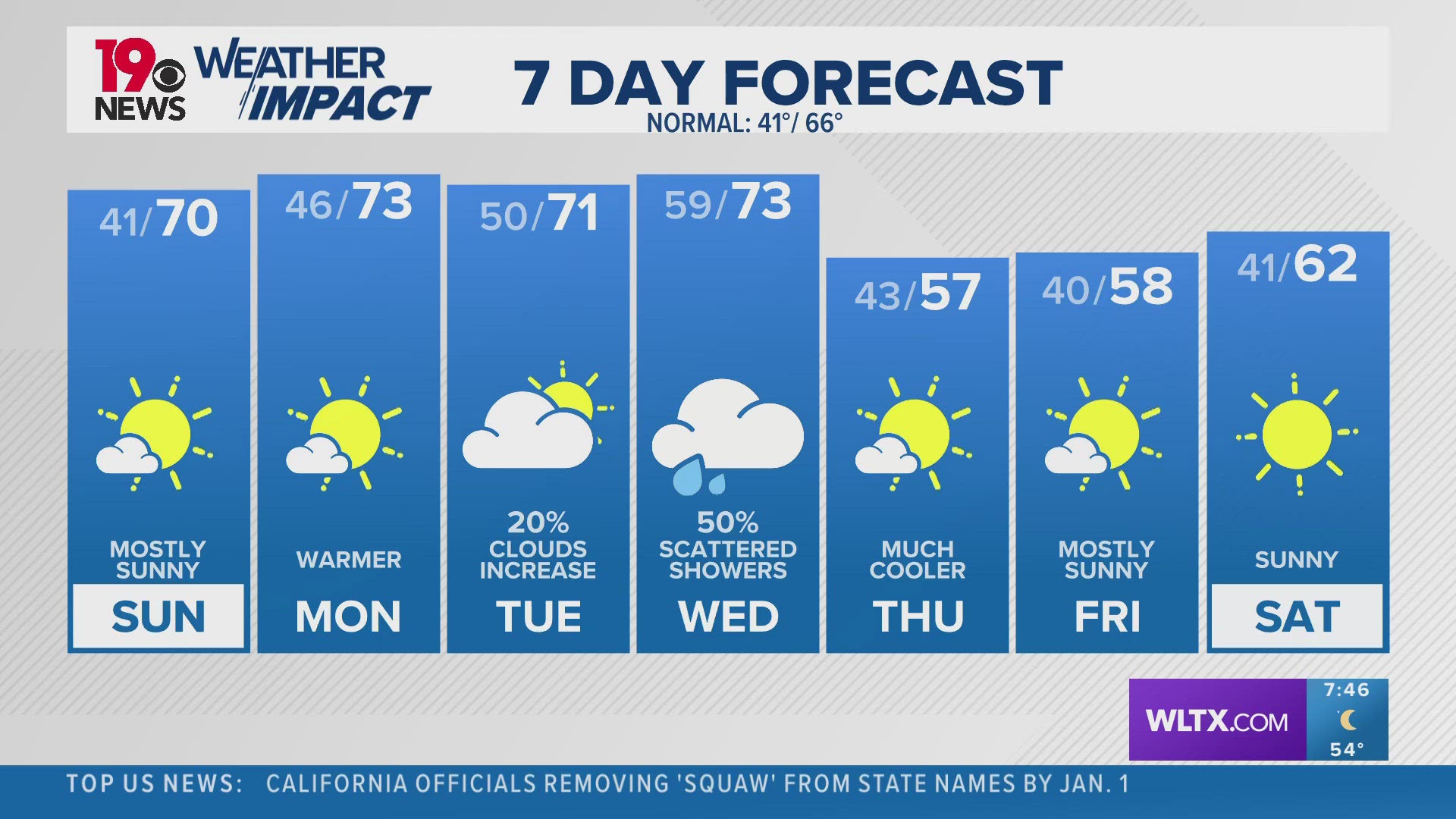
Overnight, northerly breezes will dry us out. Aside from a stray storm in the pre-dawn hours, Sunday will be sunny and mild with high temperatures returning into the mid 70s. Early next week sunshine and 80 degree high temperatures will return with no additional rain expected until at least Thursday or Friday.