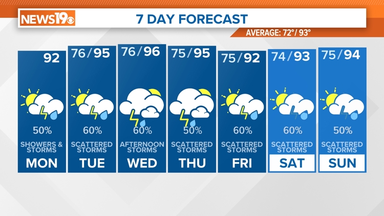
COLUMBIA, S.C. — A lot of moisture combined with an unstable air mass will likely bring scattered showers and thunderstorms during the afternoon and evening all this week.
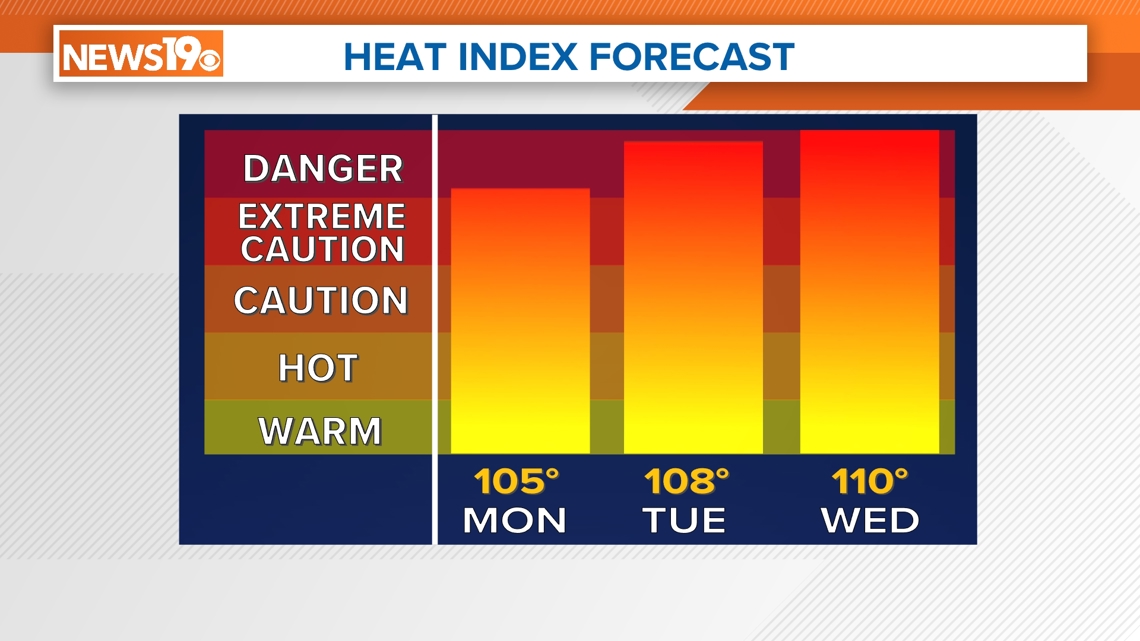
Above-normal temperatures will continue to be the norm, with heat index values exceeding 100 degrees daily, even with abundant cloud cover on Monday morning, Heat Indexes are expected to climb between 100 and 105 degrees for most of the Midlands' communities, and we can expect heat index values to increase on Tuesday and Wednesday and Temperatures as dew points increase.
Monday will likely be very similar to what we saw Sunday, with very slow-moving storms that could potentially cause isolated flash flooding.

As of 8:00 AM Monday, radar shows almost no rain across the region but showers and storms will begin to pop off in the late morning/early afternoon with the most widespread focused in southern communities such as Orangeburg, Calhoun, and Clarendon Counties.
In the next seven days Midlands communities could see anywhere from .50” of Rain in most Western areas such as Newberry, Saluda, and even Lexington. Higher totals will be focused towards Orangeburg, Clarendon, and Sumter with close to 2 inches of rain.


For those preparing for the day pack an umbrella and wear loose-fitting clothes as the primary threat will be locally heavy rain and the potential for flash flooding.
The night will remain muggy, with lows in the mid to upper 70s.