
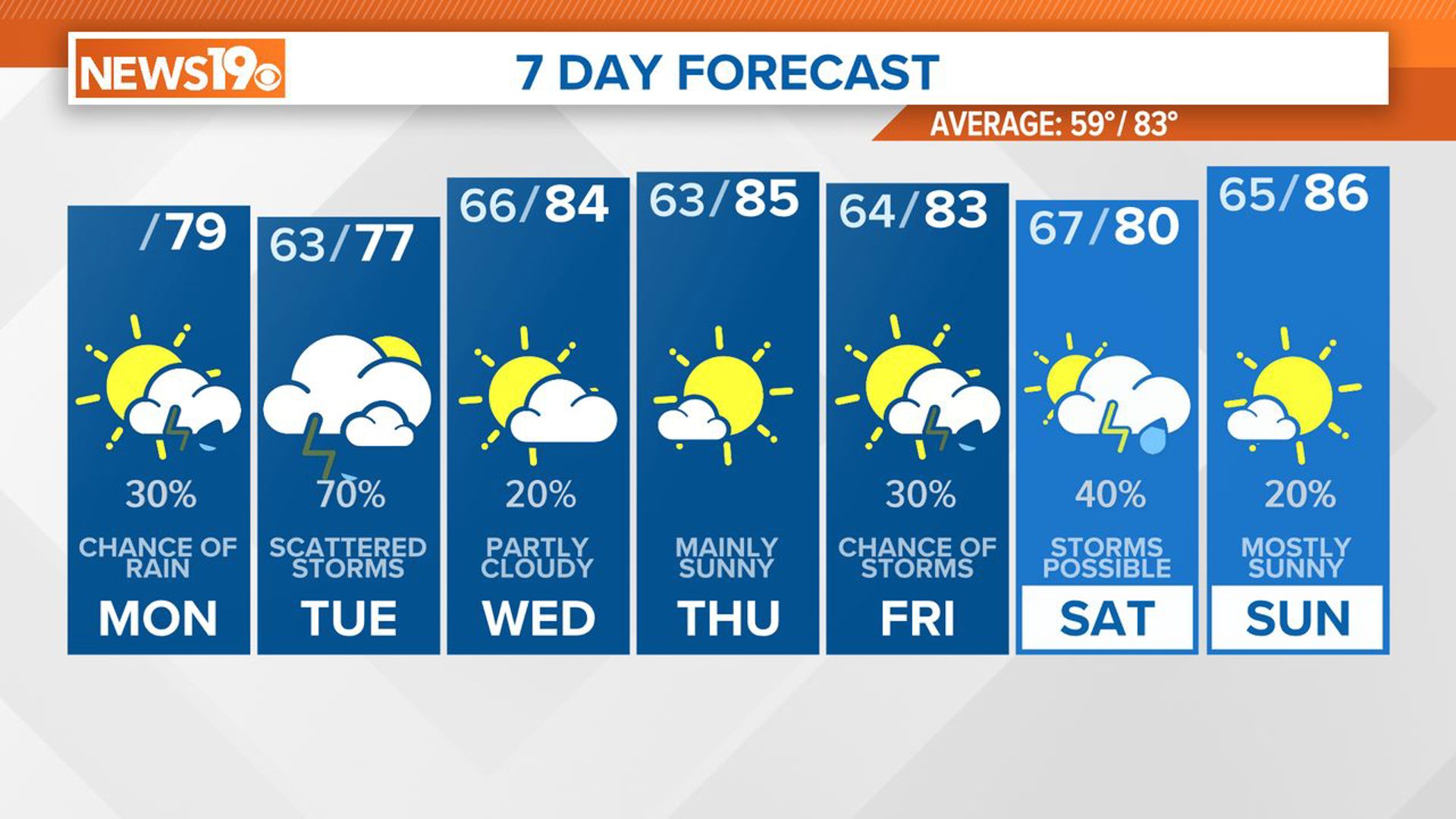
COLUMBIA, S.C. — Get ready for a week of changing weather patterns. Today, high pressure will move offshore, making way for a stretch of unsettled conditions with showers and thunderstorms through midweek. Although Thursday may bring a brief respite with drier air, moisture is set to return just in time for the weekend. Temperatures will hover near or slightly below average.
Cloud cover will be widespread, with lowering cloud heights as the day progresses. While models suggest an initial band of showers moving into the central Savannah River area during the late morning to early afternoon, dry air in the lower atmosphere may initially prevent significant rainfall until saturation occurs. Temperatures will vary, with slightly warmer conditions expected in regions where precipitation arrives later.

Tonight, expect widespread light showers and isolated thunderstorms to develop and move northward, particularly after midnight. Rainfall amounts are not expected to be significant, with temperatures in the lower to mid-60s.
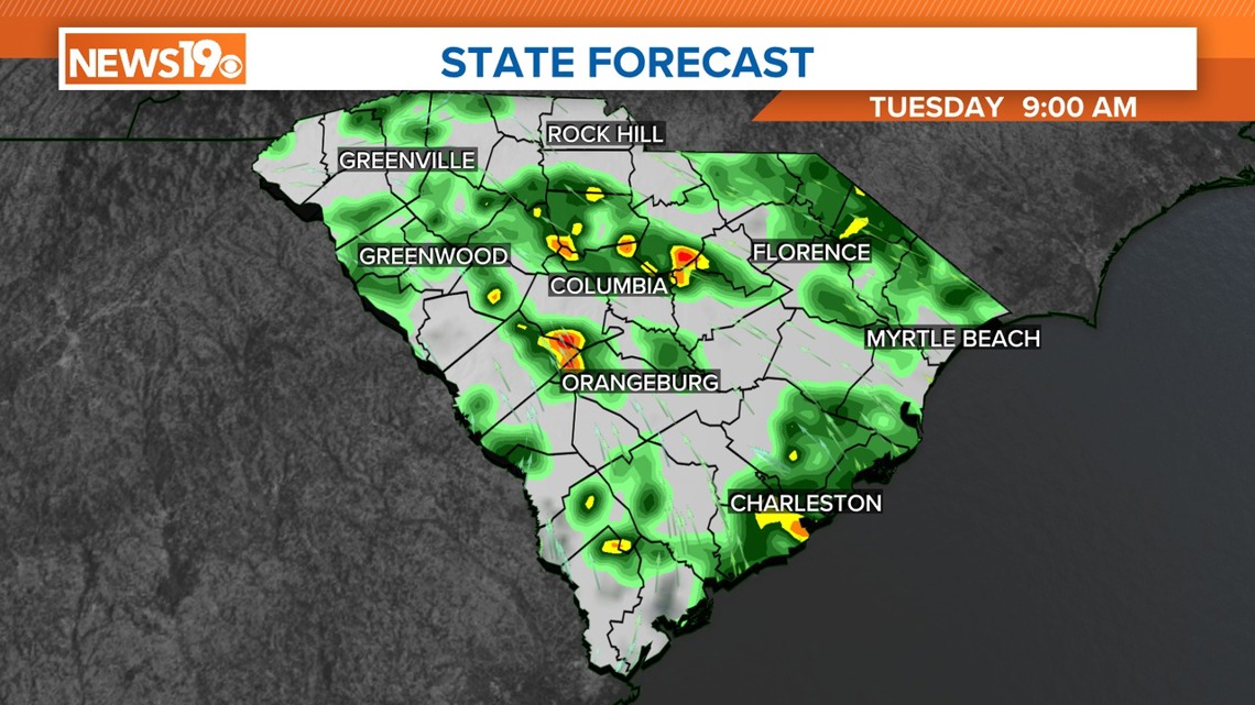
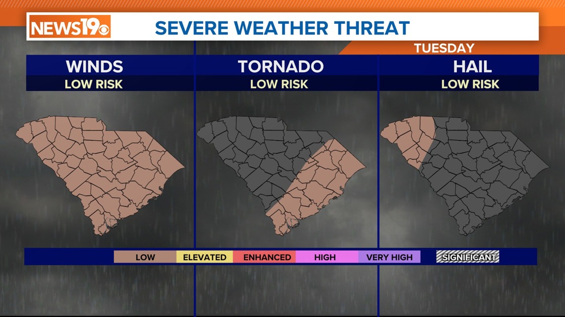
Looking ahead to Tuesday, an upper trough will be positioned over the mid-Mississippi Valley, gradually moving northeastward into the Ohio River Valley. This will bring another round of showers and thunderstorms to South Carolina, although there is some uncertainty in the timing and intensity. Despite the potential for rain, forecast amounts have decreased slightly due to drier air in the latest guidance.
The Storm Prediction Center has South Carolina under a marginal risk of severe weather on Tuesday. If a severe thunderstorm were to develop, the greatest threat would be damaging wind gusts.

Wednesday and Wednesday night may see lingering showers and thunderstorms as the upper trough continues its eastward movement through the Mid-Atlantic region. Differences in model guidance make it uncertain how quickly these conditions will dissipate. However, expect temperatures to rebound closer to average by Wednesday.
Thursday offers a brief reprieve with dry conditions as high pressure moves over the region. But moisture is expected to increase again by the end of the week ahead of another trough, potentially bringing more showers and storms. Confidence in the forecast beyond Thursday remains low due to significant variations in guidance.