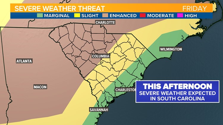
COLUMBIA, S.C. — A line of strong storms will move through the South Carolina Midlands Friday afternoon. The Storm Prediction Center has issued an “Enhanced” risk for severe weather for the western Midlands including Saluda, Newberry, Fairfield, Kershaw, Richland, and Lexington County for this afternoon.
An enhanced risk means numerous strong storms are possible. Farther east, the risk for storms is slightly lower because the storms will arrive after the peak daytime heating of the day, but any storms that develop out east will also be capable of severe weather.
Level of forecast confidence
There is some uncertainty about how widespread the severe weather risk will be today. On early Friday morning, the storm system was not producing severe weather indicating that these storms will be fueled mainly by rising air during the heating of the day. A morning shower or extra cloud cover would limit the risk for severe weather, but if skies clear out more than expected, storms will be more intense.
Threats
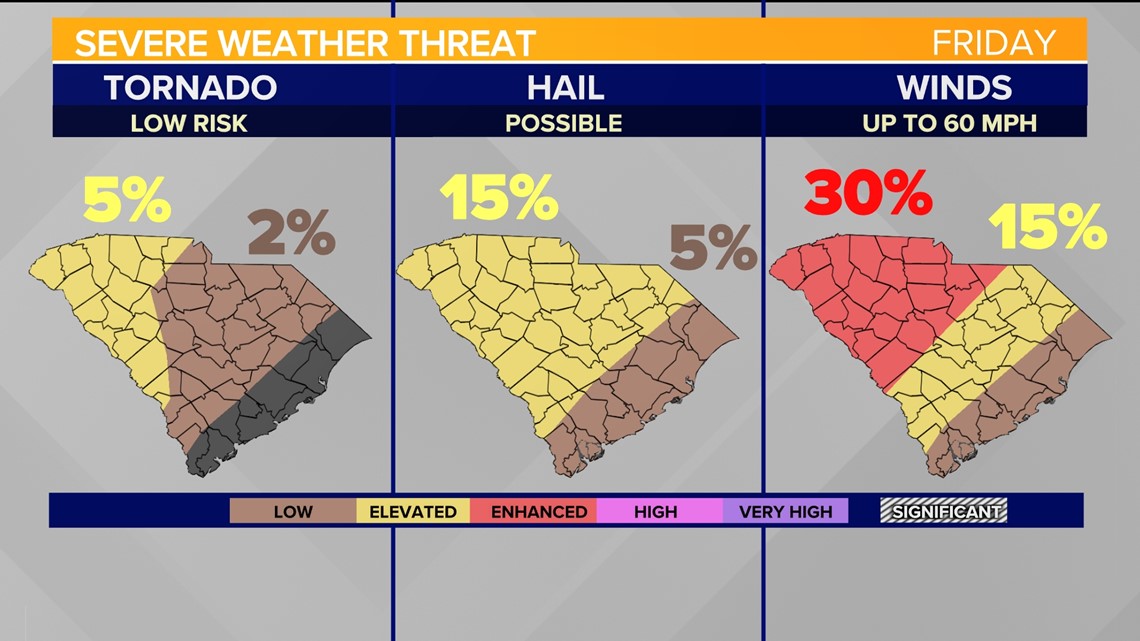
The primary threat with any strong storms that develop on Friday will be damaging wind. Rapidly rising warm and humid air can quickly create pockets of rain cooled air above that drop in the form of “microbursts”. This situation can produce brief strong wind events. There is some uncertainty about whether these storms will align along the cold front this afternoon and produce a more widespread threat for strong winds.
In addition to strong wind, hail can develop. When storms inhale warm air quickly, it can hold onto it's rain long enough for the rain to freeze into hail stones. There’s a threat for a few storms to be capable of hail up to 1” in diameter this afternoon, similar to the setup we saw earlier this week.
The risk for tornadoes is lower than the rain, straight line wind, and hail threat, but an isolated tornado cannot be ruled out in the Carolinas with these storms.

Timing
Mostly cloudy skies this morning and humid air will prime the atmosphere for afternoon storms. Any morning showers that develop will be good news – because that will eat away at some of the available energy for afternoon storms. Regardless, the cold front will arrive with the best chance for thunderstorms mid afternoon starting around 1 PM in the upstate and 3PM in the western Midlands. The front will move into the central midlands by mid to late afternoon.

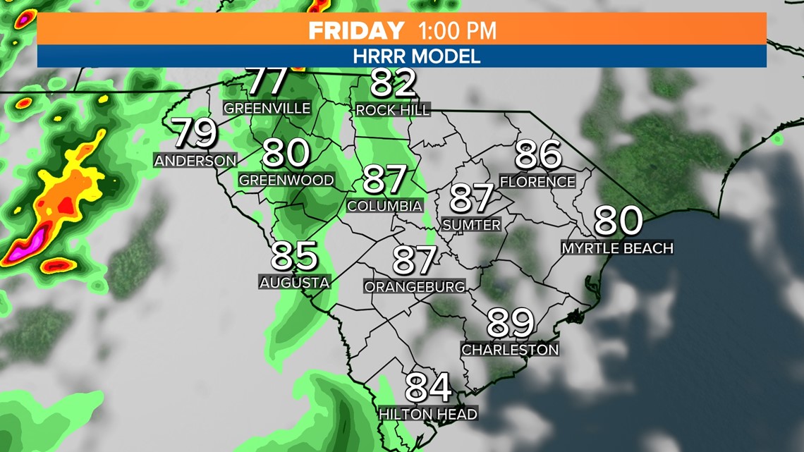


Widespread storms are expected from 4 PM into 7 PM.

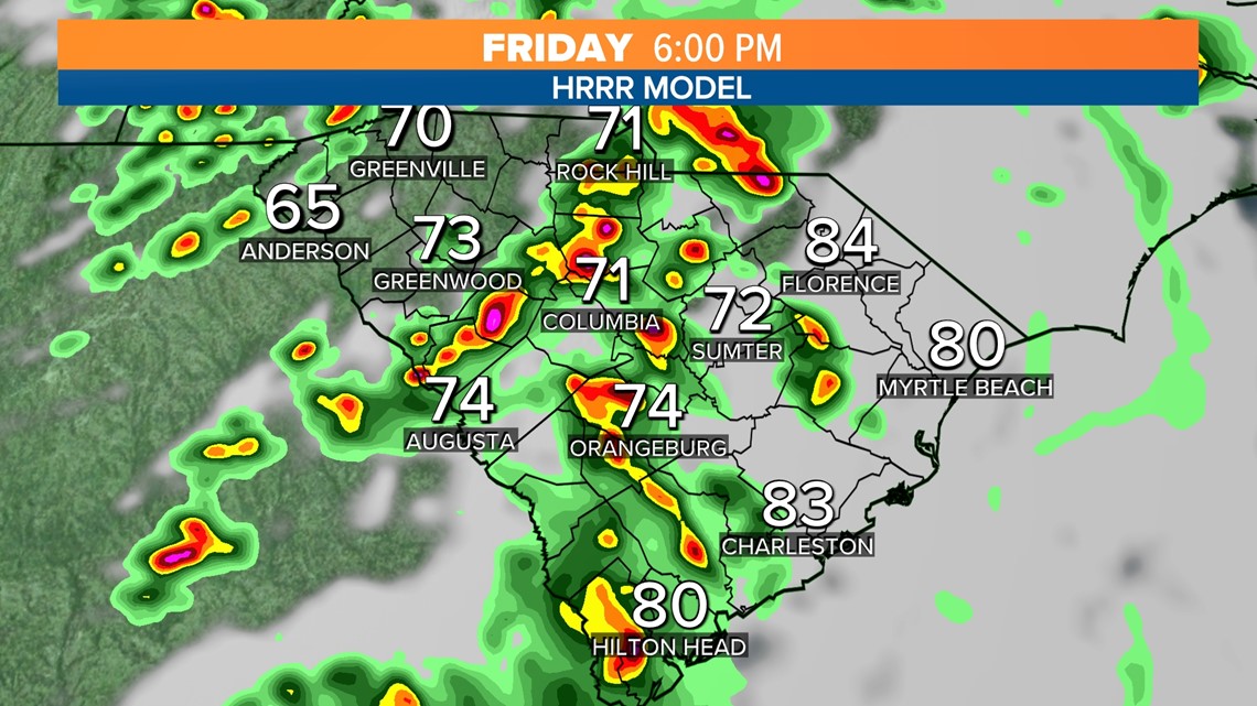
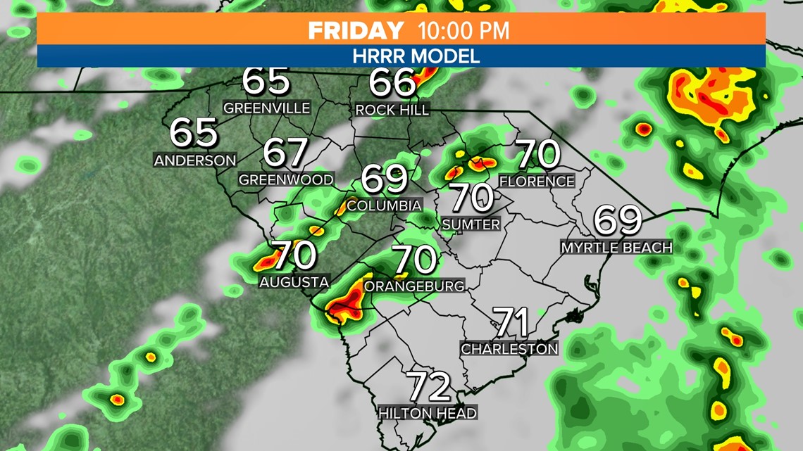
Lingering storms are possible as late as midnight, before tapering off overnight as the humidity drops.

On Saturday afternoon, an upper level disturbance will move into South Carolina bringing clouds back into the forecast, but humidity levels will be too low to support anything other than scattered showers. This disturbance will keep some clouds around for Mother's Day.


