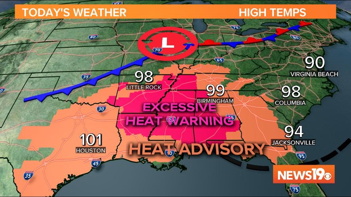
COLUMBIA, S.C. — Not only have temperatures been excessively hot, but severe weather is also in the forecast this evening.
Today, the severe weather threat is focused on the northern Midlands, but the possibility for a severe storm is valid everywhere, with the entire area in a marginal risk (1 out of 5), and the northern Midlands under a slight risk (2 out of 5). Any storms that develop this evening in the Midlands have the potential to bring damaging winds and heavy rain.

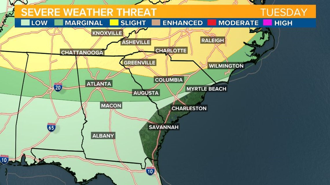
The northern Midlands will start to see storms in the early evening, between 6 and 9 pm.


Between 10 pm and midnight, the line of storms is forecast to continue its march to the southeast and affect parts of the central and southern Midlands.


The severe threat will diminish as the night progresses, with storms fading into the early morning hours.
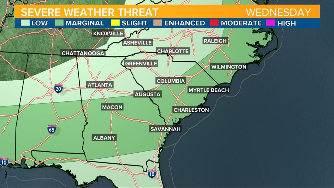
Wednesday, the southern Midlands are under a marginal risk for stronger storms. Storms are likely to develop during the afternoon and evening hours and a few may bring heavy rain and damaging winds across our area, particularly to the east where a cold front will stall.

The Midlands are expected to reach well into the 90s Tuesday and Wednesday afternoon. While temperatures so far this month are running about a degree above normal so far this month, rainfall is well below normal.
Columbia has only recorded 0.14" inches of rain, which is more than 2 inches below the average recorded by this time in the month.
This pattern points to a much needed change. Heat persists ahead of a cold front that is rolling across the eastern US through the middle of the week.

