COLUMBIA, S.C. — We saw three to seven inches of rain across the South Carolina Midlands this past week, leading to some flooding in the region.
Thankfully, we swapped the rain for the sun this weekend, and that looks to continue into Sunday with sunshine and highs reaching the lower 90s in the afternoon.
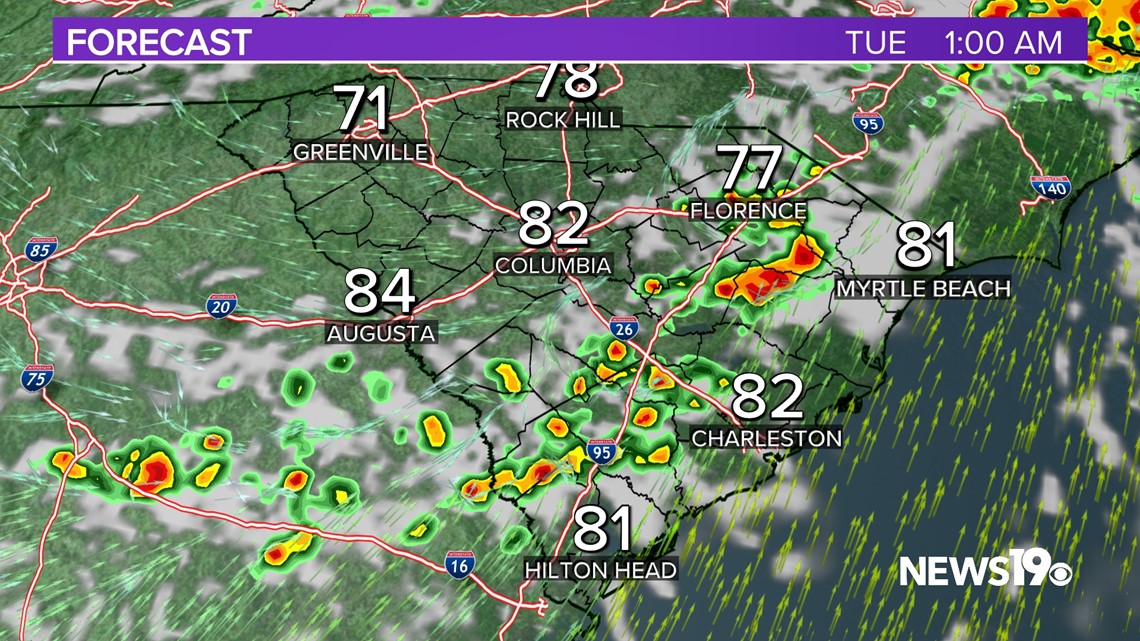
Going into Monday, some changes will be on the way. Some clouds will move through overnight Sunday ahead of a partly cloudy day on Monday. A cold front will be advancing from the west and will eventually bring the chance of some showers and thunderstorms in the afternoon and evening on Monday.

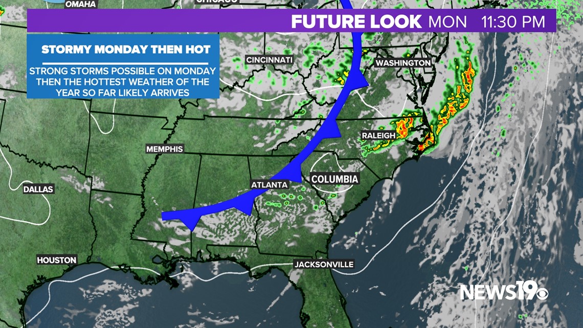
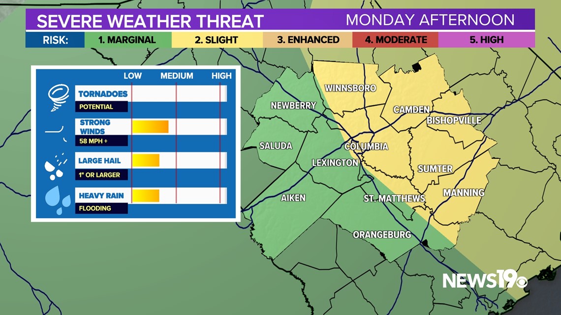
Currently, the best chance for some storms to become severe will be east of Interstate 77. This will coincide with the best daytime heating in the late afternoon and early evening hours. Storms will move out pretty quickly as the front continues to move east.

The Storm Prediction Center has placed the eastern Midlands under a slight risk of severe weather. This is where we have the best chance of storms that produce damaging winds. And we can't rule out large hail or flooding with these storms.

The weather seems to be much calmer past Monday, with the next rain chance coming as we go into next weekend. Temperatures will be at or above average, reaching the middle 90s as we close out the week. This will likely be the warmest week we have seen this year in the South Carolina Midlands.