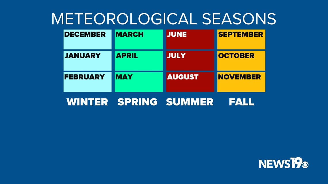
COLUMBIA, S.C. — When it comes to our year-round weather keeping records can be tricky. That is why meteorologists divide the year into 4 equal-length meteorological seasons. Summer runs from June 1st through August 31st and features our typically hottest weather of the year.

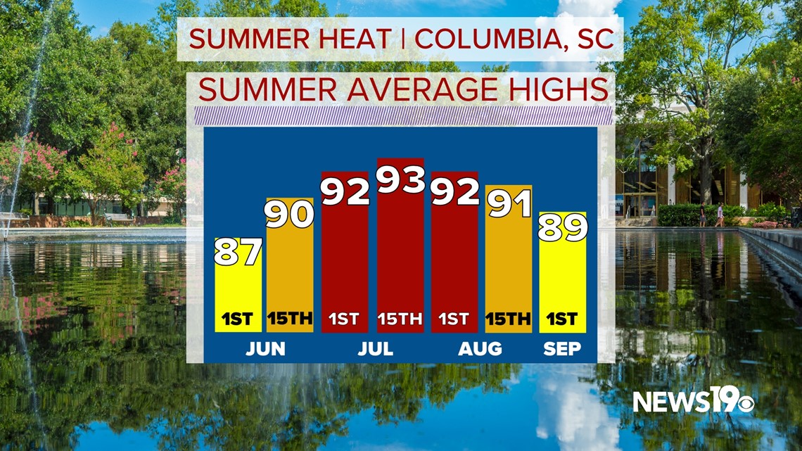
During this period, average high temperatures go from the upper 80s in June towards the lower 90s during the month of July before beginning to cool again leading into September.

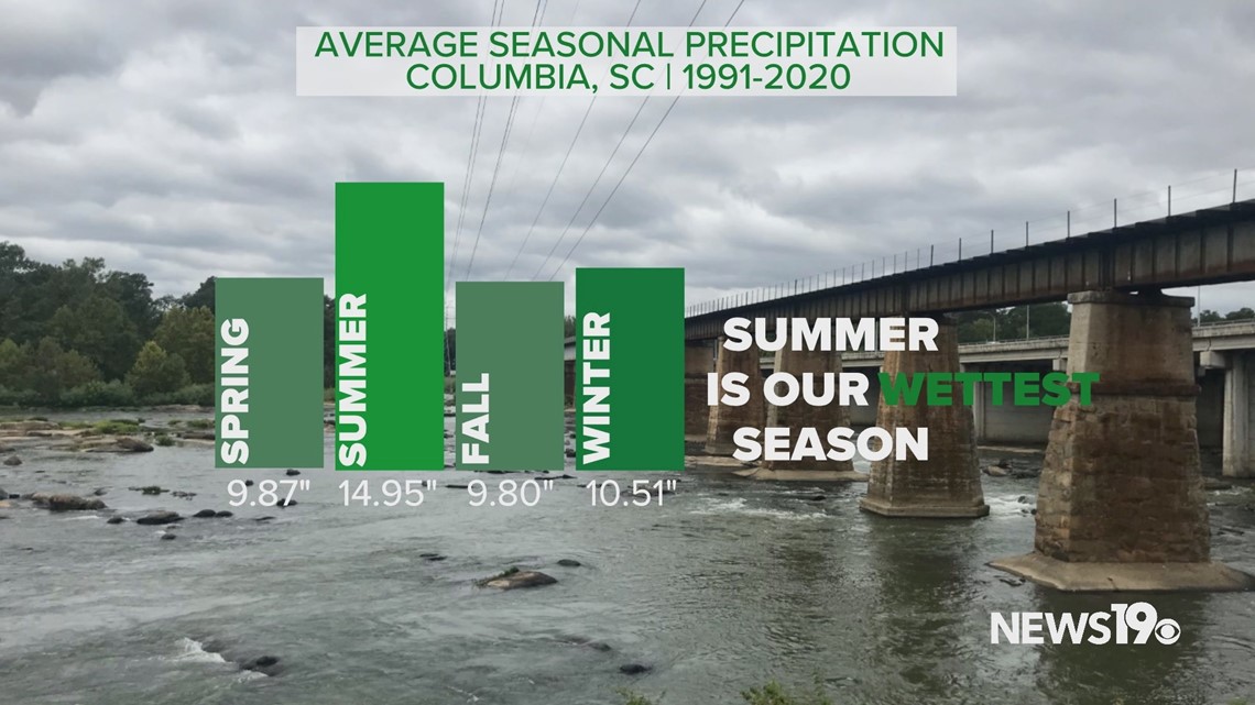
This stretch of months also features what is typically our wettest season of the year thanks to afternoon thunderstorms and tropical systems. If we do see tropical systems that can greatly add to our seasonal rainfall. This is also the season where we are most likely to see flash flooding occur here in the Midlands.

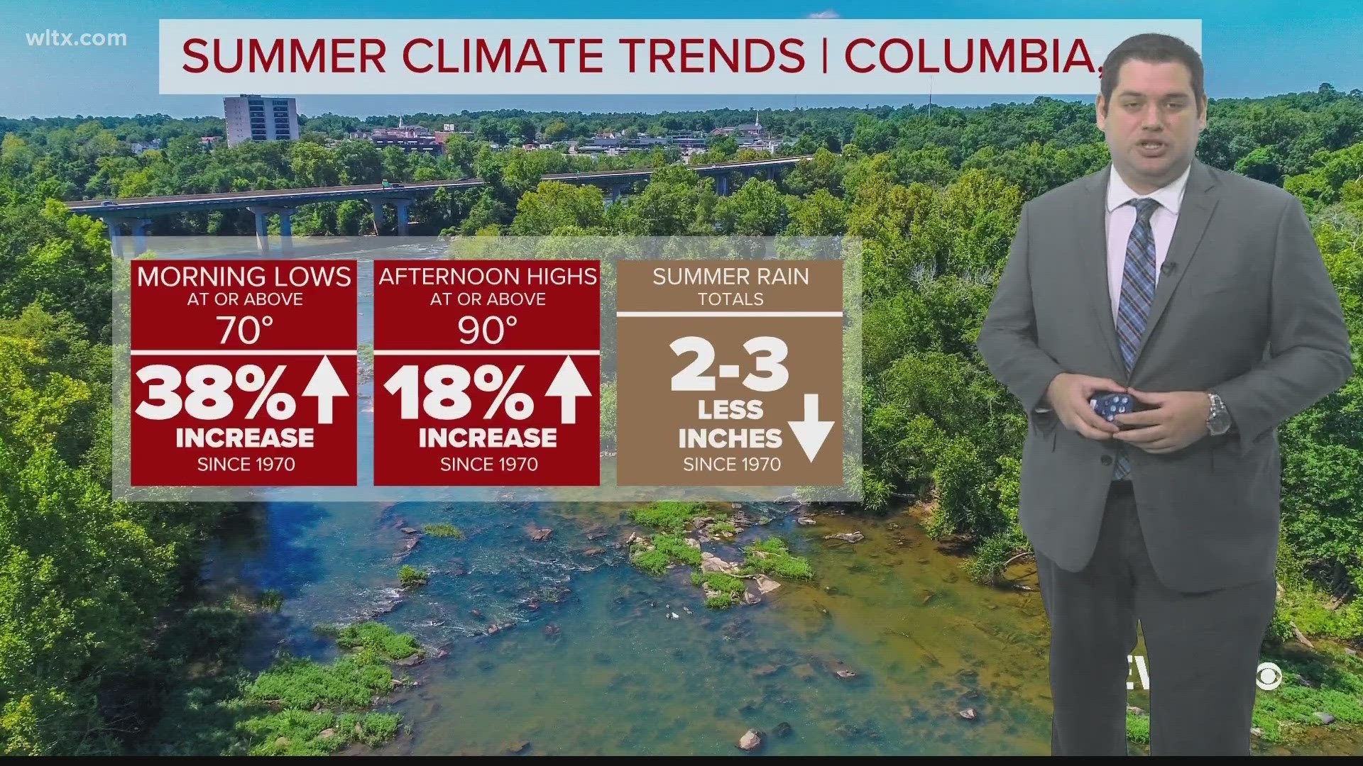
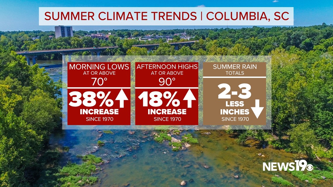
Climate data since the 1970s here in Columbia shows we are changing what our typical summer weather is. Our mornings are getting much warmer with a smaller increase in our daily highs. That rain that does help us cool off is becoming a little bit less frequent over the past 50 years.

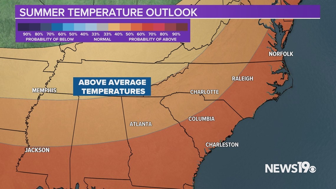
Unlike the triple-digit heat that we saw last June, we are starting off in the top 10 coolest starts but that looks to change as warmer weather leading to above-average temperatures is looking likely for the rest of the summer.

With El Nino in place, we can expect this active pattern to continue with plenty of storm chances leading to what will likely be a wetter summer ahead with more frequent thunderstorms.

