

COLUMBIA, S.C. — Expect some gorgeous weather over the next few days, as dry high pressure builds into our region. Mild afternoons and cooler-than-normal nights will grace us until the weekend. But don’t get too comfortable—this high-pressure system will move off the coast by Saturday, bringing gradual changes.
Today’s weather forecast is simple: it is going to be beautiful. High pressure continues to shift into the eastern US, keeping our area dry. With lots of sunshine, temperatures this afternoon may reach a degree or two higher than previously expected, into the lower to middle 80s. Tonight, the dry air will let temperatures drop into the mid-50s, so you might want to grab a light jacket if you’re heading out.

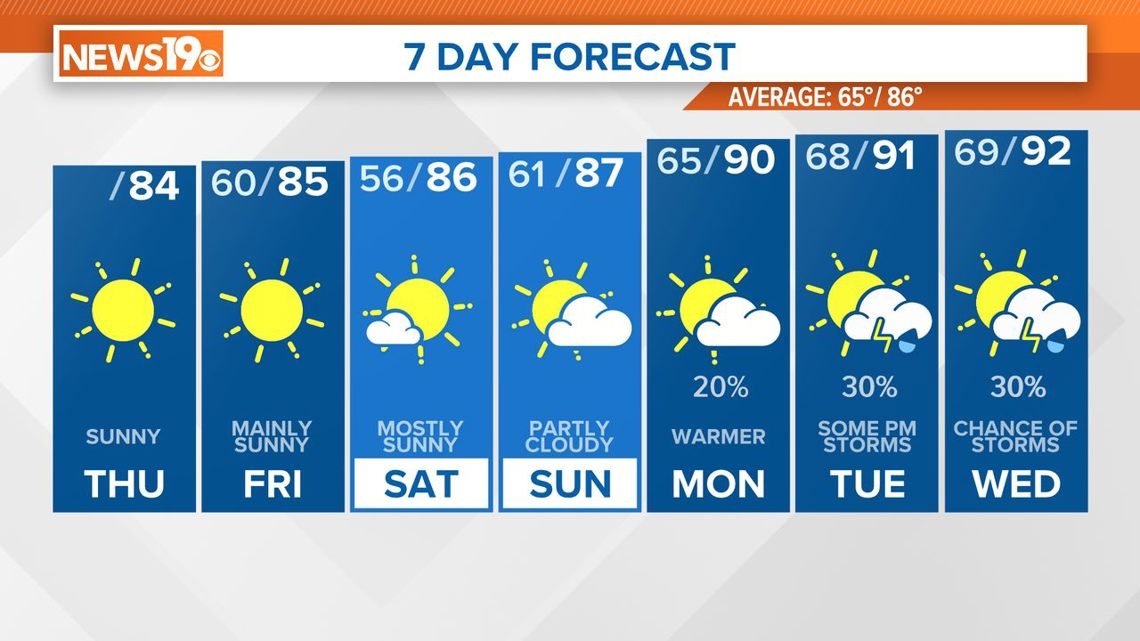
As the weekend approaches, an upper-level ridge will settle over us, and a strong pressure ridge will move southeast from the Ohio Valley into the Carolinas and Georgia, eventually shifting off the coast by Saturday afternoon. The air will remain quite dry, with dew points in the 40s and very little moisture in the atmosphere. Expect mostly sunny skies, pleasant afternoons, and cool nights.
Friday’s high temperatures will be in the low to mid-80s, slightly warmer on Saturday. Overnight lows on Friday will be in the low to mid-50s, possibly even cooler in some outlying areas.
As we head into next week, weather models show increasing moisture and a chance of scattered thunderstorms. On Sunday, moisture will begin to rise as the high-pressure system moves off the coast and a trough approaches from the Ohio and Tennessee Valleys. A short wave may bring some lift, but most of the storm activity should remain west of us.
Early next week, the air mass will become more unstable, leading to a higher chance of afternoon and evening thunderstorms, especially by midweek. A cold front may approach by Thursday, possibly increasing the likelihood of showers and storms.
Temperatures will climb above normal as the week progresses, so enjoy the mild weather while it lasts.