
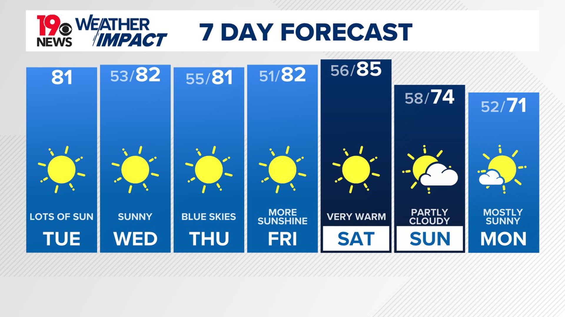
COLUMBIA, S.C. — A high-pressure system over the eastern United States will maintain dry weather throughout the week. Temperatures are expected to remain above normal through Saturday, with afternoon highs generally reaching the upper 70s to lower 80s. As the week progresses, a series of cold fronts may approach the Southeast, bringing temperatures slightly closer to average.
High pressure will continue to dominate, and Tropical Storm Oscar, moving northeast and away from the Bahamas, will push some moisture toward the region. This could lead to a few clouds, but with the dry air above, rain is not expected. Daytime highs will again climb into the upper 70s to low 80s.


For Wednesday, the warm and dry pattern will continue. Surface high pressure and upper-level ridging will keep the region dry, with temperatures around 80 degrees. Overnight lows will remain in the mid-50s, and although some moisture might increase along the coastal areas, rainfall is unlikely due to a strong high pressure in place.
Looking ahead to the weekend, a couple of cold fronts will pass through the eastern U.S. The first front, arriving late in the week, will not bring much change in temperature. Friday’s highs will stay above normal, despite the front's arrival.
A second front is expected to move in on Sunday, which could bring a slight increase in moisture, but rain is still not expected. After the front passes, temperatures are likely to cool off a bit, especially on Sunday and into early next week.
High temperatures Sunday and Monday will be in the lower to middle 70s for daytime highs.