COLUMBIA, S.C. — Over the past 5 years, the Atlantic Hurricane season we have either seen a near-average or above average season. 2020 shattered records and became the most active season on record. Looking at 2022, what can we expect and what does the past tell us?
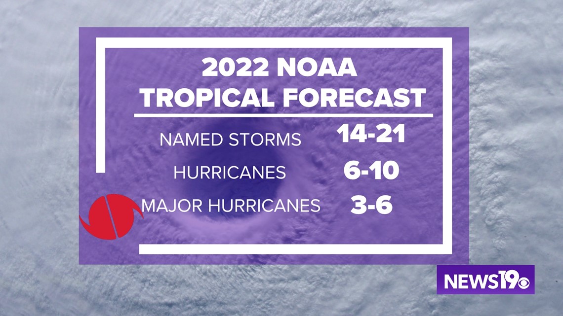
Let's start with the first official forecast of the year from the National Oceanic and Atmospheric Administration thinks once again we will see above average conditions. While 6-10 hurricanes is impressive, the 3-6 major hurricane forecast is the thing that really sticks out given on average we only see 3-4 major hurricanes in a given year.

While figuring out where exactly storms will make landfall is still something that can be challenging at times, we can take a look to the past to get an idea for where storms can form during the tropical season.
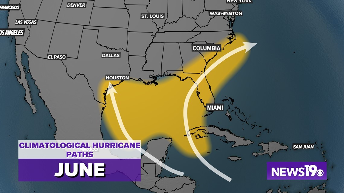
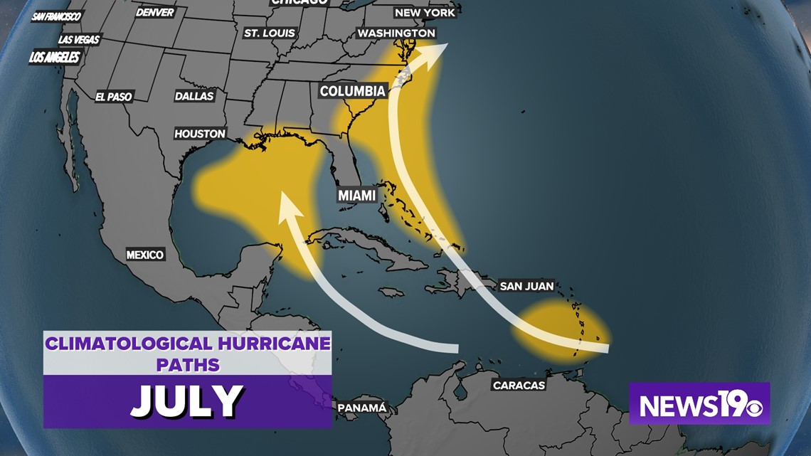
The beginning of the tropical season sees a lot of what we like to call "homegrown" systems. Low pressure forms in the Western Caribbean and Gulf of Mexico. Storms during this time of the season tend to be weaker but can still drop very large amounts of rain where they do make landfall.


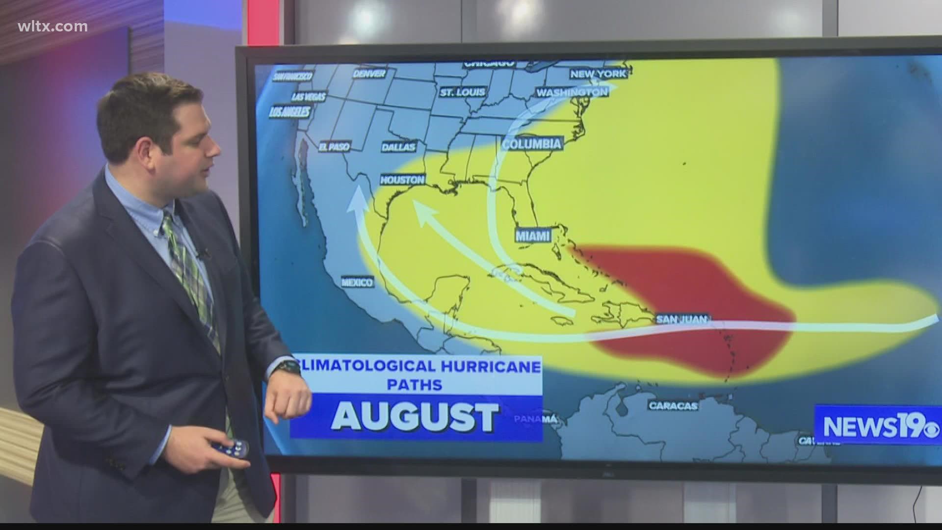
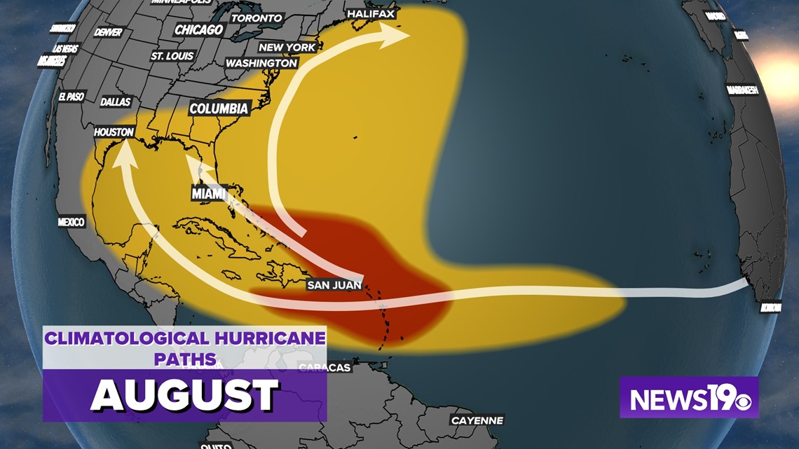
Moving towards the middle of the tropical season things really begin to change. As we see more prolonged high pressure as the summer pattern builds in along with warmer water temperatures, the area of development for tropical systems expands quite a bit. On top of this we start to see areas of low pressure come off the African coast these "waves" help produce even more tropical systems.


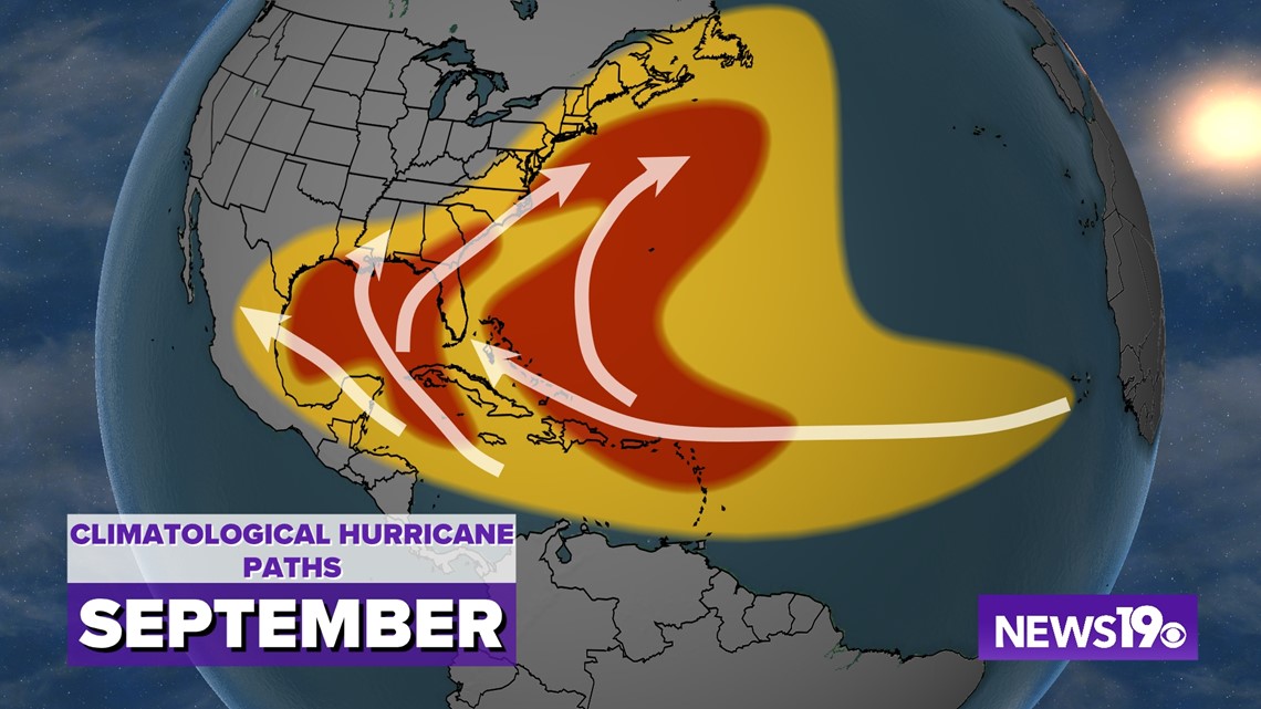
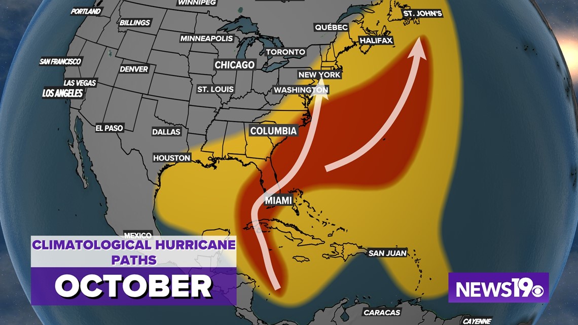
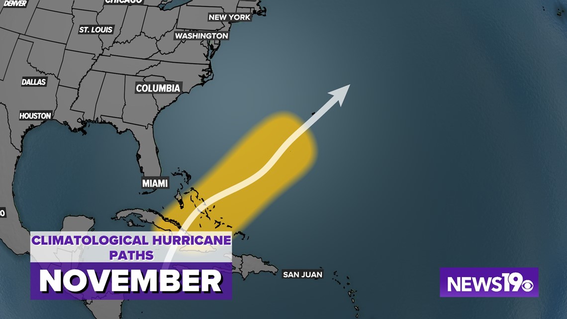
Going into October we start to see a lot change. Systems moving across America bring cold fronts which sweep tropical systems quickly out to the north and east. Along with this, we start to see tropical system decline in frequency as we go into November.


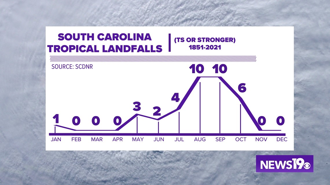
Looking specifically at South Carolina. Most of our landfalling tropical systems have historically occurred in August and September. Looking at strength, the stronger storms in our history have lined up with this for the most part even pushing into October.

