COLUMBIA, S.C. — The winter season is always viewed as a gloomy, grey, and dull time of the year. Over the last few weeks it has been rather cloudy here across the Midlands but there is a reason behind why we typically see this type of weather during the winter months.
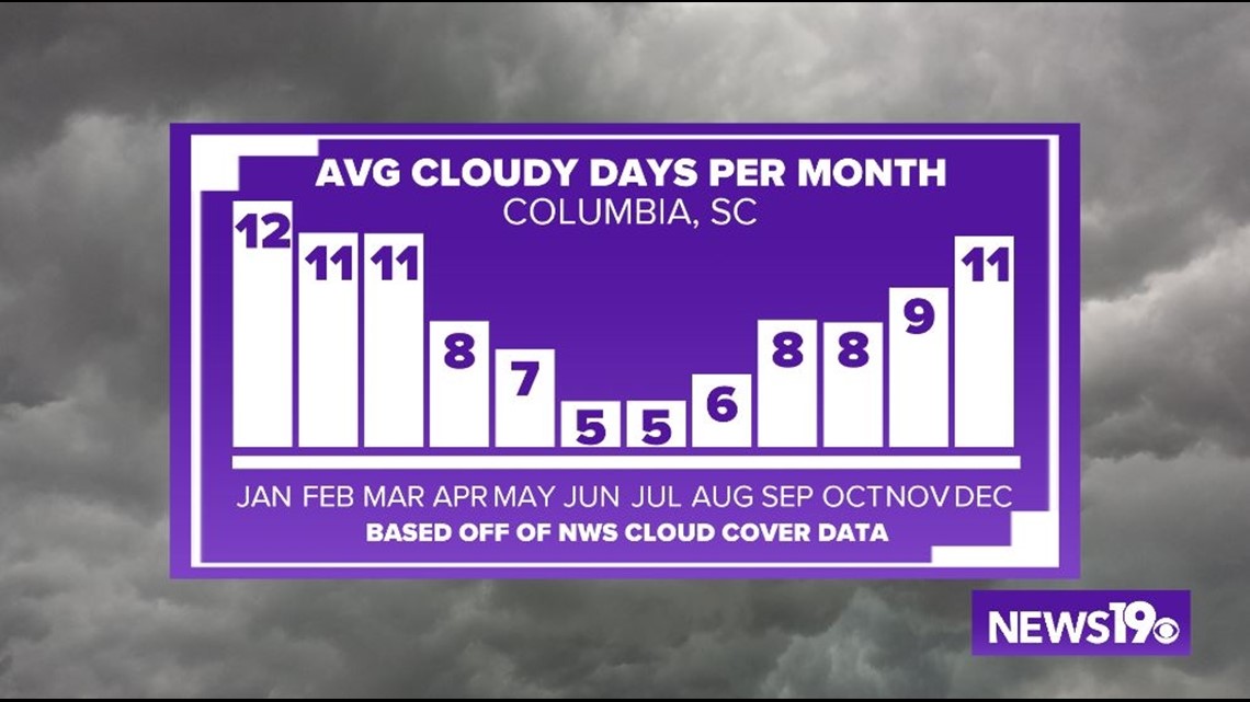
Let's first break down the facts about what we see in the Midlands. Over the course of an average winter here in Columbia we see almost 38 cloudy days according to NWS weather data. This means that roughly, we see a cloudy day one out of every 3 days. That is really cloudy!!


The reason for this? Well, during the winter months the jet stream dips much father south. While this also allows colder weather to move towards the south, it also moves low pressure systems closer to the Gulf Coast. Especially with our recent setup we have seen the active storm track setup right over the eastern US which has upped our cloudy days over the past month.


There are brighter days ahead though as we see the season change. We will shift from this active pattern in the winter to a more transitional pattern in the Spring which eventually leads to a more quiet pattern in the Summer. What does all this mean? It means that we see less weather systems moving through the area as we work towards the summer. You can see this as our cloudy days per month more than half from winter months to summer months.


With all that being said, why is the summer so much sunnier? It comes down to high pressure. We typically see the Southeast Ridge build in during the late Spring months and that allows surface low pressure to form off the coast (The Bermuda High). This weather pattern keeps us pretty quiet outside of daily convective thunderstorm chances and tropical weather.


