COLUMBIA, S.C. — Nicole is expected to make landfall in the coming days in Florida before it begins to move through the southeast. While damaging winds will be the biggest concern down in the Sunshine State, here in South Carolina, that threat appears to be lower.
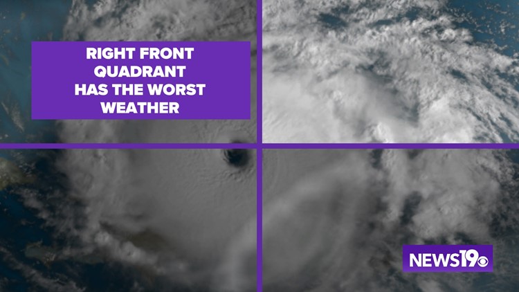
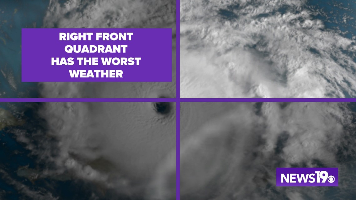
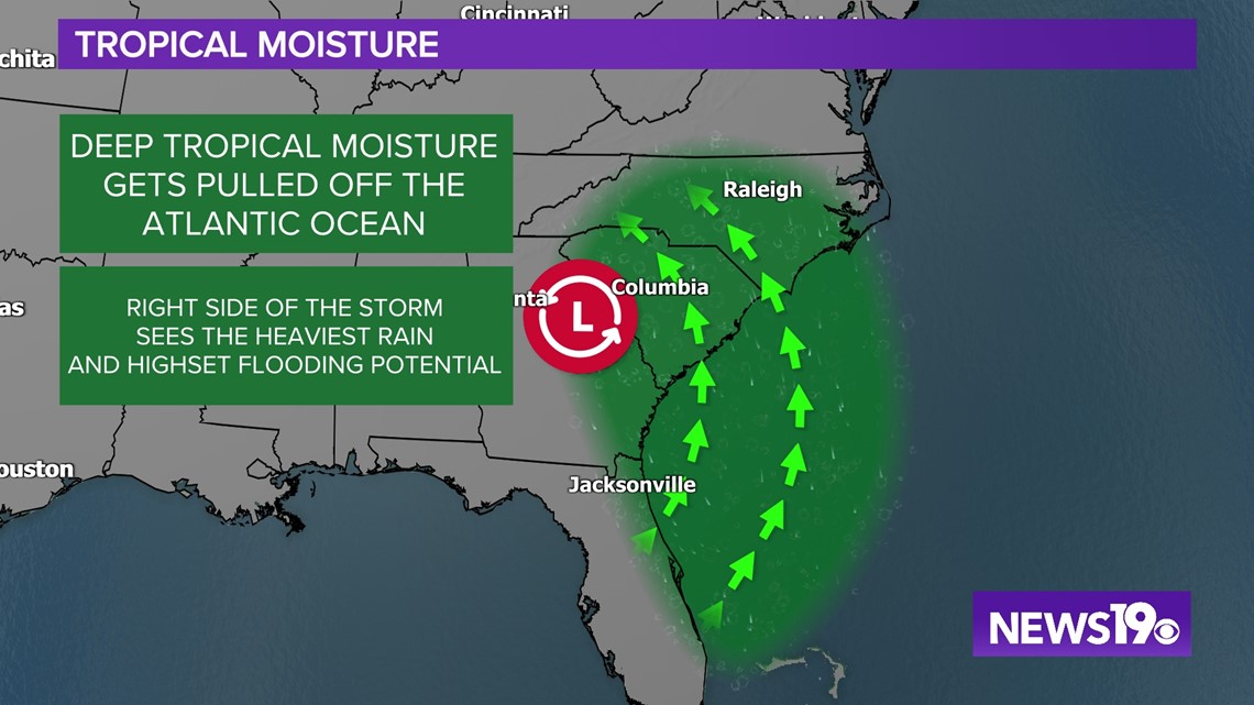
This doesn’t mean we are in the clear, Our position in the track keeps us in play for severe weather. As of Wednesday evening, the National Hurricane Center has Nicole moving through the Upstate with the Midlands likely in the right half of the system. We can divide hurricanes into four equal pieces or quadrants. When it comes to the worst weather, the right side of the storm is where we see typically see the most impacts.

Southerly winds on this side of the storm pull deep tropical moisture from the ocean which leads to more widespread and heavier rainfall that could lead to flooding.

There is one specific part of this region though where impacts are maximized. Due to multiple factors including wind direction and storm motion, the top right quadrant of the storm is where we see the worst weather in the storm.

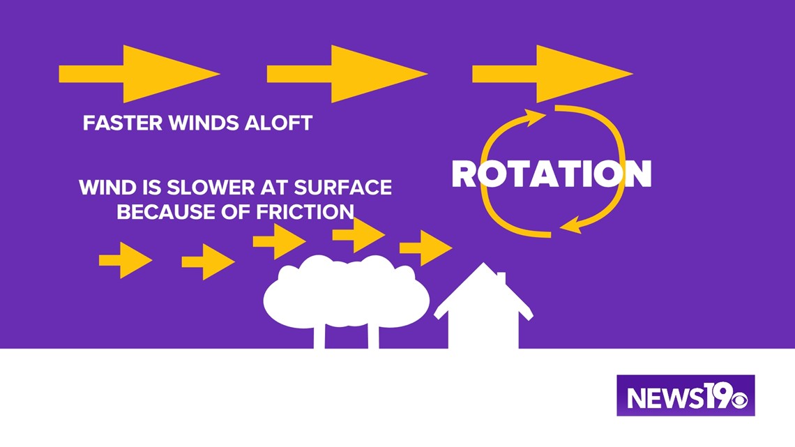
The winds in this sector remain very fast especially higher up, while winds are slowed down at the surface. This causes rotation in the atmosphere which can translate spinning storms that often spawn tornadoes. This is actually quite common in storms that have impacted the state.

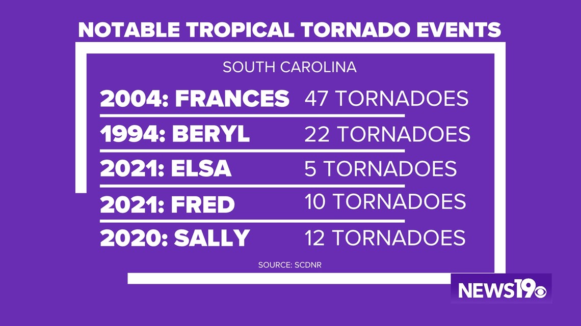
Looking back, several storms in the past 2 years brought tornadic weather to the state with storms like Beryl and Frances causing tornado outbreaks while they moved through.

