
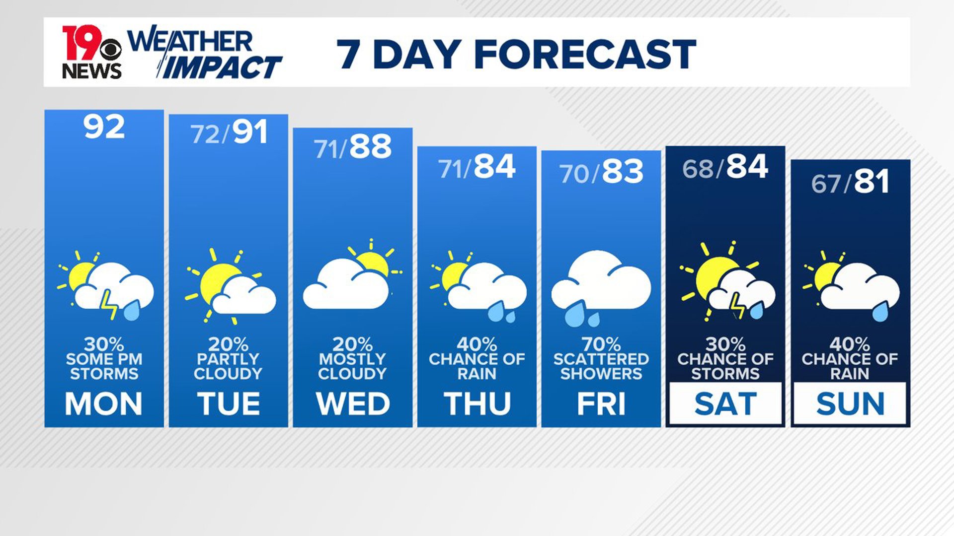
COLUMBIA, S.C. — Very warm conditions are expected to persist into the first half of the work week. An area of high pressure will lead to above-normal temperatures, with highs reaching the mid-80s in the northern areas and lower 90s in the southern Midlands. However, there will be a chance for some rain each day, as multiple shortwaves moving through the region will introduce chances for precipitation throughout the week.
Sunday was the fall equinox, but it was hot and humid. High temperatures were in the middle 90s for a large part of the Midlands. The Columbia airport reported a high of 96 degrees.

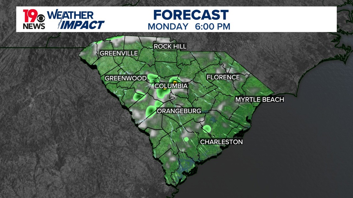
Today will be unseasonably hot, but moisture levels are expected to rise, creating a favorable environment for isolated afternoon showers and thunderstorms, particularly across the southern half of the forecast area.
Looking ahead to Tuesday and Wednesday, the upper ridge will begin to slide offshore, allowing an upper trough from the Midwest to dig southward. This change may bring additional showers and thunderstorm chances, especially in northern areas on Tuesday and the western regions on Wednesday. While temperatures will remain above average, the potential for a developing tropical system in the Gulf of Mexico is becoming increasingly concerning.
Forecast models suggest a 70% probability of tropical development within 48 hours, increasing to 90% over the next week. However, there is still uncertainty regarding the system's exact track. Depending on the upper trough’s development, the tropical system could either be pulled westward or swept toward the Southeast.

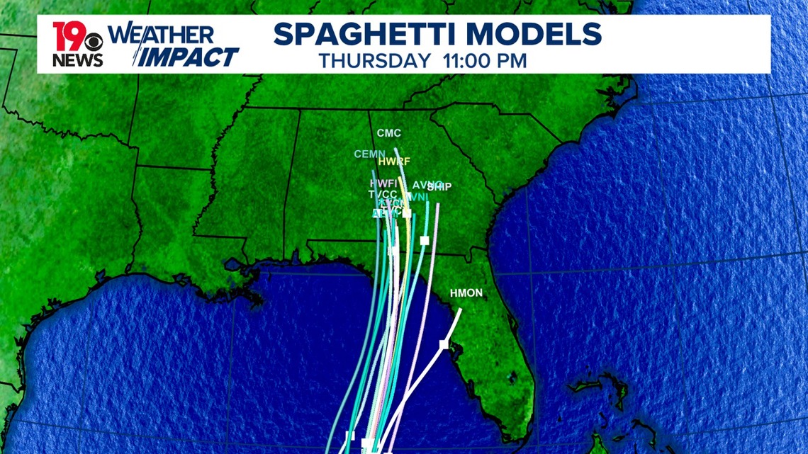
This system is expected to bring heavy rains to parts of Central America over the next few days. People in the northwestern Caribbean, the Yucatan Peninsula in Mexico, and western Cuba should keep a close watch on it. Later this week, the system is predicted to move northward across the eastern Gulf of Mexico, so those along the northern and northeastern Gulf Coast should also stay alert.
As we approach the latter part of the week, precipitation chances are likely to increase due to both the tropical system and an approaching frontal boundary.