The National Hurricane Center in Coral Gables, FL began to issue information, watches and warnings on Potential Tropical Cyclone FIVE on Sunday, and late Monday afternoon, was named Tropical Storm Ernesto.
Monday evening's 8:00 pm update indicated sustained winds at 40 mph, gusting to 50 mph. The forward motion of the tropical storm was fast at 28 mph to the west.
Tropical storm warnings are in effect for the Lesser Antilles, that includes the island of Puerto Rico. Tuesday through Wednesday, Ernesto will move through the eastern branch of the Caribbean Islands, potential with wind gusts upwards of 60 mph, before making a turn to the north and strengthening to a category 2 hurricane.
Ernesto, as a hurricane, has the potential of making a significant impact to Bermuda by Saturday.

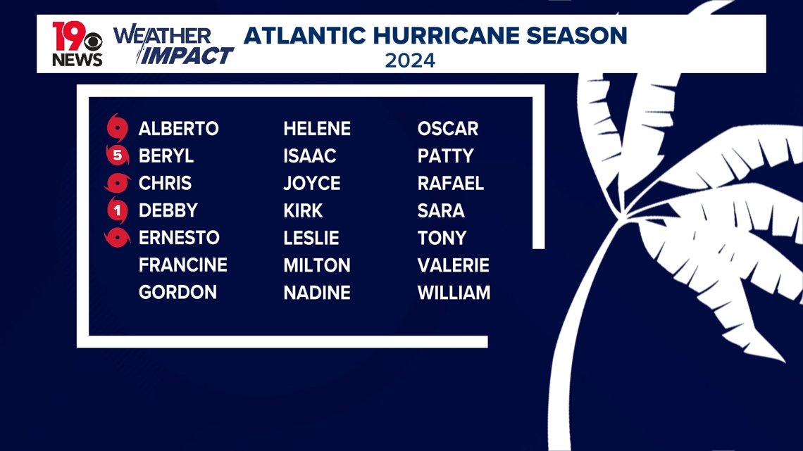
Ernesto becomes the fifth name tropical cyclone of the 2024 Atlantic hurricane season.
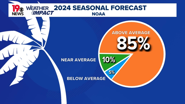
This doesn't seem like many, compared to the last decade of seasonal tropical cyclones, when more named tropical cyclones were named by mid-August. Projections from NOAA and the National Hurricane Center predicted the highest probability of activity this hurricane season for any time since predictions began.

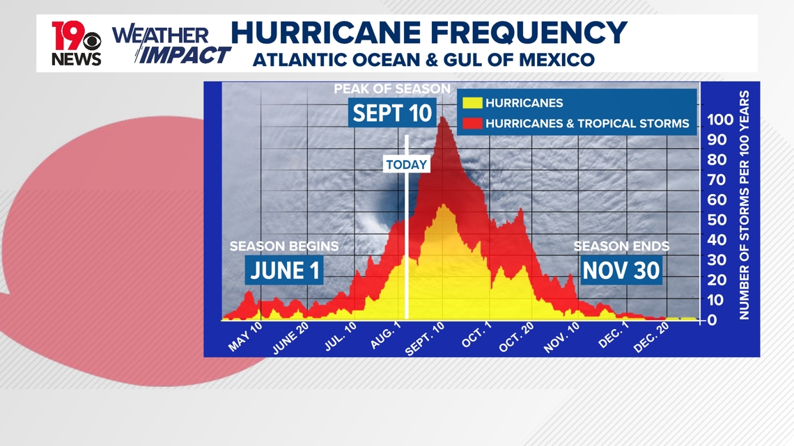
Now that we are in the middle of August, Ernesto is on the cuff of a significant increase on potential activity in the Atlantic Ocean and Gulf of Mexico.
Peak tropical cyclonic activity is September 10, and with only four weeks away, activity should accelerate. The frequency projections do not indicate the potential for direct or indirect impacts from tropical storms or hurricanes making landfall. Rather, the frequency is based on the formation of a tropical storm or hurricane in the Atlantic Ocean or Gulf of Mexico.
As we approach the peak of hurricane season, it's important to be prepared.