
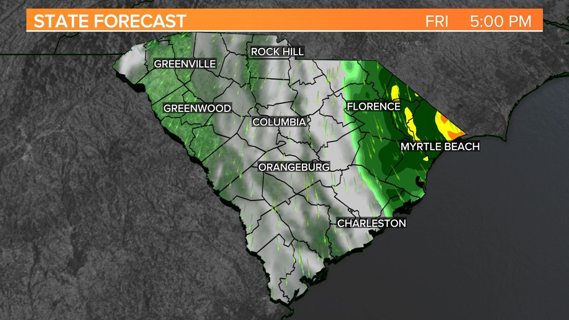
COLUMBIA, S.C. — Late tonight and into Friday, a coastal low will continue to develop. Showers are expected to increase across the Pee Dee on Friday and Saturday, with most of the area remaining dry. Regardless of showers, breezy conditions are expected, with up to 30 mph gusts. More dry air follows the low as it moves out of the area.
The moisture and clouds will continue to spread across the Midlands today as the low-pressure system develops off the coast of the Southeast. Today will be partly to mostly cloudy, with high temperatures in the lower 80s. A stray shower is possible in the southern and eastern Midlands, but most of us will be dry.

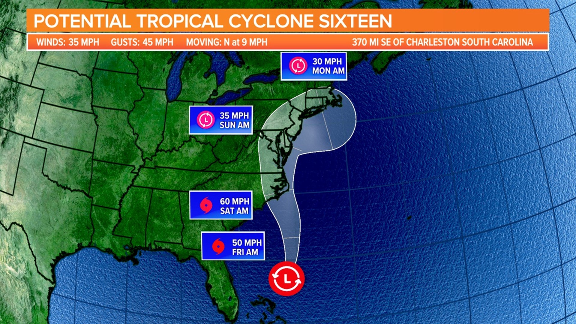
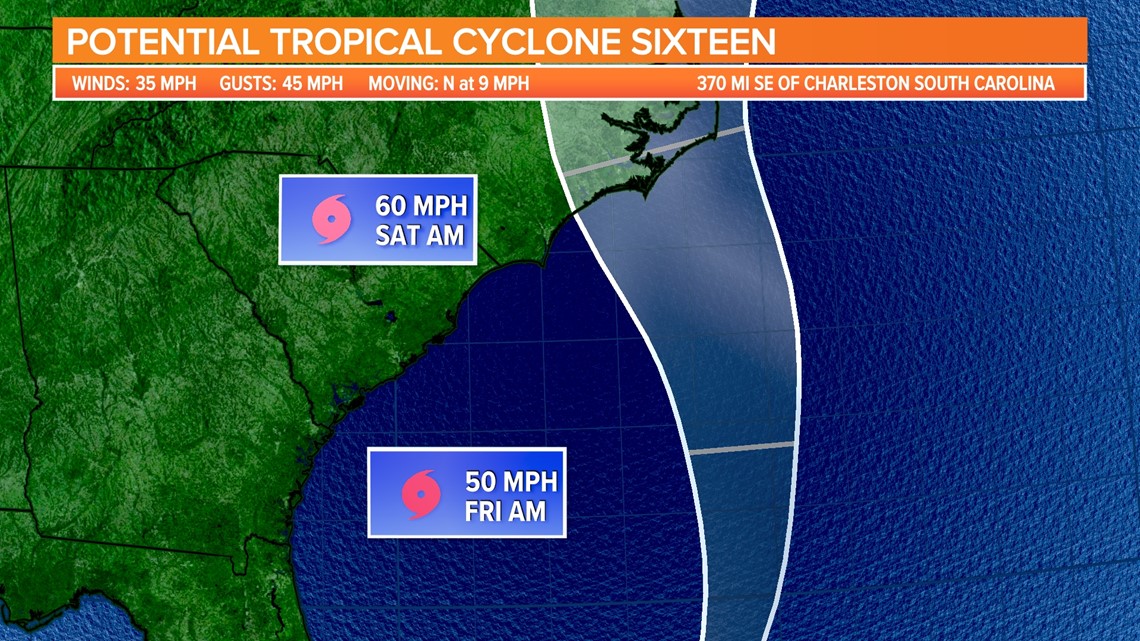
Thursday morning, the National Hurricane Center began issuing advisories for Potential Tropical Cyclone Sixteen. The storm had winds of 35 mph with stronger gusts. It was moving towards the north at 9 mph. Tropical storm warnings were issued for parts of the North Carolina and Virginia coastlines.
As the low strengthens, clouds will continue to spread across the area on Friday. A non-tropical low-pressure system is expected to form within this area by early Friday, and this system could acquire some subtropical characteristics on Friday or early Saturday while it moves generally northward toward the coast of North Carolina.
Regardless of whether it becomes a named storm, this low is expected to bring tropical-storm-force winds, heavy rain, and high surf to parts of the Southeast and Mid-Atlantic United States on Friday and through the weekend.

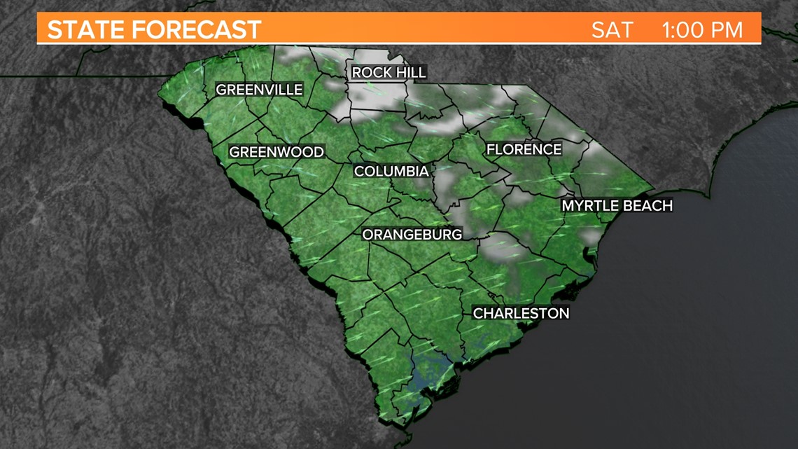
The forecasted impacts for us in the Midlands are the same: mostly cloudy skies, breezy conditions, and the possibility of rain in the eastern part of the area.
Our in-house forecast model brings some rain to the eastern part of the Midlands late Friday into early Saturday. Some rain may shift towards the west, but all the shower activity generally stays east of I-26 and I-77. It will be a breezy Friday with winds out of the northeast at 10-15 mph and stronger gusts. Highs will be in the upper 70s to the lower 80s.

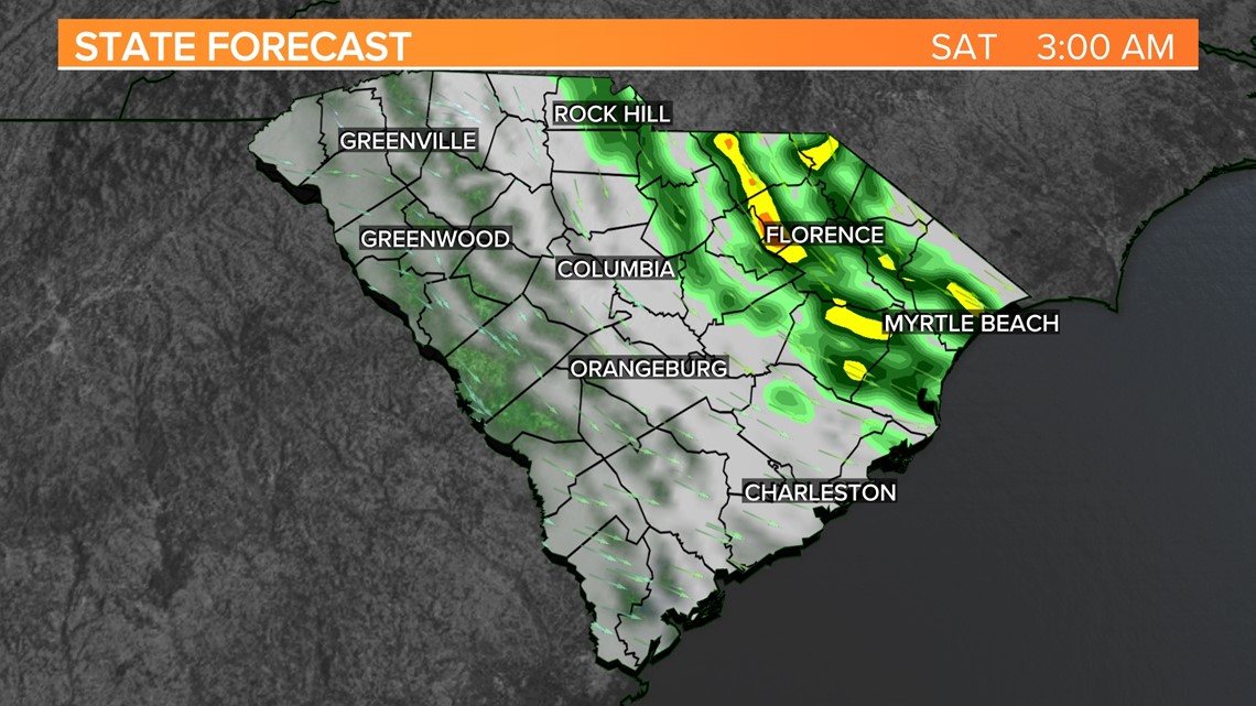
Any rain should move out of the area by early Saturday morning. Clouds will decrease throughout the day on Saturday. Highs will be in the lower 80s, but it will still be a bit breezy with winds out of the north.

Lots of sunshine is forecast for Sunday, with seasonably high temperatures in the lower to middle 80s.