
COLUMBIA, S.C. — Tropical Storm Laura and Tropical Depression Fourteen are expected to get stronger over the next several days. Both could impact the Gulf Coast next week.
Tropical Depression Thirteen strengthened Friday morning and became the 12th named storm of the 2020 Atlantic hurricane season.
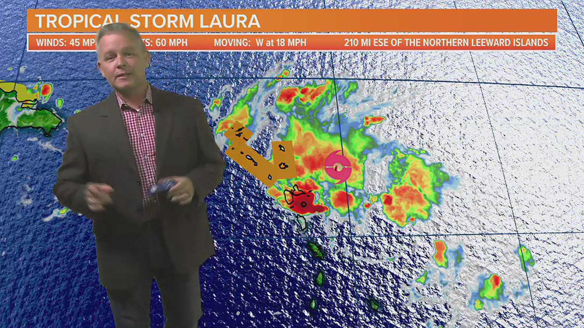
Tropical Storm Laura was located about 210 miles east-southeast of the northern Leeward Islands. It was moving west at 18 mph. The tropical storm had winds of 45 mph.
Tropical storm warnings are in effect for Puerto Rico, Vieques, Culebra, the U.S. Virgin Islands, the British Virgin Islands, Saba, St. Eustatius, St. Maarten, St. Martin, St. Barthelemy, Antigua, Barbuda, St. Kitts, Nevis, Anguilla, and Montserrat.
Tropical storm watches are in effect for the northern coast of the Dominican Republic from Cabo Cabron to the border with Haiti, the northern coast of Haiti from Le Mole St. Nicholas to the border with the Dominican Republic and the southeastern Bahamas and the Turks and Caicos Islands
Tropical storm conditions are expected within portions of the warning area area later today through Saturday.
Tropical storm conditions are possible within portions of the watch area Saturday night and early Sunday.
Laura is expected to bring heavy rain to the islands. Flash flooding and mudslides will be possible.
The details of the long-range track and intensity forecasts are more uncertain than usual since Laura could move over portions of the Greater Antilles through Monday.

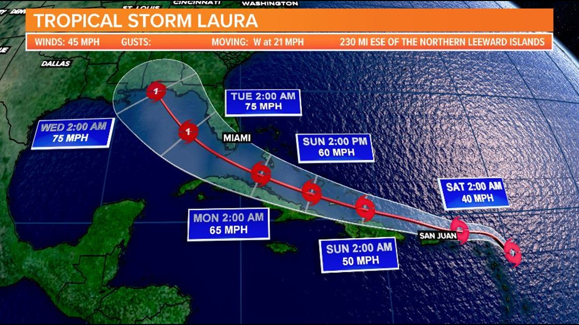
Laura could bring storm surge, rainfall, and wind impacts to portions of Cuba, the Bahamas, and Florida early next week and the northeast U.S. Gulf Coast by the middle of next week.
Interests there should monitor Laura's progress and updates to the forecast over the next few days.
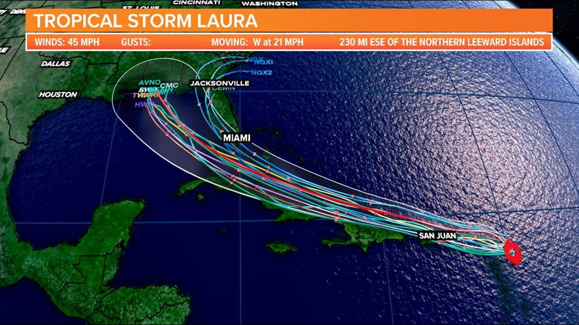
Here are the spaghetti models for Tropical Depression Thirteen:

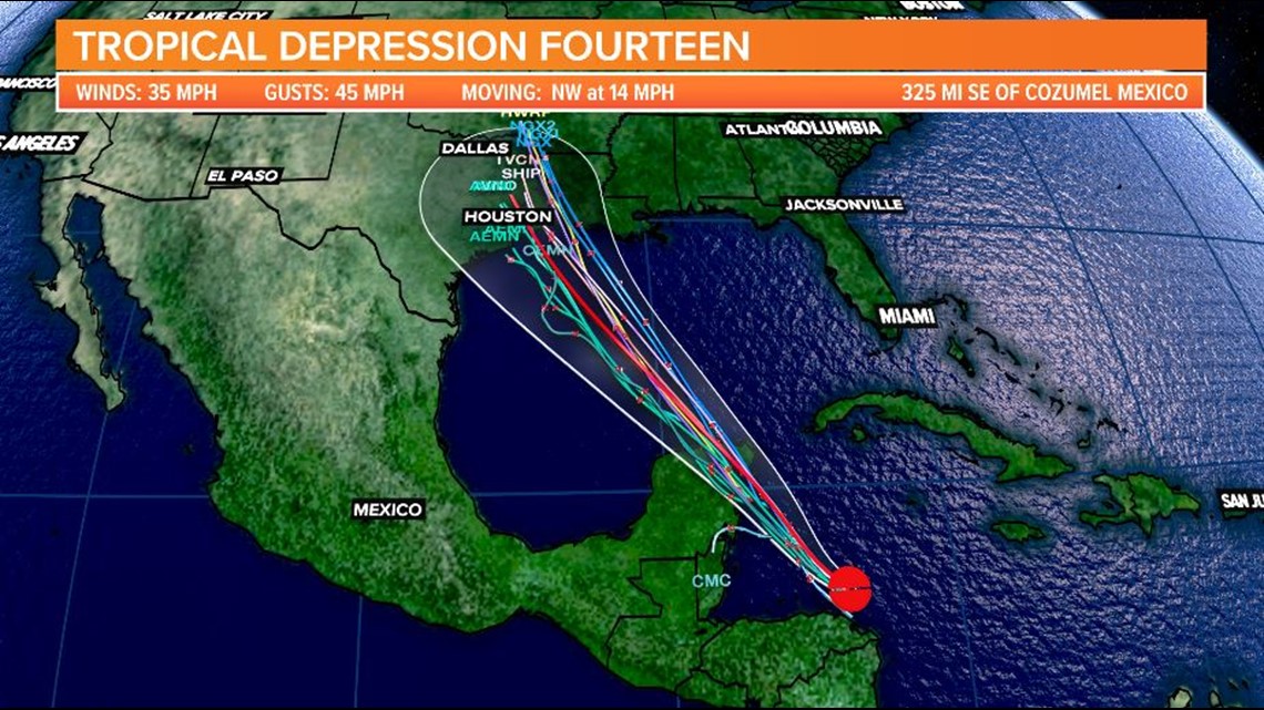
Tropical Depression Fourteen is expected to strengthen as it moves towards the Yucatan Peninsula.
Fourteen is located off the coast of Central America. It was moving northwest at 14 mph. The disturbance had winds of 35 mph.
The government of Honduras has issued a tropical storm warnings for the coast of Honduras from the Honduras and Nicaragua border westward to Punta Castilla.
A Tropical Storm Warning is in effect for the Honduras and Nicaragua border westward to Punta Castilla, Honduras.
The government of Mexico has issued a Tropical Storm Watch for the northern coast of the Yucatan Peninsula north and west of Cancun to Dzilam.
Regardless of development, this disturbance will likely produce heavy rains across a large portion of Central America and southeastern Mexico this weekend.
The system is expected to move into the south-central Gulf of Mexico as a tropical storm on Sunday.

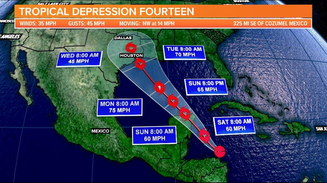
Some strengthening is anticipated while it moves northwestward over the western Gulf of Mexico early next week, but it is too soon to know exactly how strong it will get or the location and magnitude of impacts it will produce along the central or northwestern Gulf Coast.
Interests in that area should continue monitoring the progress of this system over the next few days.
Here are the spaghetti models for Tropical Depression Fourteen:

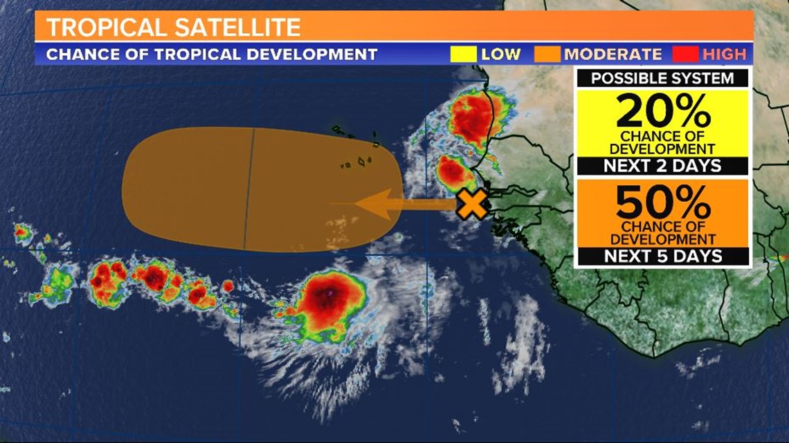
The third area being watched by the NHC is coming off the African coast. It will move over the extreme eastern Atlantic and may become better developed.
There is a medium chance of further development over the next five days. This disturbance is moving west-northwest at 15 to 20 mph.

The Atlantic has had 12 named storms so far this season, but only two hurricanes.
It is the first hurricane season on record in which nine tropical storms formed before August 1.


Hurricane season officially goes from June 1 to November 30. It sharply peaks from late August through September.
The season's climatological peak of activity occurs around September 10 each year.
To track these systems as well as any future tropical systems this season, download the WLTX App. Download the WLTX app for Android or iPhone: