COLUMBIA, S.C. — The peak of hurricane season is less than a month away.
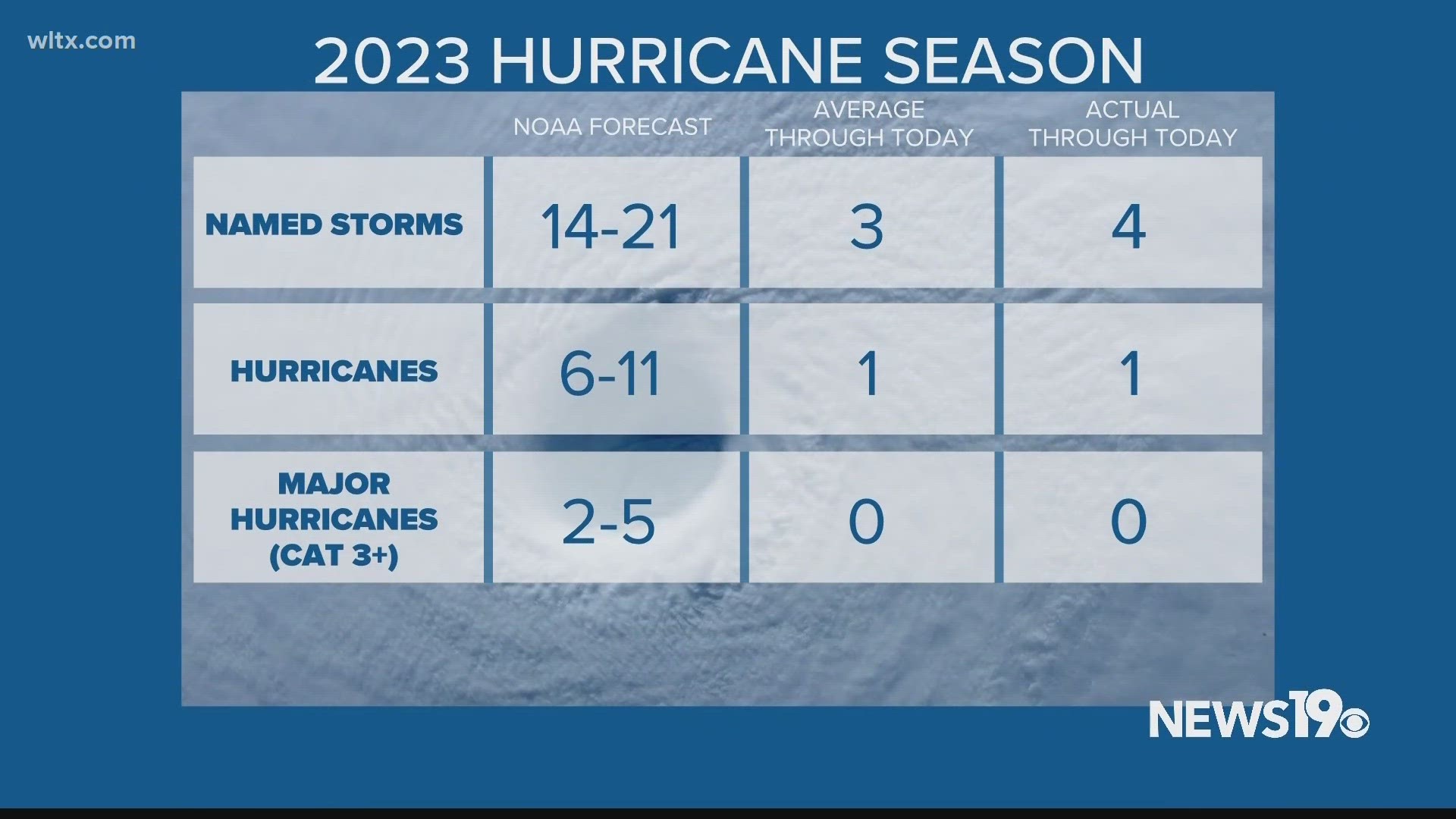
We have already seen our first hurricane this hurricane season but, overall, the tropics have been very quiet here in the U.S. That is why it might be surprising to hear that last week, NOAA increased their predictions for this year pointing towards a more active season.
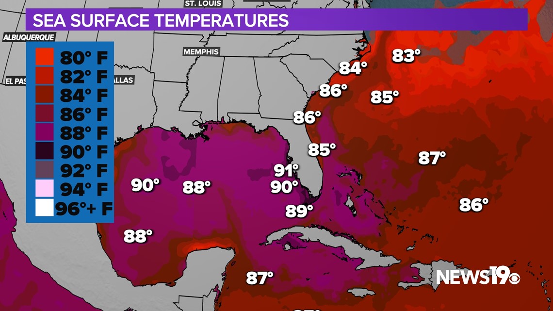
The main reason for this is the 4 months straight that have included record-breaking ocean temperatures. Portions of the Gulf of Mexico are currently pushing 90 degrees with temperatures more than hot enough to support strong storms.


There still are some questions about the rest of the season though. Dry air has been and continues to be an issue in the Atlantic. Plenty of Saharan dust can be seen over the ocean on satellite. This dust can be a big issue for storms trying to form.
There are also the effects of El Nino which typically leads to storm weakening shear over the western portions of the Atlantic Ocean.
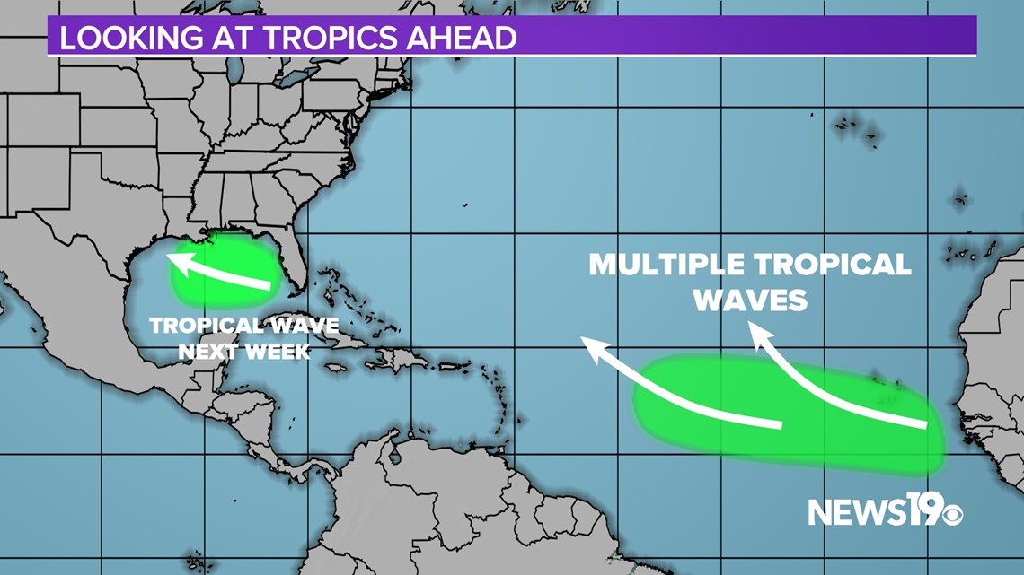
Taking a look at areas of interest over the next 2 weeks, there will be several tropical waves coming off of Africa along with a wave moving through the Gulf. While there is some model support we will have to wait and see if this leads to the beginning of a more active time in the tropics.


While there have been 5 storms this season in the Atlantic, there have already been 7 named storms in the Pacific with likely more on the way.

