
COLUMBIA, S.C. — The National Hurricane Center is monitoring Tropical Storm Franklin, located a few hundred miles east-northeast of the Turks and Caicos Islands. The NHC is also tracking three other areas for possible tropical development.
Tropical Storm Franklin
The center of Tropical Storm Franklin was 660 miles south-southwest of Bermuda. Franklin is moving toward the east-northeast at about 6 mph, and this general motion is expected to continue today. A sharp turn toward the north is expected tonight and Saturday, with a northward or north-northwestward motion over the western Atlantic continuing through early next week.
The maximum sustained wind speed remains around 60 mph, with higher gusts. Franklin is expected to gradually strengthen and become a hurricane over the weekend. Tropical storm-force winds extend up to 105 miles from the center.

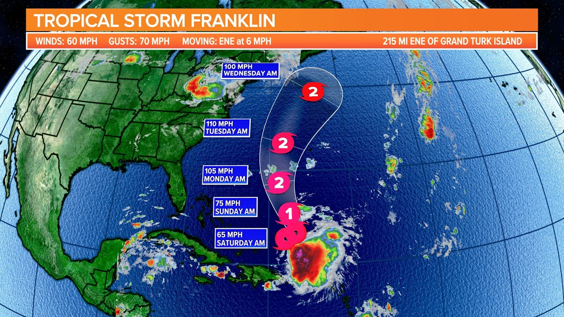
Franklin will stay away from the United States, but big swells and dangerous rip currents will impact the East Coast early next week and continue through Labor Day weekend.
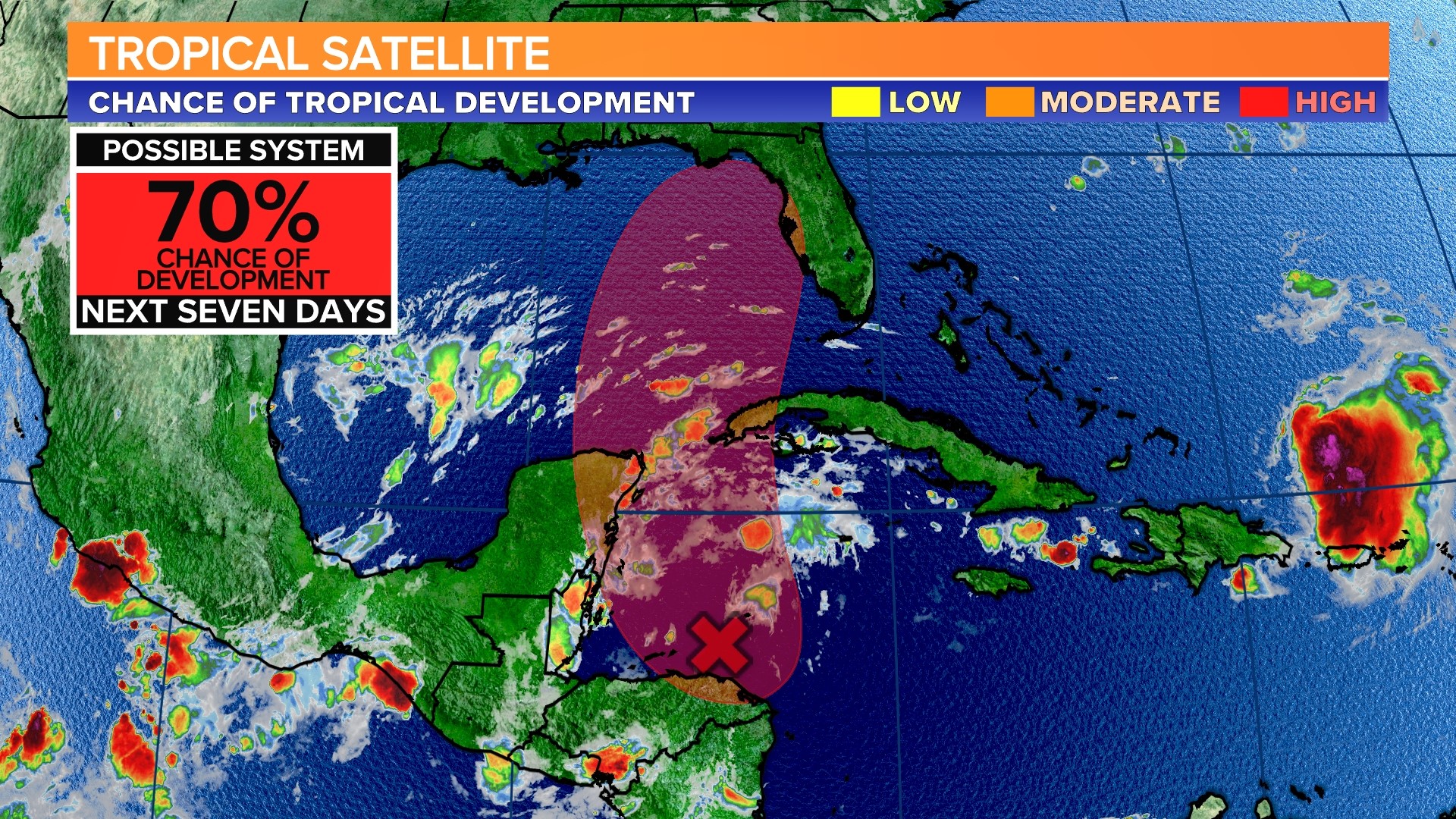
Northwestern Caribbean Sea and eastern Gulf of Mexico
A broad area of low pressure over the northwestern Caribbean Sea near Honduras' northeastern coast is causing scattered showers and thunderstorms. Environmental conditions appear to be favorable for the gradual development of this system over the next few days, and a tropical depression is expected to form late this weekend or early next week while moving northward over the northwestern Caribbean Sea and the eastern Gulf of Mexico.

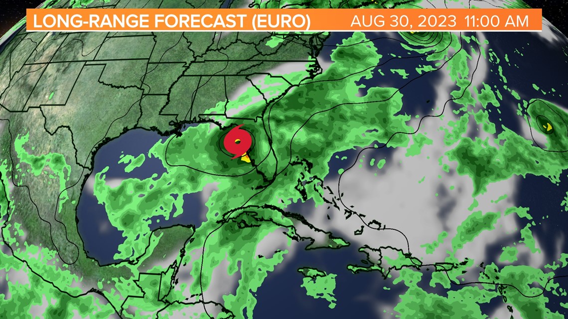
If a system forms, it will most likely track toward Florida, but it is too early to predict the timing and magnitude of any impacts. The European forecast model has this moving northeast through Florida, off the coasts of Georgia and South Carolina, by mid-next week.
Interests in Mexico's Yucatan Peninsula, western Cuba, and Florida should keep an eye on the progress of this system.
The NHC gives this area a 70% chance of further development over the next seven days.
Central Subtropical Atlantic
A trough of low pressure located about 950 miles east of Bermuda (the remnants of former Tropical Storm Emily) is producing an elongated area of disorganized showers and thunderstorms.
The environment is becoming less conducive to the formation of a tropical cyclone. The low is expected to merge with a frontal boundary over the north-central Atlantic within the next day or two.
Central Tropical Atlantic
Showers and thunderstorms persist with a low-pressure system halfway between the Cabo Verde Islands and the northern Lesser Antilles. In a few days, environmental conditions could improve, and a tropical depression could form by early next week as the system moves northwestward toward the central subtropical Atlantic.