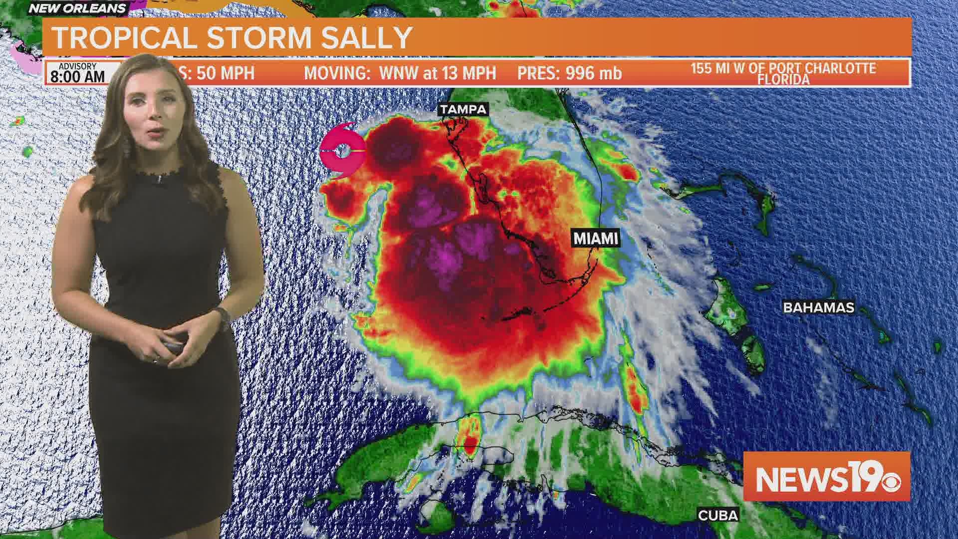
COLUMBIA, S.C. — Tropical Storm Sally is located just west of Tampa, Florida and is forecast to strengthen before making landfall as a hurricane along the northern Gulf Coast.
The storm, now over the warm waters of the Gulf of Mexico, has winds of 50 mph as of 8 am Sunday. It is moving to the west northwest at 13 mph.
Sally will likely strengthen into a hurricane on Monday as it slowly approaches the Gulf Coast. The latest forecast path does have it becoming a category 2 hurricane with winds of 100 mph before making landfall along coastal Louisiana.
The slow movement of the storm along with high winds will create strong storm surge as well as prolonged heavy rainfall.

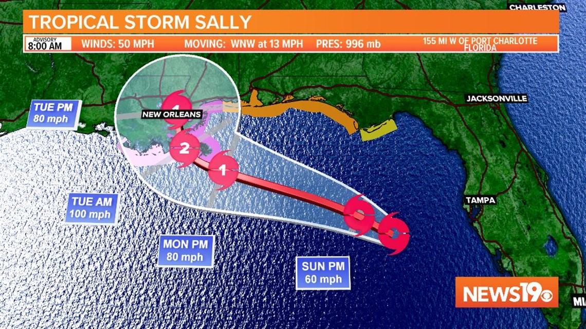
The storm will slowly move north before a cold front turns it to the northeast near the second half of the week. The cone of uncertainty from the National Hurricane Center has part of the Midlands in it on Friday as the remnants of Sally turn northeast.
If the storm moves east enough, some tropical moisture could move into the Midlands for the end of the week.

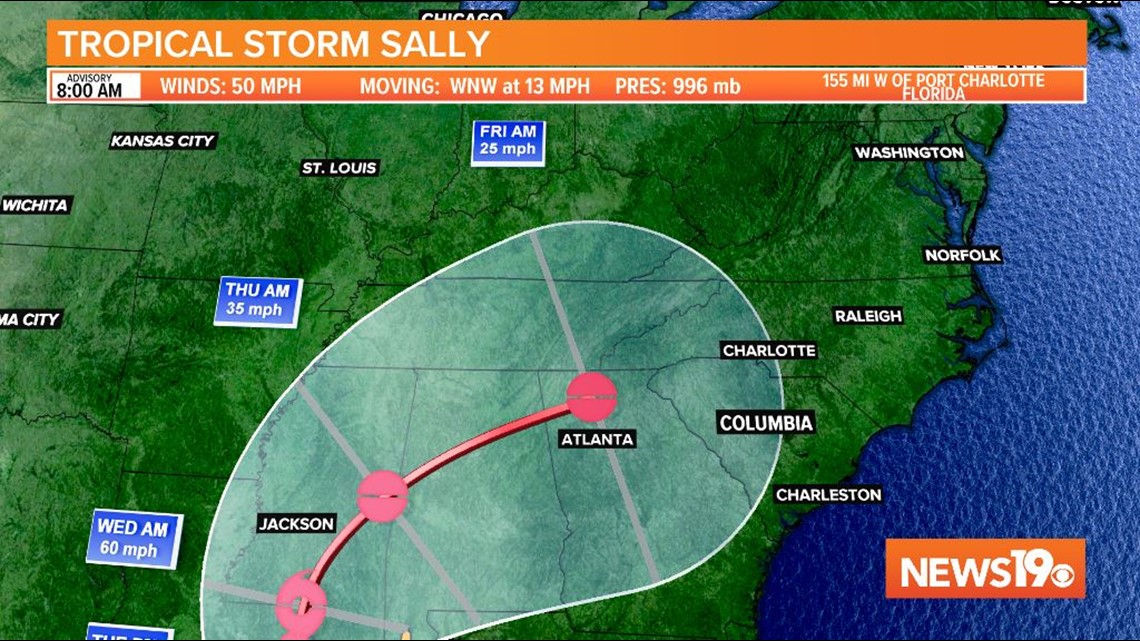
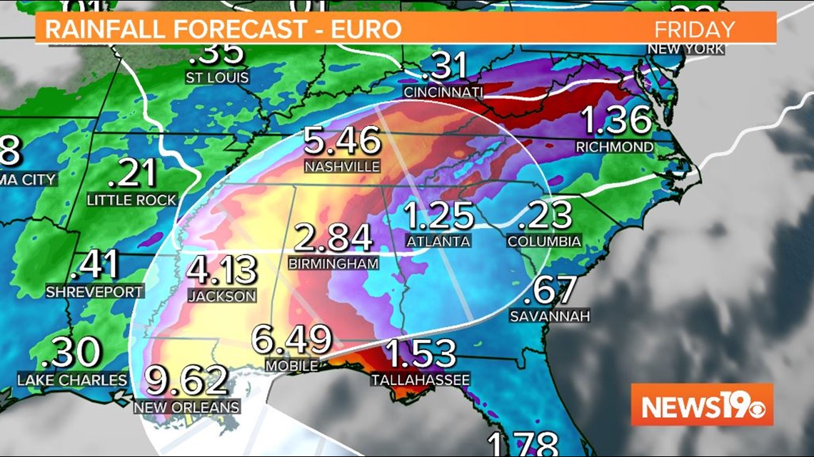
Models are not in great agreement long-term in regards to where the cold front picks Sally up and where the tropical moisture will go. The European model keeps the plume of tropical rainfall just west of the Midlands. On the other hand, the GFS model has the remnants of Sally moving faster and farther east.
RELATED: Local Forecast

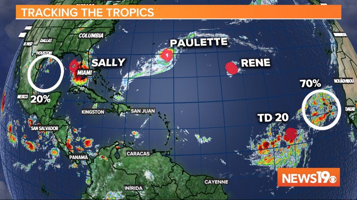
Outside of Sally, there are five other storms and areas of interest that the National Hurricane Center is watching. Hurricane Paulette will affect Bermuda but remain out to sea.
Tropical Depression Rene is forecast to weaken and dissipate over the Atlantic Ocean.
The other two areas in the Atlantic, Tropical Depression 20 and the wave with a 70 percent chance of formation are both very far out and not a concern as of now.
The wave in the Gulf of Mexico with a 20 percent chance of development is also not a concern for the Midlands.

