
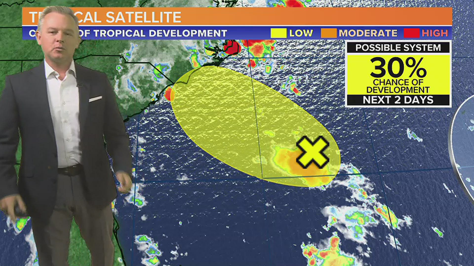
COLUMBIA, S.C. — The climatological peak of hurricane season is this week and the tropics are extremely active. There are four disturbances in the Atlantic being watched by the National Hurricane Center.
The closest disturbance to the United States is located about 375 miles southeast of Wilmington, NC. It is producing some showers and thunderstorms near its center of circulation.
Some gradual development of this system is possible before it moves inland over eastern North Carolina Thursday afternoon. Regardless of development, this low will increase moisture to the Carolinas.
Interests along the coasts of North and South Carolina should continue to monitor the progress of this disturbance.
The NHC gives this low pressure system a 30% chance of further development over the next two days.
There are no watches or warnings associated with this system, but it have to be monitored over the next several days.
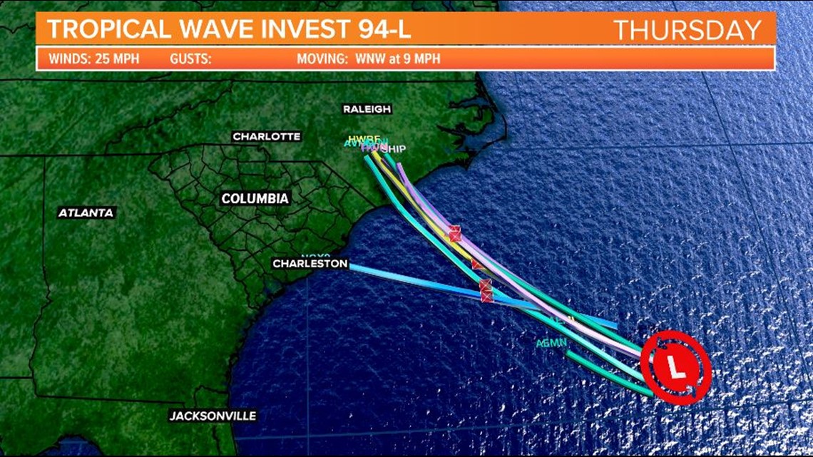
Here are the spaghetti models through Thursday for Invest 94-L:

The NHC is also monitoring three other areas in the Atlantic, two tropical storms and one tropical wave.
Tropical Storm Paulette was located over the central Atlantic. It was moving slowly west-northwest at about 9 mph. The storm had winds of 60 mph with some stronger gusts.
RELATED: Local Forecast
Tropical storm force winds extend outward up to 240 miles from the center.
Paulette is expected to get stronger over the next few days, but remain below hurricane strength through Monday morning.
Paulette became the earliest 16th named Atlantic storm on record. The old record was previously set by Philippe on September 17, 2005.

Rene became the earliest 17th named Atlantic storm on record Monday. The old record was previously set by Rita set on September 18, 2005.
Rene was downgraded to a tropical depression early Wednesday morning, but regained tropical storm later in the day.
Tropical Storm Rene was located over the eastern Atlantic. It was moving west-northwest at about 13 mph. The storm had winds of 40 mph with some stronger gusts.
Tropical storm force winds extend outward up to 45 miles from the center. There are no watches or warnings associated with this depression.
Rene is forecast to get stronger over the next few days. It could become a hurricane later this week.

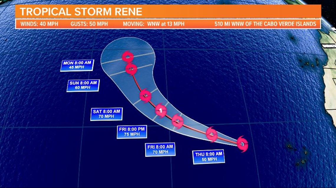
The spaghetti models for both Paulette and Rene keep the storms in the middle Atlantic, away from the continental United States.
The fourth area being monitored by the National Hurricane Center is forecast to emerge off the west coast of Africa Thursday.
Gradual development is anticipated once the system moves over water, and a tropical depression could form late this week or over the weekend while the system moves generally westward across the eastern tropical Atlantic.

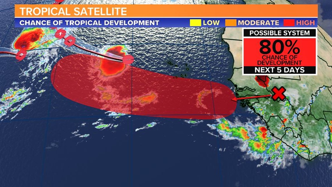
The NHC gives this tropical wave an 80% chance of further development over the next five days.