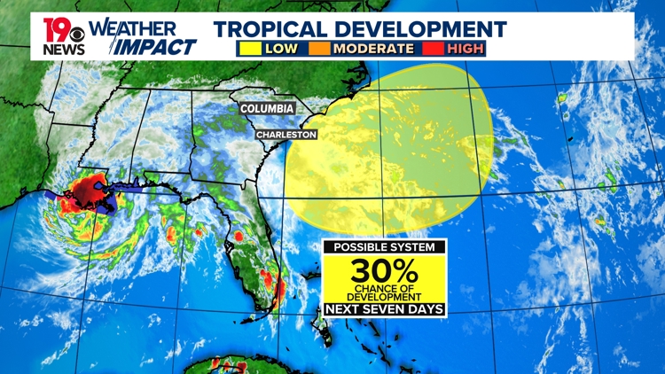
COLUMBIA, S.C. — An area of low pressure is expected to form along a lingering frontal boundary a few hundred miles off the Southeastern U.S. coastline this weekend. The area could further develop into a tropical low-pressure system during the early part of next week. The lingering frontal boundary is from the cold front that moved through the Midlands earlier this week, ahead of Hurricane Francine.
The National Hurricane Center is monitoring this area, which has a 30% chance of developing over the next seven days. If the system develops, it would drift to the north or northwest.

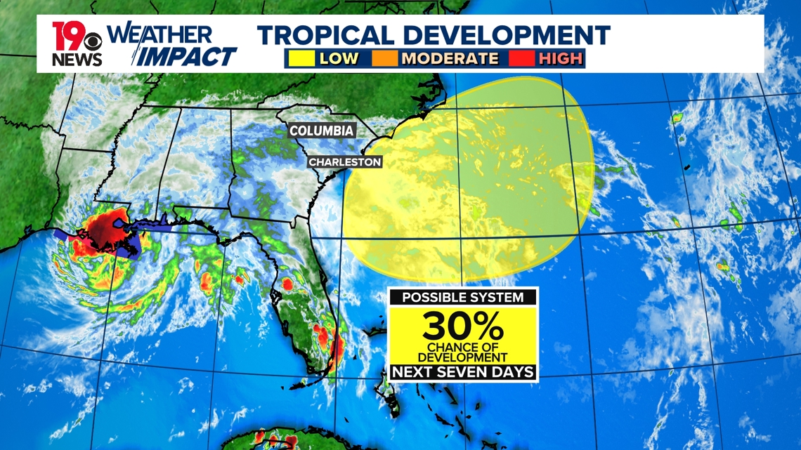
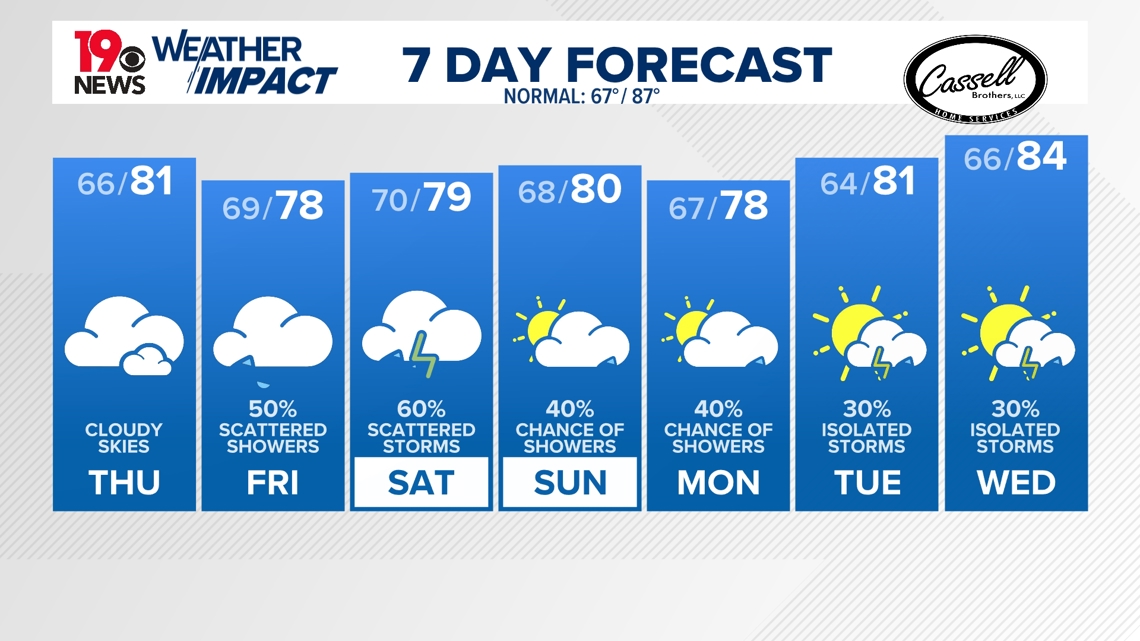
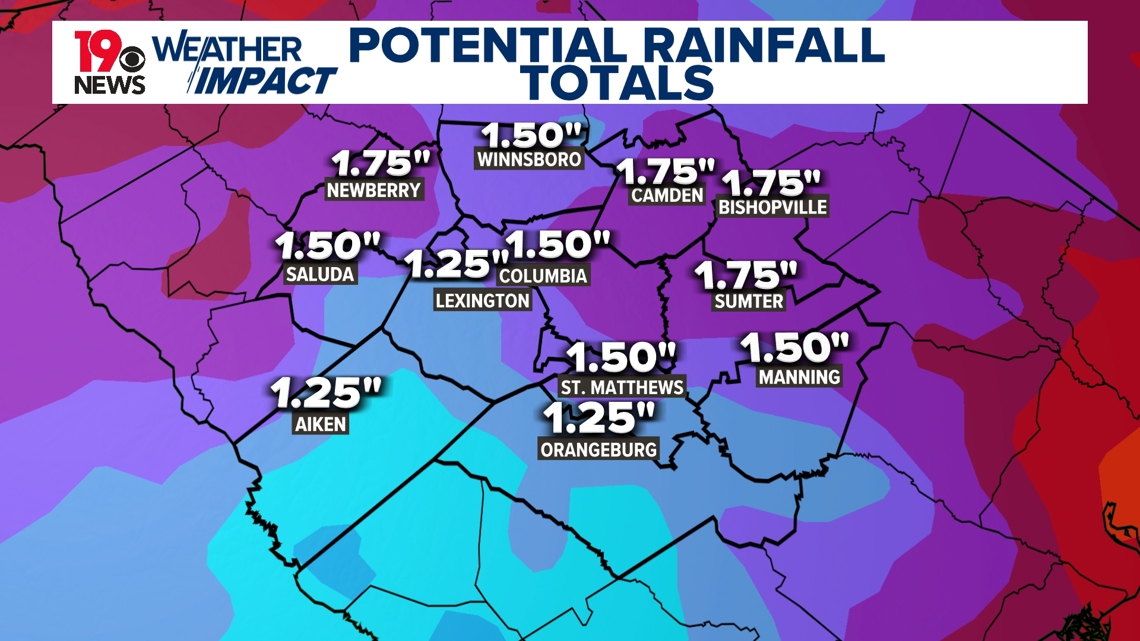
The path of this system remains uncertain, but it could bring some rainfall and gusty winds across the Carolinas early next week. This system, combined with remnants from Francine, could bring 1.25 to 2 inches of rain across the Midlands.

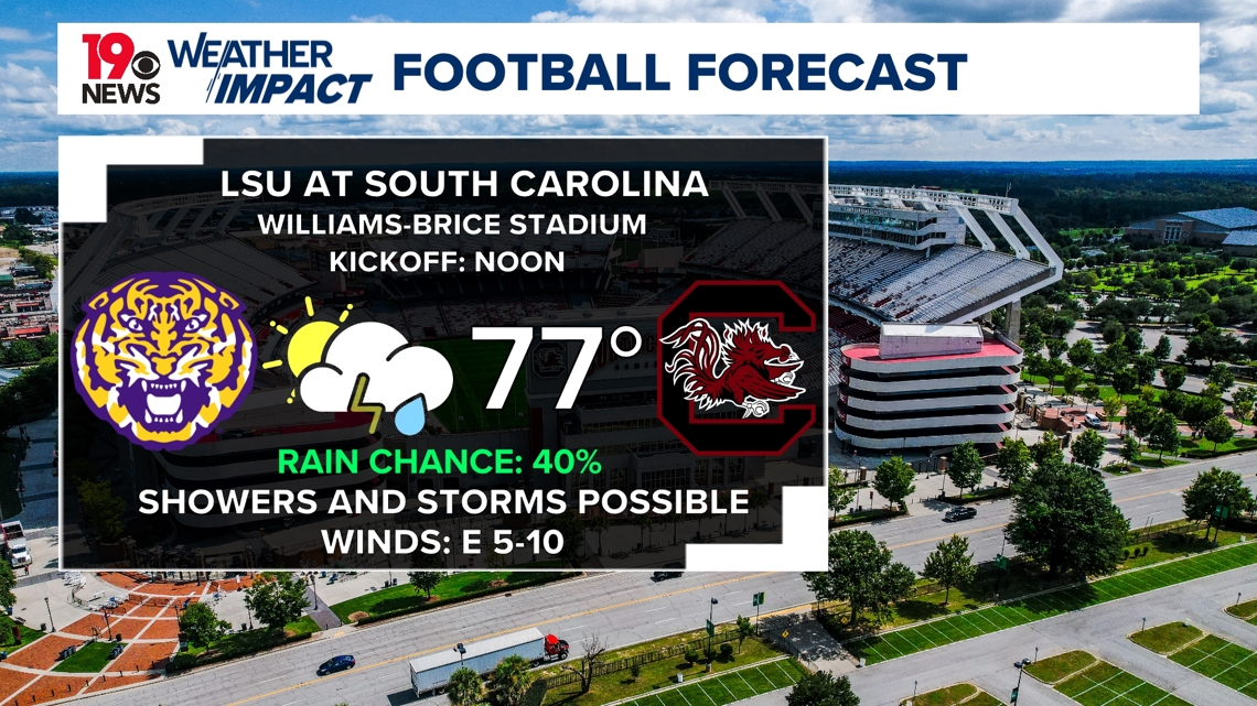
This could also impact football in the Midlands. Rain could impact the football game between the South Carolina Gamecocks and LSU Tigers at Williams-Brice Stadium this weekend. Kickoff at noon is expected to be in the upper 70s with a chance of showers and storms.

Before this potentially impacts the Midlands and the rest of the Carolinas, we will see dry weather on Thursday with cloudy skies. Temperatures on Thursday will reach the low 80s. Scattered showers could return Friday, and the chance for rain will likely linger over the weekend and into next week.
Our average high temperature right now is 87 degrees. The Midlands will continue seeing high temperatures below that in the upper 70s and low 80s.