COLUMBIA, S.C. — Temperatures will rise into the middle to upper 60s today as high pressure builds into the region. This weekend is expected to be cooler due to a dry, cold front that passes through the area tonight. The next chance of rain is late on Sunday into Monday, and then there will be another long stretch of dry weather.
Very quiet and benign weather is expected through today as high pressure quickly moves out ahead of a dry backdoor cold front tonight. We expect that temperatures will be quite warm today, as most of the high cloud coverage is expected to move out this afternoon. Highs will be in the middle to upper 60s.

A cold front is expected to move through the forecast area tonight between 8 p.m. and 12 a.m. The only likely effect will be a shift in overnight winds from the north to the northeast. Expect these to remain up through the night, with 5–10 mph readings being typical due to the weak cold advection. This will only allow lows to fall into the middle to upper 30s on Saturday morning.
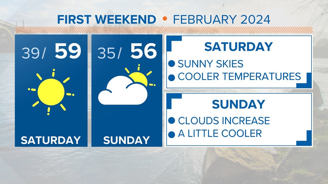
Sunny skies are expected on Saturday afternoon. Highs will be a little cooler for the weekend, topping out in the upper 50s to near 60 degrees. Clouds will move back into the Midlands on Sunday, ahead of an area of low pressure.

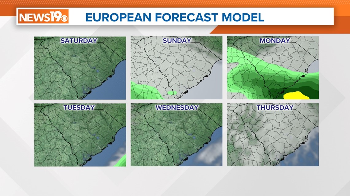
The latest runs of the forecast models indicate a more southern track for the low. The overall chances for rain have decreased for the Midlands, but some rain is possible late Sunday and into early Monday morning.
Skies will clear out Monday afternoon, and the rest of the workweek is forecast to be dry.