COLUMBIA, S.C. — A warming trend starts today as high pressure shifts offshore. Today will remain dry, but cloud cover will increase throughout the day. Rain chances increase along with the quickly warming temperature for Tuesday onward. High temperatures will run 15-20 degrees above normal by the end of the week.
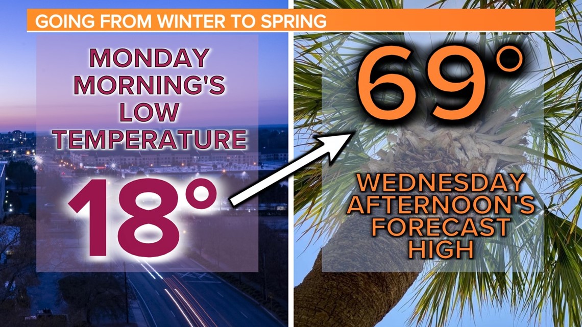
It was a very cold weekend. Temperatures were in the middle to upper 30s Saturday afternoon. Morning lows Sunday dropped into the middle teens for many locations. The Columbia airport reported a low of 17° Sunday morning. Sunday afternoon, highs were in the upper 30s to lower 40s. This morning, the Columbia airport dropped to at least 18 degrees.

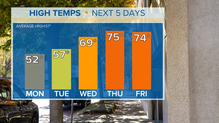
Mainly sunny skies are expected for today. Temperatures will be warmer than over the weekend. Highs will be in the lower to middle 50s across the Midlands. The clouds will increase this evening and tonight. With the clouds in place, low temperatures will only be in the middle to upper 30s. This is close to normal this time of year.
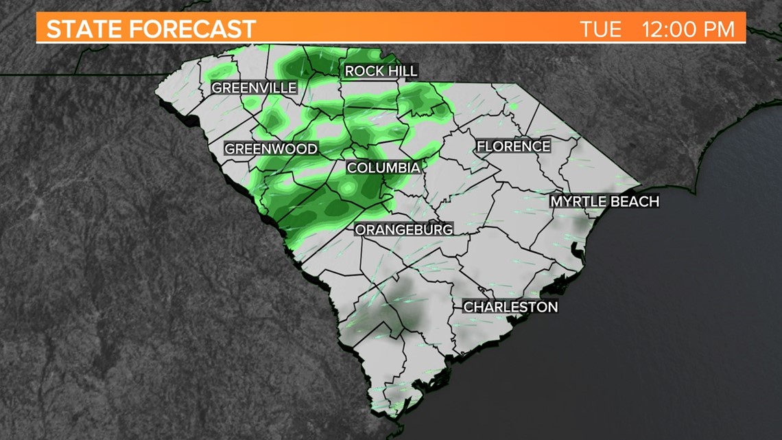
The moisture will increase on Tuesday. A few light, isolated showers are expected. Temperatures will be wide-ranging during the afternoon. Highs will be in the lower 50s in the northern half of the MIdlands, but in the southern half of the area, temperatures may climb into the lower to middle 60s.

Moisture will continue to increase on Wednesday. There will be a chance for showers, but the rainfall amounts appear to be light. High temperatures will warm into the middle 60s to the lower 70s.
Temperatures will be even warmer on Thursday and Friday. It will feel like spring by the end of the workweek, but the rain chances will be even higher. Showers and some thunderstorms are possible both Thursday and Friday. High temperatures are forecast to hit the lower to middle 70s.