COLUMBIA, S.C. — An active weather pattern continues to move through the southern half of the country. Storms on Tuesday brought more than 3 inches of rain to cities like Columbia, a total of 15 tornado warnings in the Midlands, and multiple confirmed tornadoes across the state. This Mesoscale Convective System, which is a term used to describe a cluster of severe thunderstorms, has moved well to the east of South Carolina and over the Atlantic. However, a storm threat will return today courtesy of a humid airmass left in the wake of yesterday's storms.
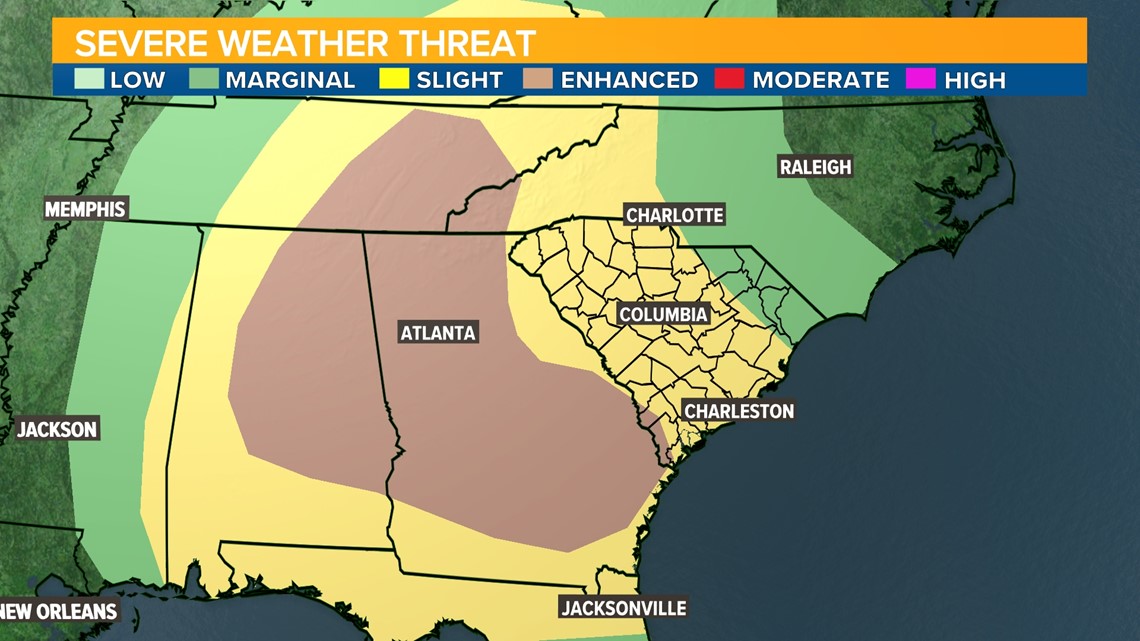
Today, a humid air mass and weak surface boundary will produce thunderstorms capable of flash flooding, damaging wind, and isolated tornadoes across the South. The Storm Prediction Center has issued a slight risk for the South Carolina Midlands, with a 5% chance for a tornado within 25 miles and a 15% chance for damaging wind. The greatest risk for flooding from these storms will be south of the I-20 and I-26 corridor.

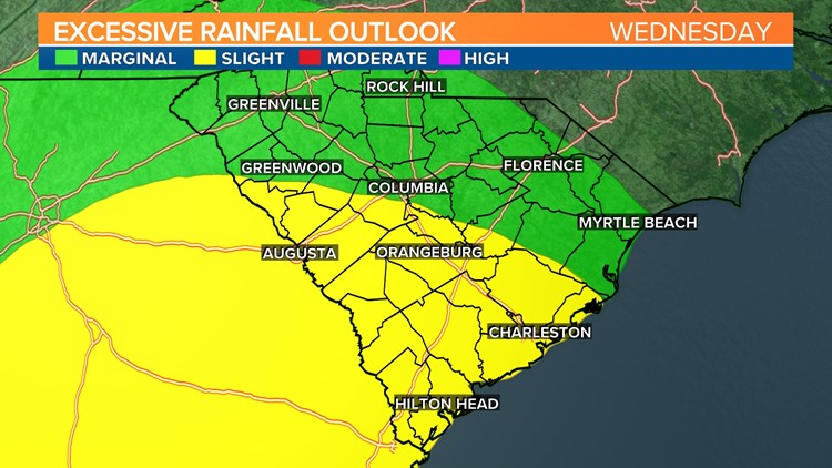
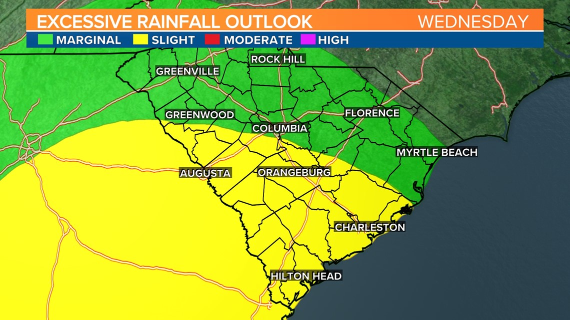
Storms will be less widespread this afternoon, particularly farther north, but will be capable of severe weather where they develop. The boundary located over Georgia and the South Carolina Lowcountry this morning is producing showers early. These showers will gradually develop into thunderstorms this afternoon, so the eventual location of that boundary will be key in the afternoon forecast. In anticipation of frequent, drenching storms, the Weather Prediction Center has issued a slight risk for flash flooding in the southern Midlands (level 2 out of 4) and a marginal risk (level 1 out of 4) for the northern Midlands.

Timing
Unlike yesterday’s severe weather event, the storms today will be fueled by daytime heating. A few showers are possible in the southern Midlands, by mid-morning. Thunderstorms will gradually build around noontime, becoming more likely in the mid-afternoon and early evening. Storms will taper off after 8 p.m., but showers will linger into Thursday morning.