
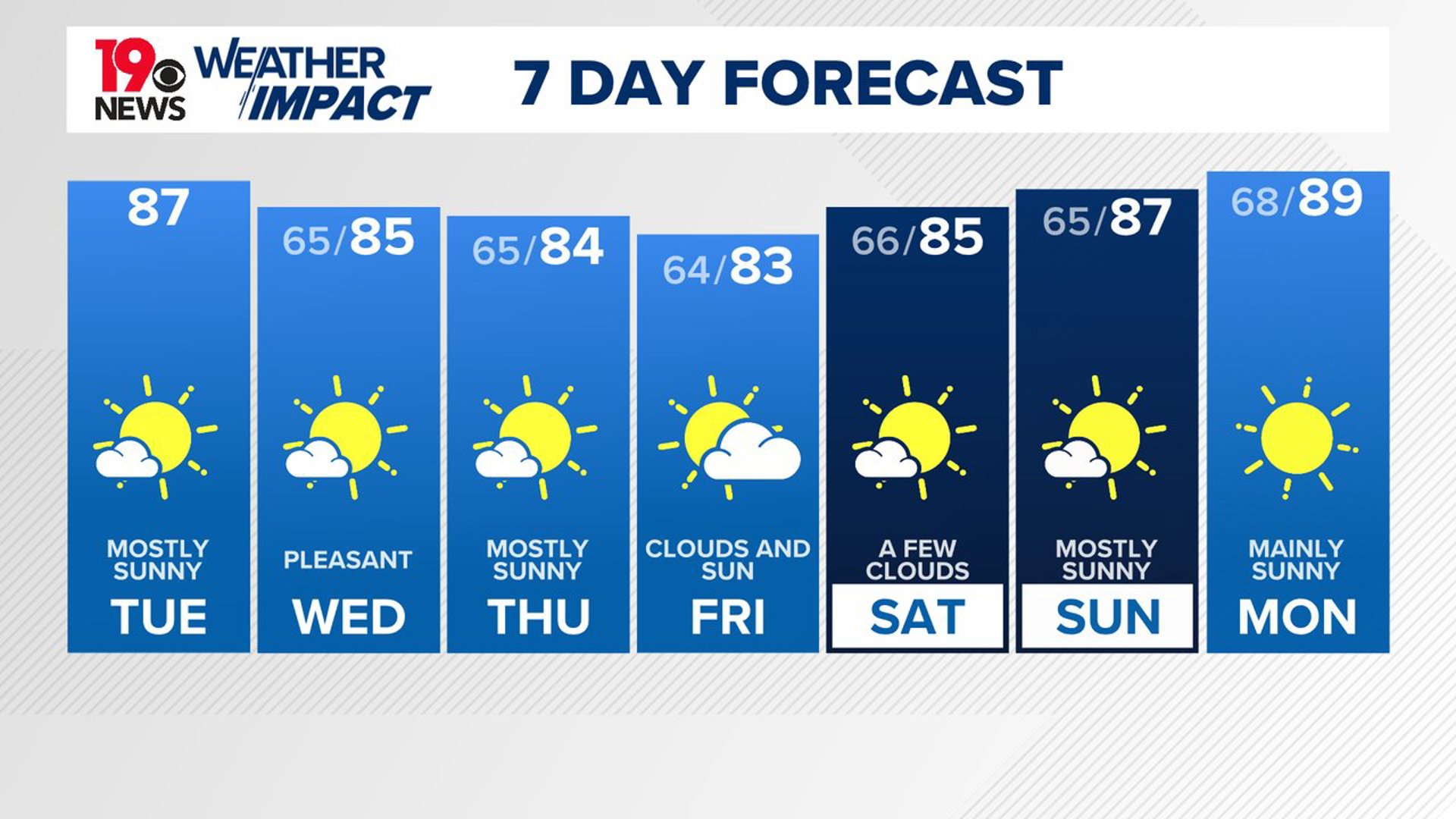
COLUMBIA, S.C. — Pleasant August conditions are expected over the next several days as high pressure controls the weather across South Carolina. High temperatures today will be a little cooler than normal under mainly sunny skies; this type of weather is expected to continue over the weekend.
Monday was seasonably hot, with high temperatures in the upper 80s to lower 90s. The Columbia airport had a high temperature of 91 degrees. A few isolated showers and storms developed late in the day, but most of the Midlands stayed dry.
High pressure will continue to build into the region, keeping a stalled frontal boundary just offshore. In the upper atmosphere, a large trough will dominate the eastern U.S., resulting in cooler and drier air over our area.

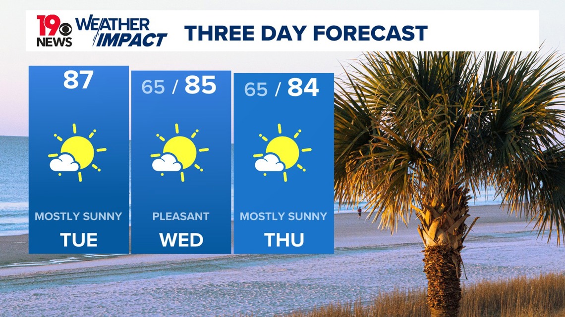
However, models suggest that moisture levels will be higher in the far eastern Midlands and southern Central Savannah River Area due to the nearby front offshore. The chance for rain is still very small, at best. High temperatures today will be in the middle to upper 80s.
For Wednesday, there is a slight chance of rain along and east of I-95. On Thursday, this slight chance shifts mainly along and south of I-20. Otherwise, the cooler and drier air will create pleasant conditions, with dewpoints in the low to mid-60s, possibly even lower at times. With temperatures in the low to mid-80s, it should feel comfortable over the next couple of days. Overnight lows will range from the low to mid-60s.

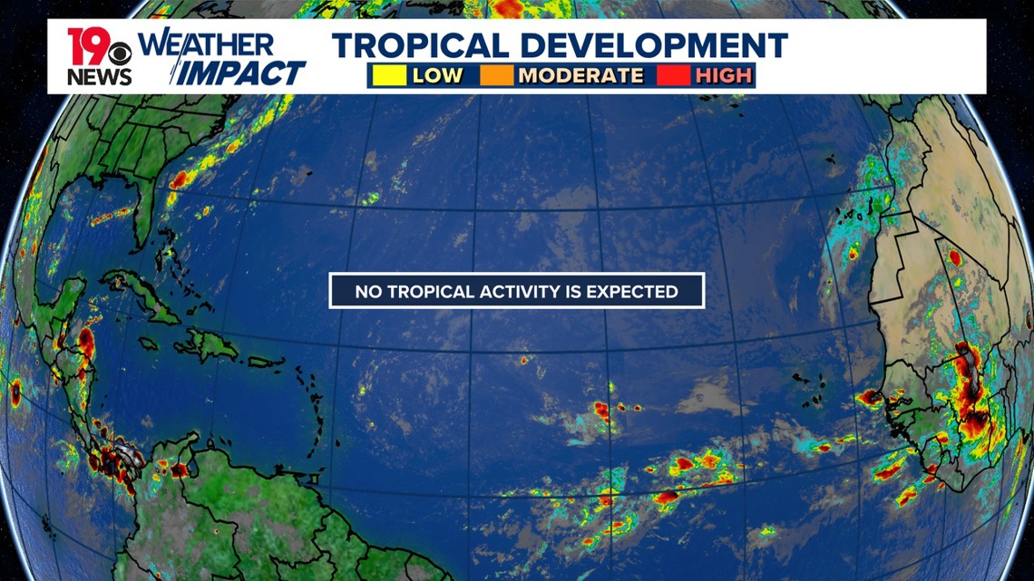
Tracking the Tropics:
Ernesto continues to move away from North America. Elsewhere in the Atlantic, no tropical activity is expected over the next seven days.