COLUMBIA, S.C. — The News19 Weather Team has issued a Weather Impact Alert Day through tonight for the Midlands due to the possibility of heavy rainfall and storms. A Weather Impact Alert Day is a new type of announcement from News19's weather team that informs you about potentially hazardous weather and how to prepare ahead of time.
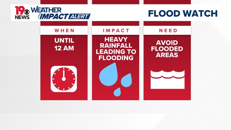
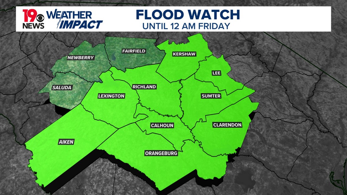
A flood watch remains in effect through this evening due to the potential for flash flooding caused by excessive rainfall. The watch includes Aiken, Calhoun, Central Orangeburg, Kershaw, Lee, Lexington, Northwestern Orangeburg, Richland, and Sumter counties until midnight.
The impacts of excessive rainfall may lead to flooding of rivers, creeks, streams, and other low-lying and flood-prone areas. Creeks and streams might overflow their banks, and flooding could occur in areas with poor drainage and in urban regions.

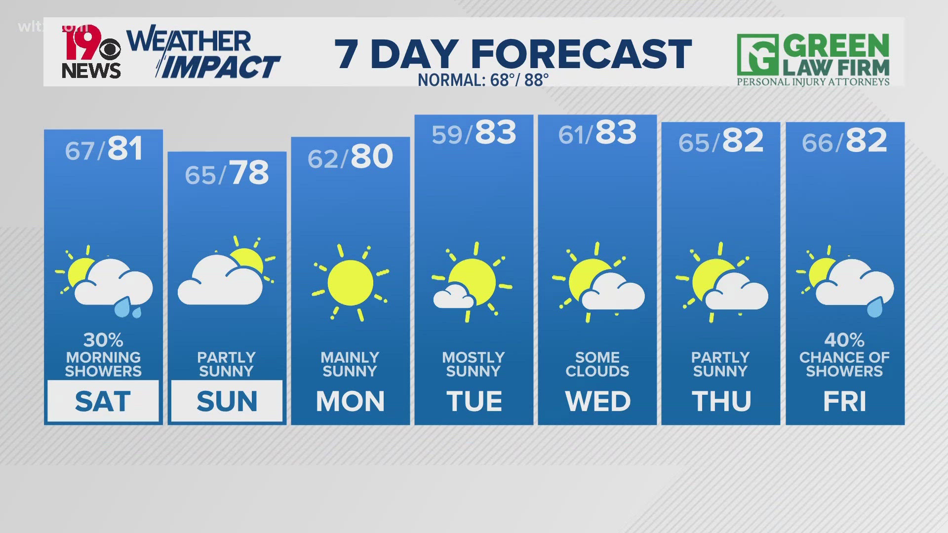
The threat of flash flooding remains high today. Scattered showers and thunderstorms are anticipated this afternoon and evening. The main concern is heavy rainfall rather than severe weather, though stronger thunderstorms could produce gusty winds.
The heaviest rainfall is predicted for the southwestern areas of the state. While confidence in flash flooding is lower in northwestern counties, any thunderstorms in the region could still cause heavy rainfall and flash flooding. Daytime temperatures will be cooler, with highs in the mid to upper 80s. Tonight, rain will diminish under mostly cloudy skies, with overnight temperatures in the lower 70s.

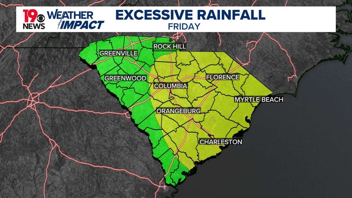
On Friday, numerous showers and thunderstorms with heavy rainfall potential are expected. On Saturday, drier air will move in, but a few showers and storms are still possible. High temperatures will be slightly below those on Friday.
On Saturday, as the upper ridge expands west and the trough deepens over the Atlantic, high pressure will bring in drier air. However, showers and thunderstorms are still expected, mainly in the afternoon and evening. Rainfall rates should be lower than previous days, with high temperatures remaining several degrees below normal.
From Sunday to Tuesday, a few showers and thunderstorms are expected, with a reduced threat of heavy rainfall. This will be more of a typical summertime pattern, with temperatures close to normal.