
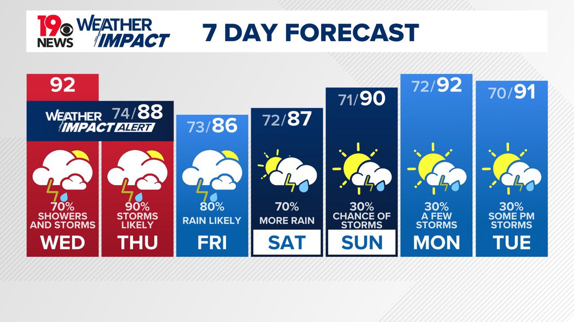
COLUMBIA, S.C. — The News19 Weather Team has issued a Weather Impact Alert Days for Wednesday and Thursday for the Midlands due to the chance of heavy rain and storms.
A Weather Impact Alert Day is a new type of announcement from News19's weather team that allows you to know when potentially hazardous weather is coming your way and how to prepare ahead of time.
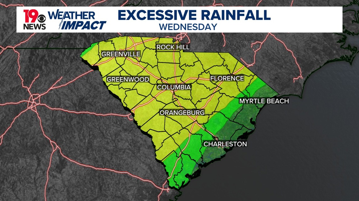
The biggest weather threat today and Thursday will be heavy rainfall, leading to flash flooding. The National Weather Service has issued a flash flood watch for a large part of the Midlands. This includes Kershaw, Lexington, Richland, Lee, Aiken, Sumter, Calhoun, northwestern Orangeburg, and central Orangeburg County.

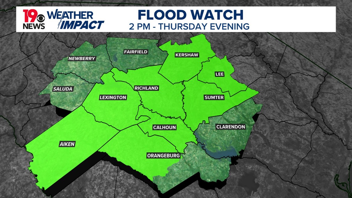
Recent heavy rain and flash flooding, combined with the threat of 1.5 to 3” of additional rainfall and the potential for excessive rainfall rates across portions of the Midlands, has led to concern for areas of flash flooding in the watch area.
High temperatures this afternoon will be in the lower 90s, but with the humidity in place, it will feel like the triple digits in many locations.
The flash flood watch remains in effect for much of the Midlands through Thursday evening. Recent heavy rain, along with more expected rain, could cause flash flooding in these areas. High temperatures Thursday will be in the upper 80s; this is a little below normal for this time of the year.

On Friday, the weather pattern will change slightly, as the western Atlantic ridge moves south of the area and an upper trough shifts into New England and the Mid-Atlantic region. A nearly stationary front will drop into the area, leading to more widespread showers and thunderstorms, especially in the afternoon and evening. There is still a chance of heavy rainfall in some parts, which could continue the risk of flooding. Highs will be in the middle to upper 80s.
On Saturday, expect scattered to numerous showers and thunderstorms, with the potential for heavy rainfall. From Sunday through Tuesday, the coverage of showers and thunderstorms will be less. Daytime temperatures will be below normal over the weekend, with a slight warm-up early next week.