
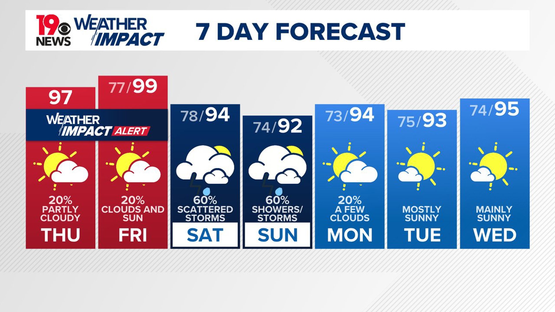
COLUMBIA, S.C. — A heat advisory has been issued for most of South Carolina from noon until 7 p.m. During this period, heat index values are expected to soar up to 110 degrees. The combination of hot temperatures and high humidity increases the risk of heat-related illnesses. Residents should take necessary precautions to stay safe and cool.
To ease the effects of the heat, it is essential to drink plenty of fluids, stay in air-conditioned rooms, and avoid direct sunlight. It is also important to check on relatives and neighbors, particularly those who are vulnerable.
Never leave young children or pets in unattended vehicles, as car interiors can reach deadly temperatures within minutes. When outdoors, wear lightweight and loose-fitting clothing, and try to schedule strenuous activities for early morning or evening.

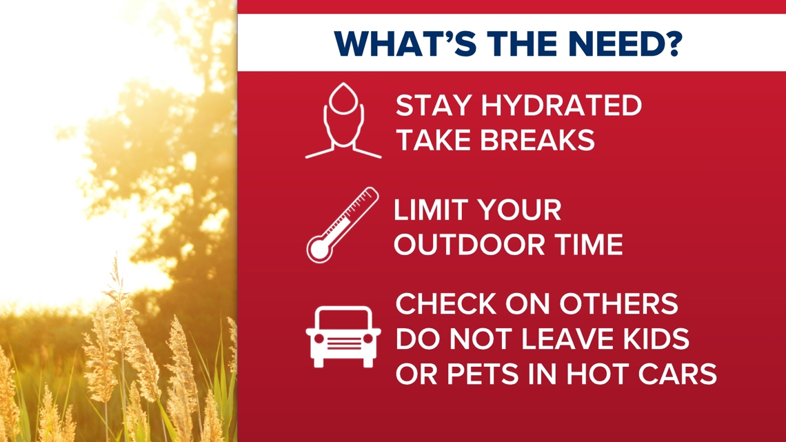
Be alert to the symptoms of heat exhaustion and heat stroke and take immediate action if they occur. For outdoor workers, the Occupational Safety and Health Administration advises taking frequent breaks in shaded or air-conditioned environments. If someone shows signs of heat exhaustion or heat stroke, move them to a cool, shaded area and call 911 immediately. A heat stroke is a medical emergency.
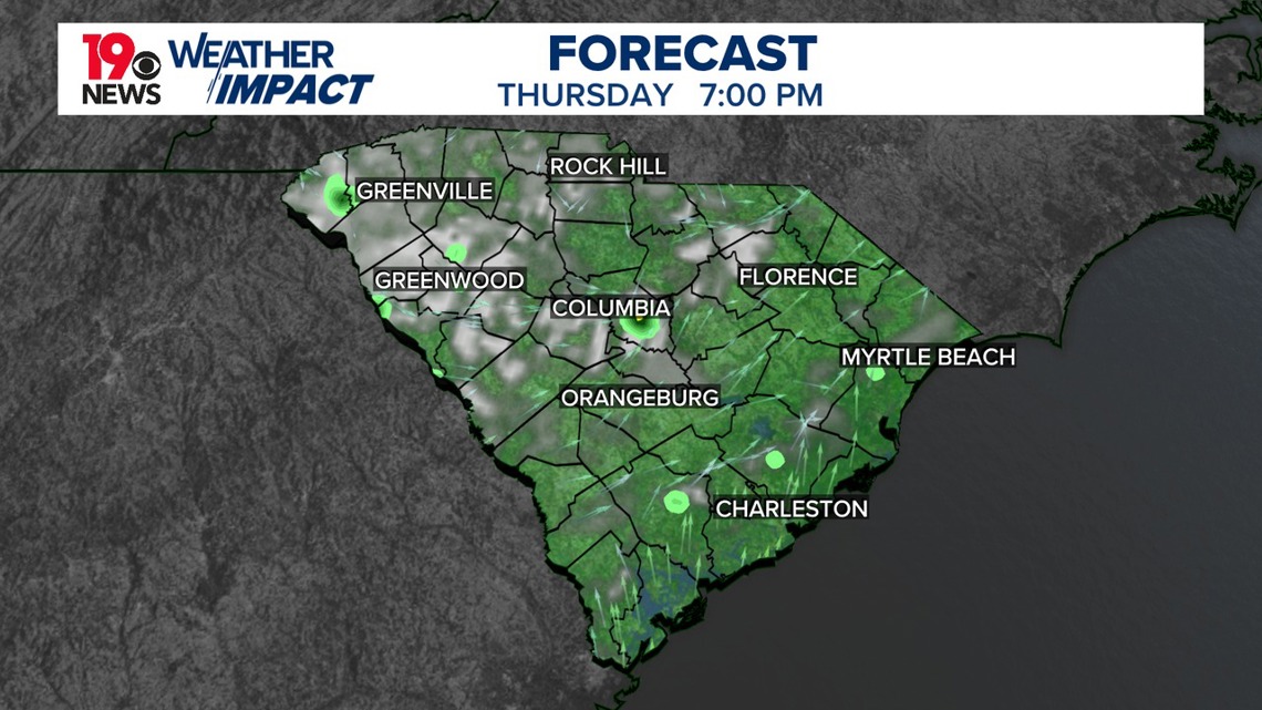
This afternoon, the combination of strong heating and moist conditions with dewpoints in the low to mid-70s is expected to create moderate to strong instability. High-resolution guidance suggests isolated to scattered storms developing in the higher terrain of North Carolina and the Upstate.
These storms will move southeastward into the southern part of the forecast area through the evening. There is a potential for isolated severe weather, particularly damaging winds, due to the strong instability. Storms may persist into the late evening but should diminish by midnight.
The weather pattern for Friday and Saturday will feature very warm temperatures and a high likelihood of showers and thunderstorms. A robust weather system is expected to move southeast through the Ohio Valley on Friday, bringing multiple waves of unsettled weather.
Friday has a lower chance of rain compared to Saturday. Isolated thunderstorms are still expected. Any storms that do develop on Friday could be strong to severe, with the potential for damaging winds. Temperatures will be high, with heat index values reaching 109 degrees. Another heat advisory may be needed.

On Saturday, the approaching weather system will continue to intensify. A low-pressure system in the Ohio Valley will push eastward, bringing a surface front towards the Carolinas by the afternoon. This will create favorable conditions for numerous thunderstorms, which could lead to back-building and training, increasing the risk of flash flooding.
Moisture levels will be high, further enhancing this threat. While the severe weather risk on Saturday is lower compared to Friday, the potential for flash flooding is higher. Temperatures will be cooler overall on Saturday due to the earlier onset of showers and storms ahead of the advancing system. Storms are likely to continue into Saturday night as the system slowly moves eastward.