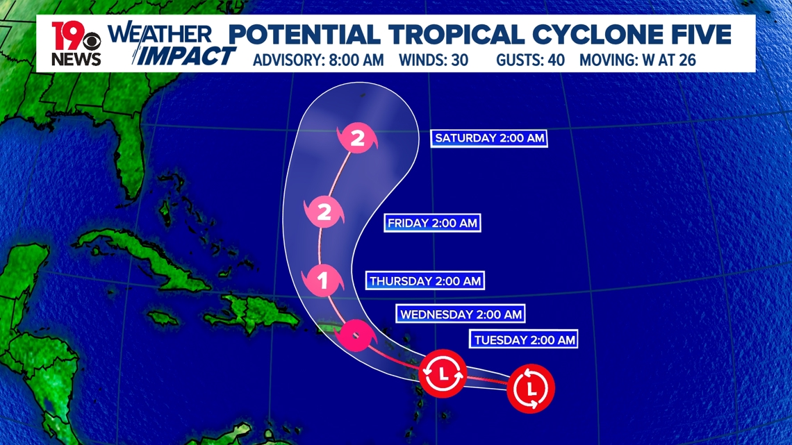
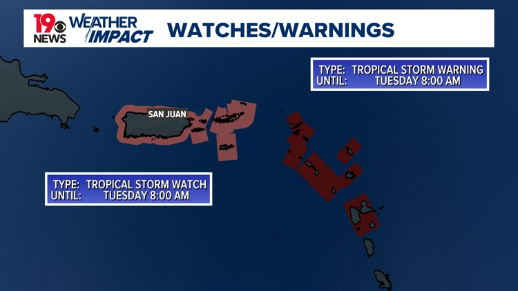
COLUMBIA, S.C. — A tropical storm watch has been issued for Puerto Rico and the nearby islands. Additional watches and warnings will likely be required for portions of the northeastern Caribbean later today as Potential Tropical Cyclone Five is forecast to develop.
Heavy rainfall may result in locally considerable flash flooding and mudslides in areas of the Leeward Islands by later today into Wednesday and over Puerto Rico late Tuesday into Thursday.
The tropical wave located east of the Lesser Antilles is currently being closely monitored. Although initial reports indicate that the system lacks a well-defined center and the associated thunderstorms are not well organized, there are signs that a new center might be forming to the west or northwest of its current position.


The system is moving quickly westward at approximately 25 mph. A high-pressure system to the north is expected to keep it on this path for the next 24-36 hours, although it may slow down slightly. After that, a weather system moving eastward from the U.S. is likely to create a gap in the high pressure, causing the storm to turn northwest and then north.
While most forecast models agree on this general track, there is still some uncertainty, particularly because the exact location of the storm's center has not yet been pinpointed. This uncertainty means it is still unclear exactly where the system will head concerning the Leeward Islands, Virgin Islands, and Puerto Rico. The latest forecast shows only minor changes from previous predictions.
Given that the system is still not well organized and is facing wind shear from the east, the forecast for its strength over the next 36 hours has been slightly downgraded. However, it is still expected to develop into a tropical storm near or over the Leeward Islands.
After 24-36 hours, conditions are expected to become more favorable for the storm to strengthen, with significant intensification forecasted during this period.


