


COLUMBIA, S.C. — Life-threatening and catastrophic flash flooding is possible through Thursday night across South Carolina. The Weather Prediction Center has part of the Midlands at a rare moderate and high risk for flash flooding over the next three days. In response, the News19 Weather Team has issued Weather Impact Alert Days for Monday through Thursday due to potential flooding from Debby.
WHEN:
The heavier rains began in some parts of the state Tuesday night and will continue through the morning. That will mostly be in the southern half of the Midlands (Orangeburg, Clarendon) but will increase throughout the day, with greater rain totals as the day progresses. However, the entire Midlands will get heavy bands of rains as the day progresses. There will also be some gusty winds that will get up to tropical storm force.
Heavy rain will continue the rest of the day and overnight into Wednesday. There may be a brief break that day but as the day goes on, the rain will get heavier again. The rain will persist through Thursday before tapering off somewhat late Thursday and into Friday morning. By later Friday, the storm will move out of the state, ending the threat of rain.
IMPACT:
The state has rarely seen a flooding threat like this one. The greatest problem with Debby will be that once it reaches the South Carolina coastline Tuesday, it will not move much over the next two days. With no mechanisms to steer it on its way, it will continue to dump band after band of rain, and that will cause rain totals to rise.
For heavier bouts of rain, there will be a risk of flash flooding. That will be a risk starting Tuesday and will persist throughout the event. As the totals pile up, river flooding will also be a concern, and anyone near a waterway, weather that's a lake or creek, will need to be extra concerned.
Roads in low-lying areas could become impassable.
Rainfall projections vary, but it's possible the southern Midlands could see rain totals by Friday of 15+ inches are not impossible, and 10+ inches could fall in the central Midlands. Along the coast it will be far worse, with rainfall totals of 20 inches or more a distinct possibility.
A deeper, day-by-day breakdown of timing can be seen further down in this article.
NEED:
State officials are warning people to stay off the road if at all possible. If people need to drive, they must never attempt to driver over a road covered with water. As the saying goes, "turn around, don't drown."
People should be prepared to deal with power outages, and those living in flood prone areas must be ready to evacuate at a moment's notice.

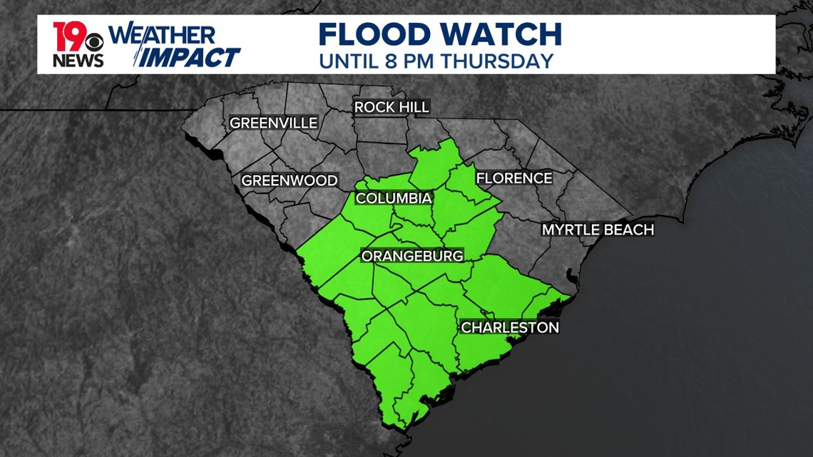
A flash flood watch will be in effect from through Thursday evening for much of the Midlands. The flash flood watch includes Aiken, Bamberg, Barnwell, Calhoun, Central Orangeburg, Clarendon, Kershaw, Lee, Lexington, Northwestern Orangeburg, Richland, Southeastern Orangeburg, and Sumter counties.
The threat of tropical-storm force winds across the Midlands is low at this point, but strong to even severe thunderstorms are possible this afternoon and this evening across the southern Midlands.
Early Tuesday Morning:
The rain will spread over South Carolina and the Midlands from south to north as Debby moves generally northward. Low temperatures will be in the lower 70s.

Tuesday:
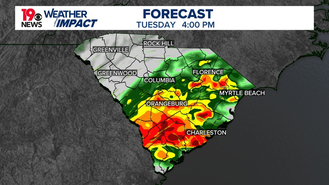
Major flooding is possible on Tuesday as Debby pushes towards the north. The Weather Prediction Center has much of the Midlands at a moderate to high risk of flooding. Heavy rainfall and extreme flooding will be possible throughout the day as Debby moves slowly from the south.

Wednesday:
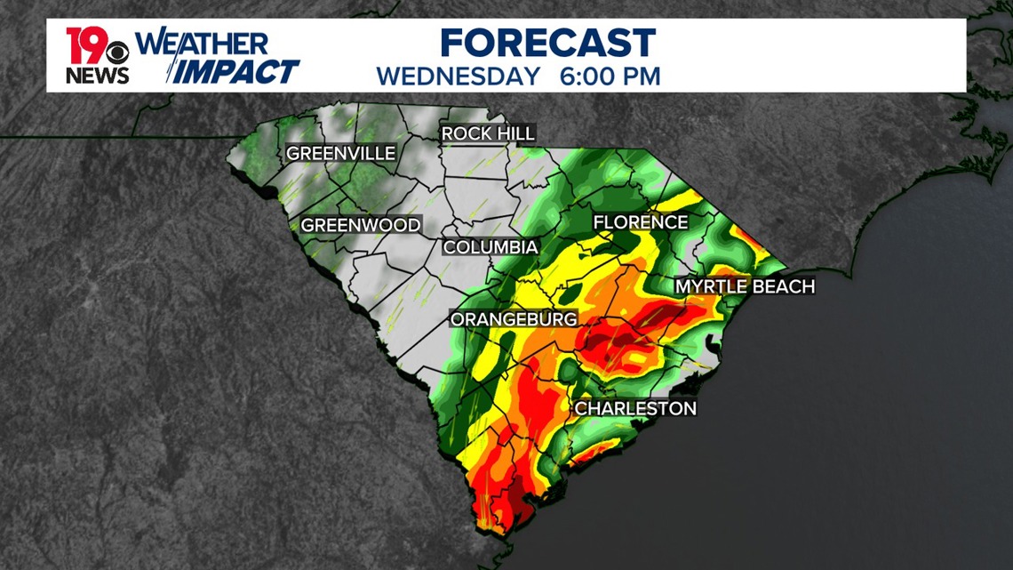
More heavy rainfall and flooding are possible. Rain totals through Wednesday are forecast to be between 3-6” along and south of I-20, with some areas getting 8” or more. Additionally, more rainfall is possible through Friday, which could cause even more flooding issues.
Thursday:
More heavy rainfall is possible, especially along and east of I-77, but this is highly dependent on the track of Debby. The flood watch will continue through the evening hours. Rainfall totals through Friday evening could reach 10–15” of rain or more in the southern and eastern parts of the Midlands.
Friday:
There may still be some rain around, but this will be highly dependent on the track of Debby.


Confidence:
There is high confidence that a significant rainfall event will occur for parts of the Midlands through Wednesday. The confidence is highest along the southeastern Midlands.
