
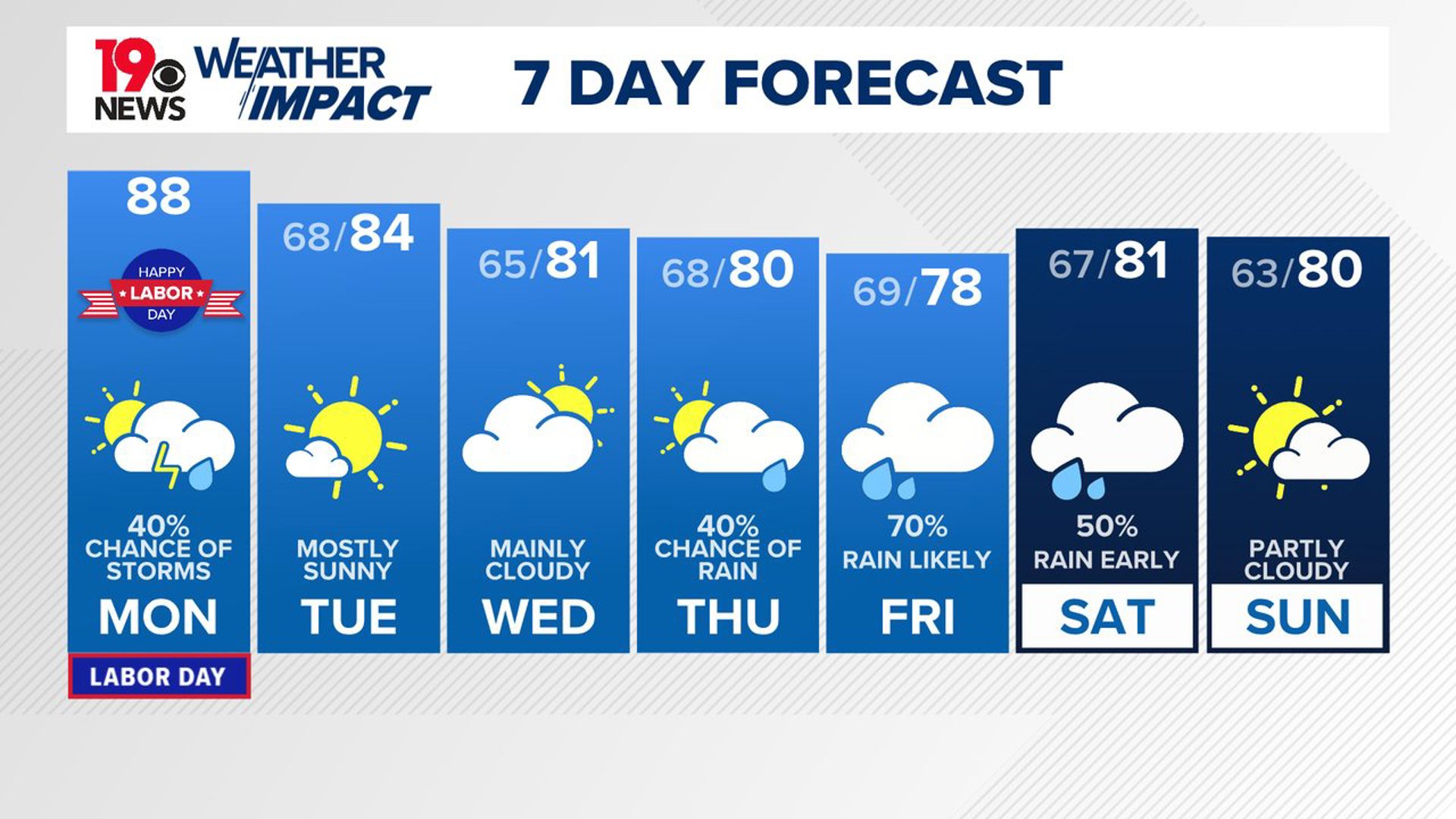
COLUMBIA, S.C. — A cold front is expected to bring wedge-like conditions starting Tuesday, lasting through much of the week. This will result in cooler temperatures below normal. The chance for rain will return late this week. Some of the rain could linger into the early part of the weekend.
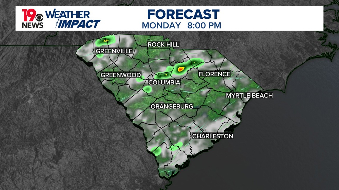
There will be a chance for showers and thunderstorms, especially south of I-20 this afternoon. Rain could be moderate to heavy at times. High temperatures today will be in the middle to upper 80s. Heat index values will be in the middle 90s this afternoon.
Temperatures will be much cooler on Tuesday, falling below normal for early September. Dewpoints will drop, and a new airmass will lead to dry conditions through Wednesday afternoon. However, a few showers might appear Wednesday evening or night due to easterly flow and a weak disturbance. Overnight lows will range from the low to mid-60s.

Expect continued cool temperatures throughout the week. Cloud cover will persist due to a wedge-like pattern, increasing the chances of light rain by Thursday. Rain chances will be higher Friday into the weekend, with support from an upper trough and other weather systems. Severe weather is unlikely, temperatures will remain below normal, with highs in the upper 70s to lower 80s and lows in the 60s.
Tracking the Tropics:
There are three areas being watched in the Atlantic. Off the upper Texas coast, a broad low-pressure area is causing disorganized showers in the northwestern Gulf of Mexico. It may meander near the coast for a few days with a low chance of development but could bring heavy rain and possible flash flooding to the Texas coast.

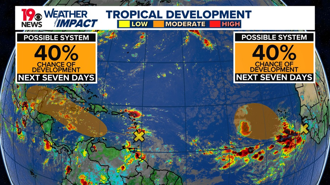
In the Lesser Antilles and Caribbean Sea, a tropical wave is producing disorganized activity and is expected to move westward, with a medium chance of development as it moves into the central and western Caribbean later this week.
Lastly, a tropical wave near Africa is generating showers and thunderstorms, with environmental conditions becoming favorable for potential development into a tropical depression as it moves over the eastern Atlantic.