
COLUMBIA, S.C. — A cold front that moved through the area yesterday will spread cooler and drier air into the Midlands through midweek. Weak low pressure in the Gulf of Mexico and along the Carolina coast may spread showers into South Carolina late this week into early this weekend.
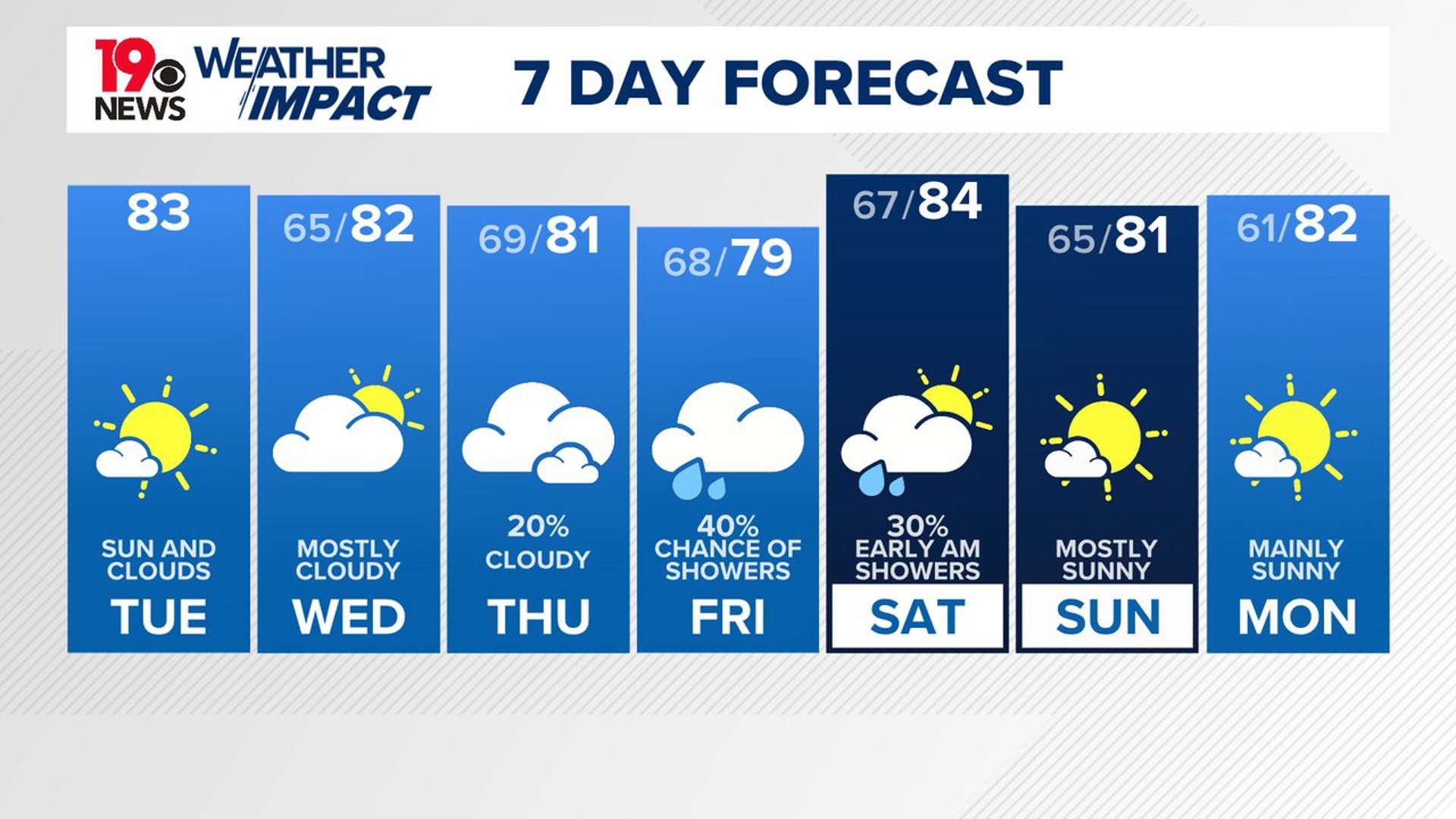
Temperatures this afternoon will be a bit lower than we have seen lately, staying in the low to mid-80s. Some clouds will be around, but they should start to clear out as the day goes on. By tonight, temperatures will drop even further, with lows settling into the middle 60s under partly cloudy skies.

The middle of the week looks to be quite pleasant. Thanks to a high-pressure system moving in from Canada, we will enjoy cooler temperatures and lower humidity, a nice break from the heat and humidity over the last several days.
Highs on Wednesday will be in the lower 80s, and Thursday might be even cooler, with highs only reaching the upper 70s to low 80s. The nights will also be cooler, with lows in the mid-60s. There’s a slight chance of some showers on Thursday, but the rain will not be widespread.
As we approach Friday, there is a higher chance of rain, especially in the evening and overnight. Another area of high pressure will move in afterward, bringing more cool and dry air. Expect temperatures to stay below normal, with highs in the low to mid-80s, and nights remaining comfortably cool.
Tracking the Tropics:
In the Caribbean Sea, a tropical wave is causing disorganized showers and thunderstorms as it moves westward. While the chances of development are low over the next 48 hours, conditions are expected to improve by late this week, possibly leading to the formation of a tropical depression in the western Caribbean or southwestern Gulf of Mexico, with a 40% chance of development within the next seven days.

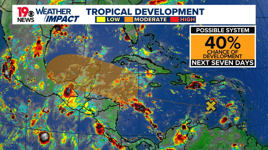
Meanwhile, in the eastern tropical Atlantic, another tropical wave is showing signs of activity. Environmental conditions may support development in the coming days, potentially leading to a tropical depression. This system could bring heavy rains and gusty winds to the Cabo Verde Islands soon.