
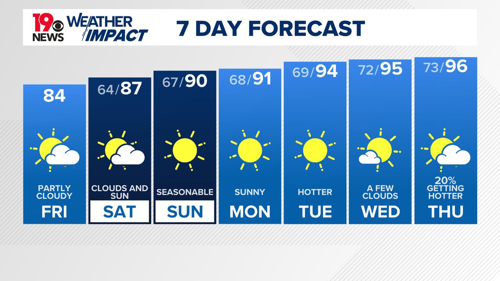
COLUMBIA, S.C. — High pressure will continue to dominate our weather. Dry, cooler conditions will persist through Saturday, but temperatures will start to warm by Sunday. Warmer-than-normal high temperatures are in the forecast for next week. Heat index values will likely return to the triple digits.
This morning, temperatures were much cooler than normal. Lows dropped into the upper 50s and lower 60s. The Columbia airport fell to at least 61 degrees this morning. Cedar Creek reported a low of 53. Our average low temperature this time of the year is closer to 71 degrees.
Today will be partly cloudy, with clouds moving in from the southeast. However, it will still be dry and cooler than normal, with a breeze out of the northeast. High temperatures will be in the lower to middle 80s.

Temperatures will be a little warmer on Saturday afternoon. High temperatures on Saturday will be in the middle to upper 80s under partly cloudy conditions. Sunday will be sunny and seasonable, with highs near 90 degrees.
The heat and humidity will increase next week. High temperatures will gradually climb into the lower to middle 90s by the middle of the week. The humidity will also increase. Heat index values will likely return to the triple digits.
The chance of rain is very small over the next seven days.
Tracking the Tropics
Ernesto dissipated earlier this week, and there has been a lull in activity.
The National Hurricane Center is tracking several tropical waves in the Atlantic, but no tropical activity is expected over the next seven days.