
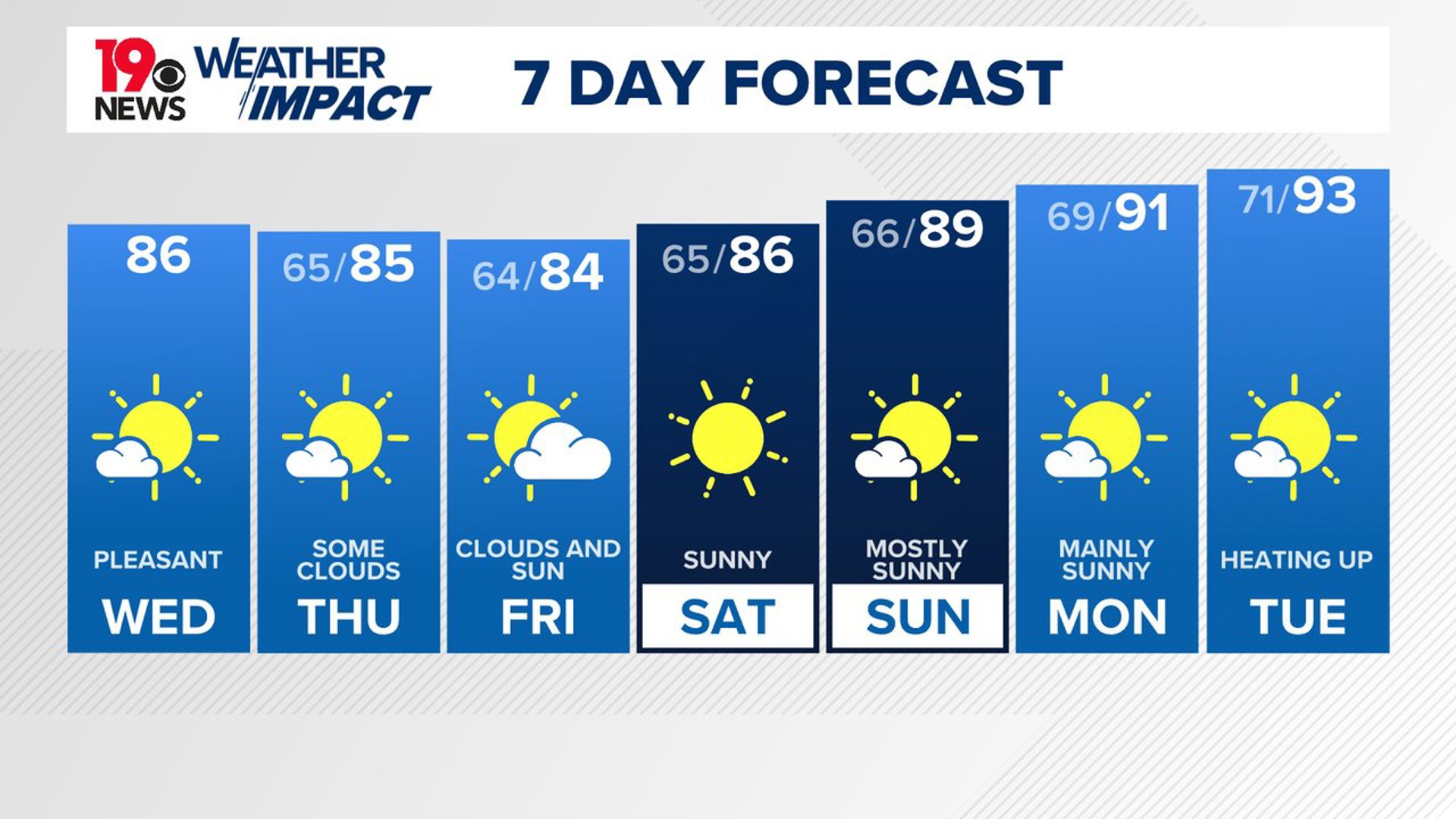
COLUMBIA, S.C. — This week, cooler and drier air will continue to move into the region, bringing a taste of fall-like weather to South Carolina. While a few showers and thunderstorms might occur, they will likely stay south of the Midlands, along the coast of South Carolina. As Sunday approaches, warmer temperatures will begin to return and continue into the early part of next week.
Today and tonight, the upper trough over the region is expected to move further south. A stationary front will linger to the east and south, but any showers or thunderstorms from this boundary should remain outside of the area.

A high-pressure system over the Great Lakes will move toward the Mid-Atlantic, bringing cooler and drier air with northeasterly winds. Afternoon highs today will range from the lower 80s in the north to mid-80s in the south, with dew points in the lower to mid-60s. Tonight, temperatures will drop to refreshing lows in the lower to mid-60s.
From Thursday through Friday night, cooler and drier conditions will continue. A surface ridge and an upper-level trough along the East Coast will dominate the weather pattern. The main surface front will stay well to the south and east, keeping the best chances for rain along the coast near the sea breeze. Afternoon temperatures in the mid-80s combined with lower dew points will make the afternoons feel more refreshing. Overnight lows will be close to the dew points, dropping to the low to mid-60s.
Looking ahead to the weekend, mostly dry conditions with cooler temperatures will persist through Saturday. However, as the upper-level trough weakens and the surface trough to the south and east starts to diminish, there will be a slight increase in moisture each day. This could lead to isolated afternoon showers or storms, primarily near the coast. Saturday will still see highs in the mid-80s, but by Sunday through Tuesday, temperatures will gradually increase, reaching around 90 to the lower 90s by Tuesday.


Tracking the Tropics:
Ernesto has dissipated. No tropical activity is expected over the next seven days.