COLUMBIA, S.C. — The Midlands received some much-needed yesterday and today. Unfortunately, it was too much of a good thing for many areas, especially in the southern half of the Midlands. The showers will decrease this afternoon. High temperatures will still be above normal for November.
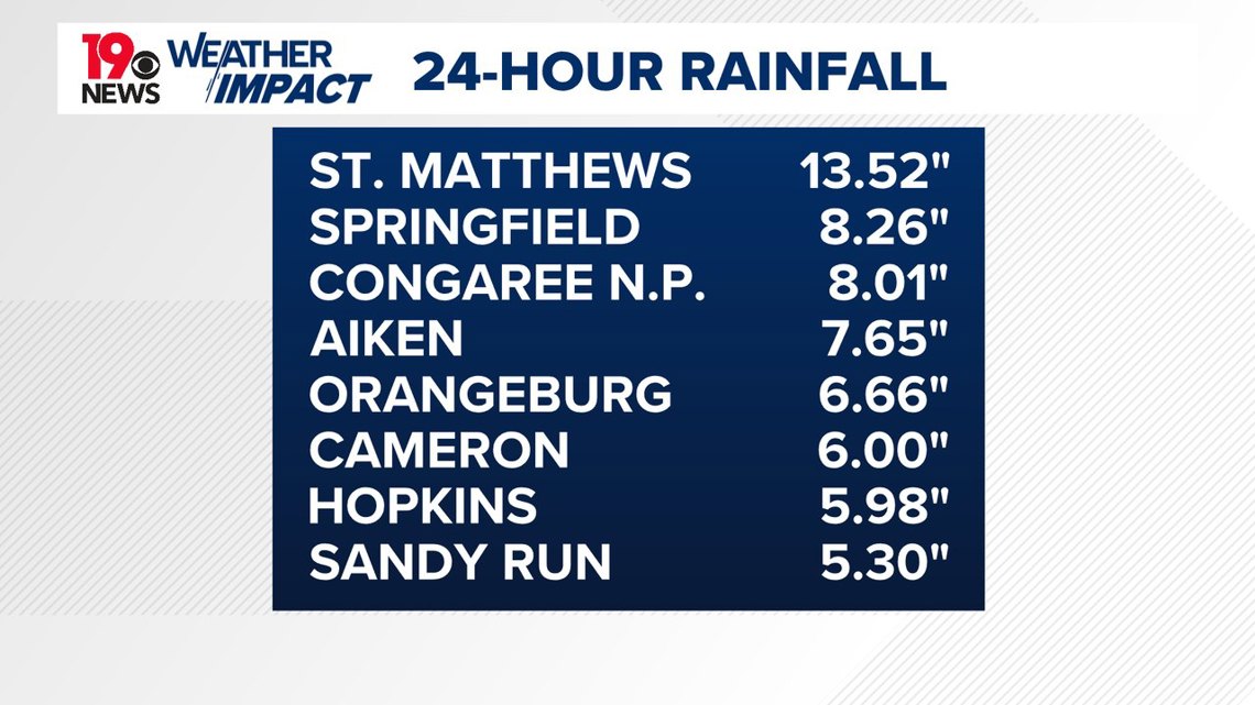
The rain was heavy late Wednesday and early this morning. The Columbia airport reported 1.39” of rain yesterday. Many areas in the Calhoun and Orangeburg counties received over 10” of rain over the last 24 hours.
We got a report from a News 19 viewer who said they had gotten over 18” of rainfall since Wednesday afternoon in the St. Matthews area. The NWS reported 13.52” of rain near St. Matthews too. Earlier today, a portion of I-26 was closed due to flooding.


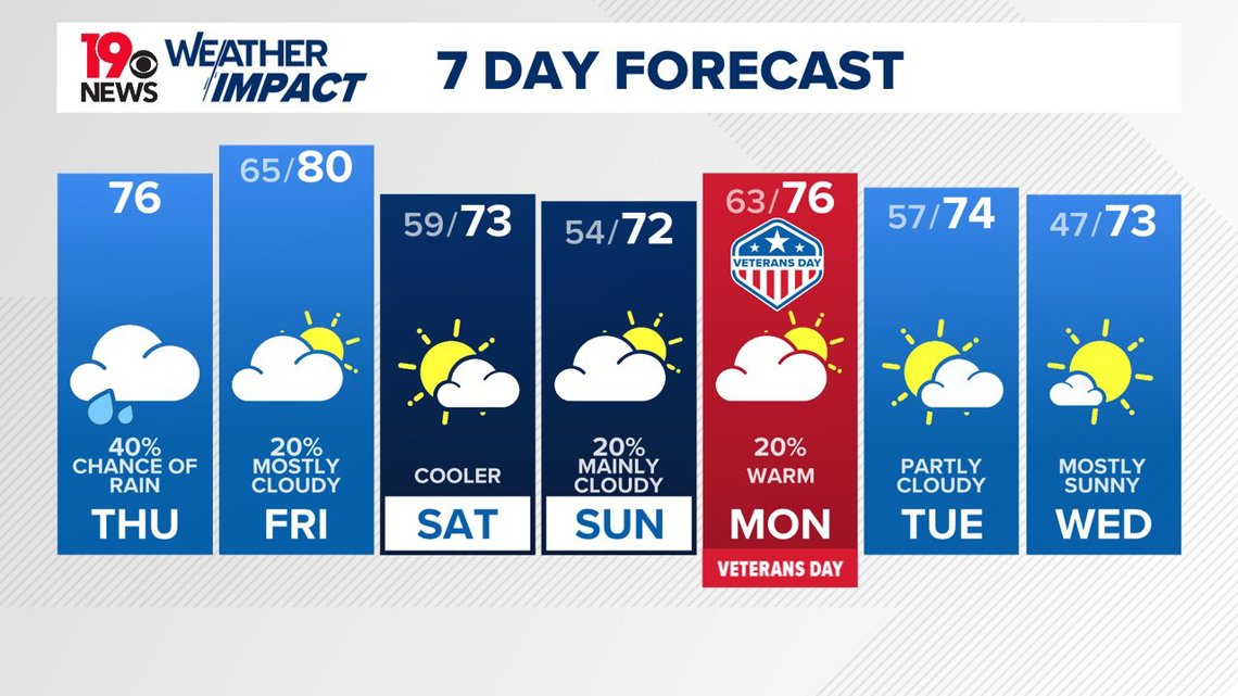
There will be a chance for more rain this afternoon, but the showers will decrease. High temperatures will remain above normal, in the middle to lower 70s.
A cold front will approach the area Friday. The clouds will hang around, but the chance of rain appears to be small. High temperatures on Friday will be in the upper 70s to near 80 degrees.
The front will move south of the area on Saturday. This will bring cooler and slightly drier air, with high temperatures ranging from the upper 60s in the northern areas to the mid-70s.


On Sunday, some moisture will return ahead of a weak trough, bringing a brief period of isolated rain. As the work week begins, drier conditions are expected to prevail through mid-week. In the longer term, above-normal temperatures remain likely.

