
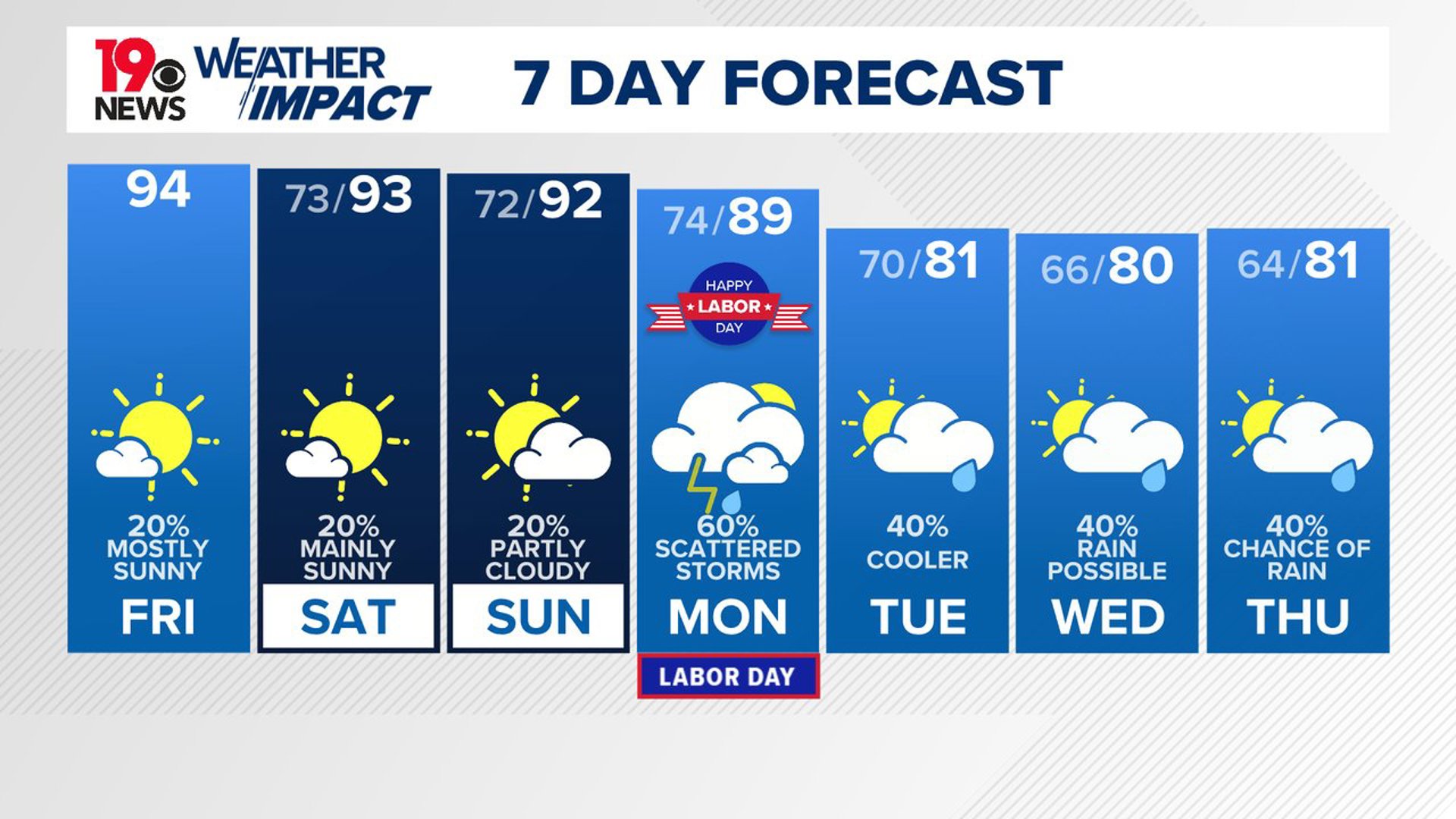
COLUMBIA, S.C. — Hot and humid conditions are set to continue through the weekend, with the possibility of isolated afternoon showers and storms. Early next week, a cold front will bring cooler and more unsettled weather to the region.
Today, a few showers and storms are expected to develop, particularly in the northwestern part of the area. The temperatures will remain slightly above average, with highs in the low to mid-90s.
Some isolated showers or storms will be possible this afternoon and early this evening. With drier air in place aloft, any storm that does develop has the potential to produce strong to possibly damaging wind gusts.

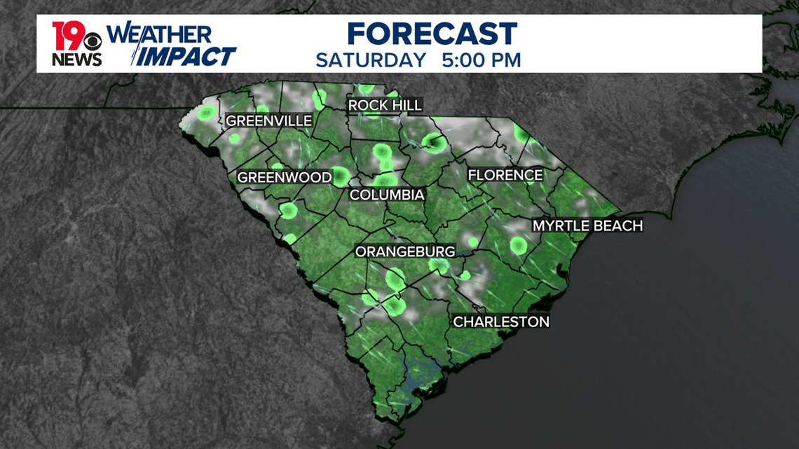
As we head into Saturday and Sunday, temperatures will be slightly cooler but still humid, with heat index values around 100 degrees. Showers and storms will continue to develop each afternoon. The persistent upper ridge over the region will begin to break down on Saturday as an upper trough digs southeastward into the Great Lakes region.
This will push a cold front into the Mid-Atlantic and central Appalachians, but it will remain north of our area on Saturday. Precipitable water values will be like those of previous days, with isolated afternoon storms expected. Severe storms are unlikely, but if a strong storm does develop, it could produce damaging wind gusts.
On Sunday, the upper trough will continue to move southeastward, pushing the cold front closer to our area. A surface trough will likely develop in the area, which could be a focus for afternoon showers and storms. Temperatures will remain near slightly above normal, with highs in the lower to mid-90s and heat index values around 100 degrees.
Looking ahead to Monday through Thursday, a pattern change is expected to bring cooler and more unsettled weather. On Monday, a cold front is forecast to move through the region, increasing rain chances.
An unusually strong surface high will build into the region from the north on Tuesday, bringing cooler and drier air. Temperatures are expected to drop into the upper 70s and lower 80s by midweek, with overnight lows falling into the 60s and possibly the upper 50s in some sheltered locations.
Tracking the Tropics
A tropical wave over the central Tropical Atlantic is creating scattered showers and thunderstorms, which are becoming slightly more organized near its center. The conditions in the area are favorable for gradual development, and there is a chance that a tropical depression could form by early next week as the system moves westward at 10 to 15 mph, nearing the Lesser Antilles. By the middle of next week, the system is expected to continue moving westward to northwestward across parts of the eastern and central Caribbean Sea. The chance of formation within the next 48 hours is low at 10% but increases to 50% within the next seven days.

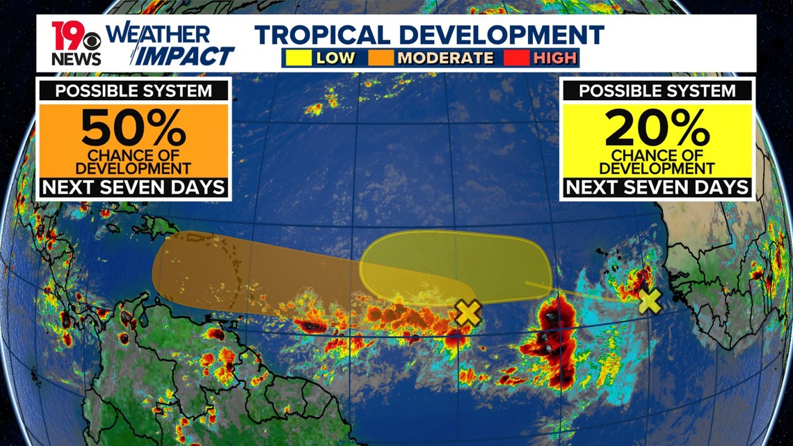
Meanwhile, another tropical wave just west of the African coast is producing disorganized showers and thunderstorms. There is a slight possibility that this system could develop slowly through the middle of next week as it moves west-northwest or northwest over the Eastern Tropical Atlantic. The chance of formation within the next 48 hours is very low, near 0%, with a 20% chance over the next seven days.