
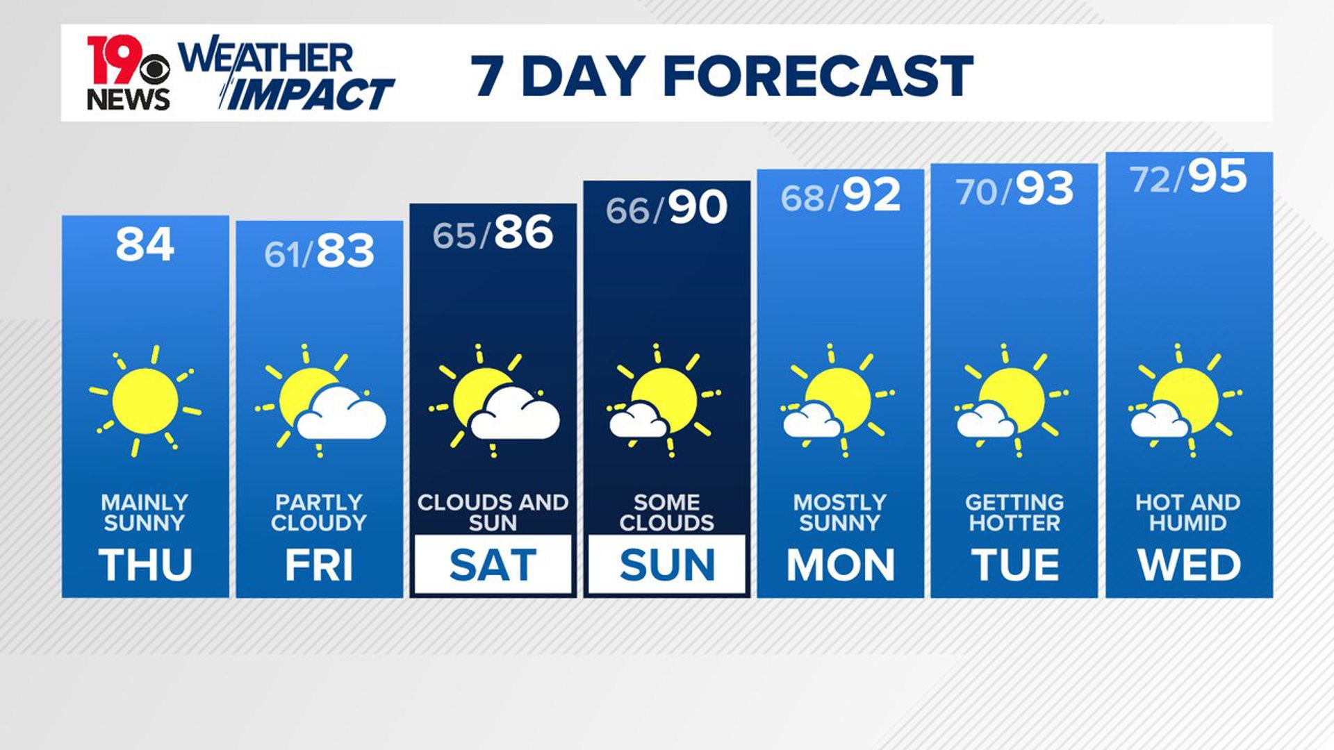
COLUMBIA, S.C. — High pressure will continue to dominate our weather as cooler and drier air remains over South Carolina. A few showers and storms will be possible along the coast over the weekend, but the Midlands should remain dry. Gradually, the heat and humidity will return to the area.
Wednesday was very pleasant and even fall-like for parts of the state. The Columbia airport dropped to 66 degrees. Cedar Creek reported a low temperature of 59° Wednesday morning. Temperatures in the afternoon were generally in the lower to middle 80s. The lower than normal humidity levels made it feel pretty good outside, especially for August.

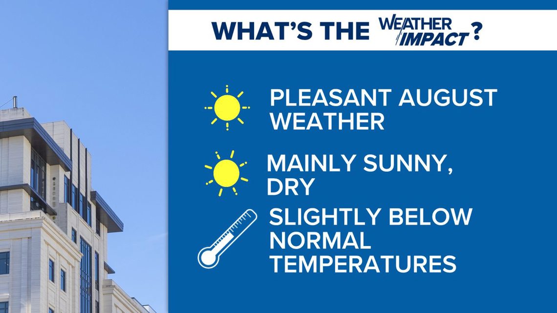
Another fall-like day is in the forecast for today. Skies will be mainly sunny this afternoon. High temperatures will be in the lower to middle 80s. Our average high temperature this time of year is closer to 90 degrees.
Dew points will remain in the middle to upper 50s this afternoon. It will be very pleasant. Tonight, low temperatures will drop into the lower 60s. Several places will likely drop into the upper 50s Friday morning.
Skies will be partly cloudy Friday, but things will remain dry. High temperatures will be in the lower to middle 80s. Moisture will begin to increase as the humidity builds, but the weekend is forecast to be dry across the Midlands.
A return to typical summer weather is expected by Sunday. High temperatures will return to near 90 degrees. The heat and humidity will continue to build next week. Highs are expected to climb into the lower to middle 90s. Heat index values will likely return to the triple digits.