
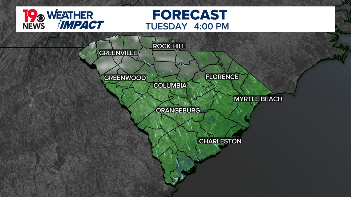
COLUMBIA, S.C. — A reinforcing cold front is expected to move through tonight, potentially bringing isolated showers over the northern Midlands. This front will bring the coldest air of the season, with below-normal temperatures forecasted to persist for the remainder of the week. Over the weekend, an upper ridge will build over the region, leading to a gradual warming trend.
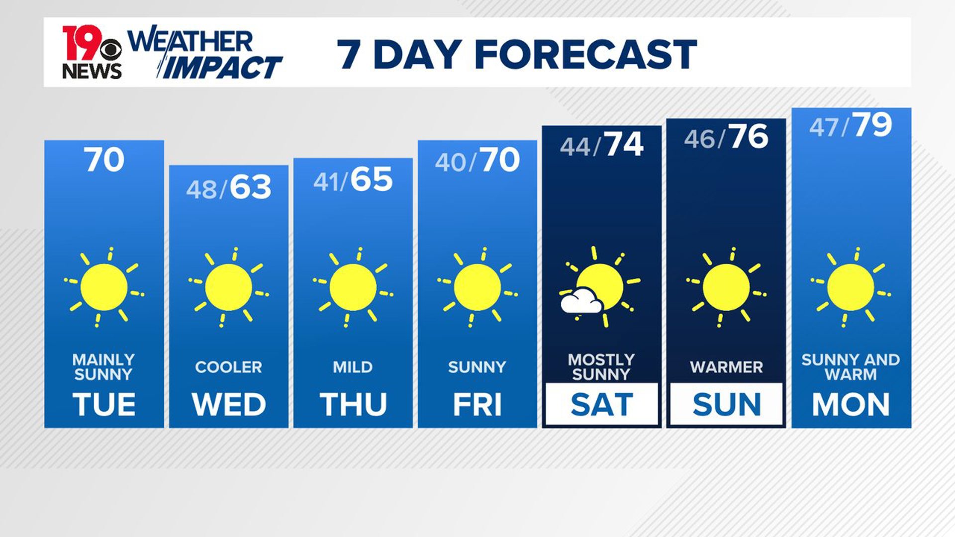
Dry and cool conditions are expected today as high pressure dominates. High temperatures will be near 70 under mainly sunny skies. A secondary front is expected later tonight, increasing north-northwest winds and bringing the potential for isolated showers across the northern Midlands and between 2 AM and 7 AM.

Much cooler air moves into South Carolina Wednesday, with temperatures dropping 10-15 degrees below normal. Dry weather is expected to persist as high pressure strengthens over the region.
Temperatures on Wednesday and Thursday nights will be especially cool, with lows about 10 degrees below normal. Low temperatures are expected to fall in the lower 40s. Some of the traditionally cooler areas may drop into the 30s.
As the week progresses, the weather will remain calm with dry conditions continuing. An upper-level area of high pressure builds over the East Coast, resulting in a gradual warming trend over the weekend.
By Friday, temperatures will be in the upper 60s to near 70, but by Monday, highs will climb into the upper 70s. Moisture levels will remain low, ensuring continued dry weather through the extended forecast period.
Tracking the Tropics:
A well-defined area of low pressure over the central tropical Atlantic is producing occasional showers and thunderstorms, but development is unlikely in the next couple of days due to dry air. However, conditions may become more favorable for gradual development later this week as the system moves west-northwest, with a potential tropical depression forming near the Leeward Islands by the weekend. The chance of formation over the next 48 hours is low but increases to 60% over the next 7 days.

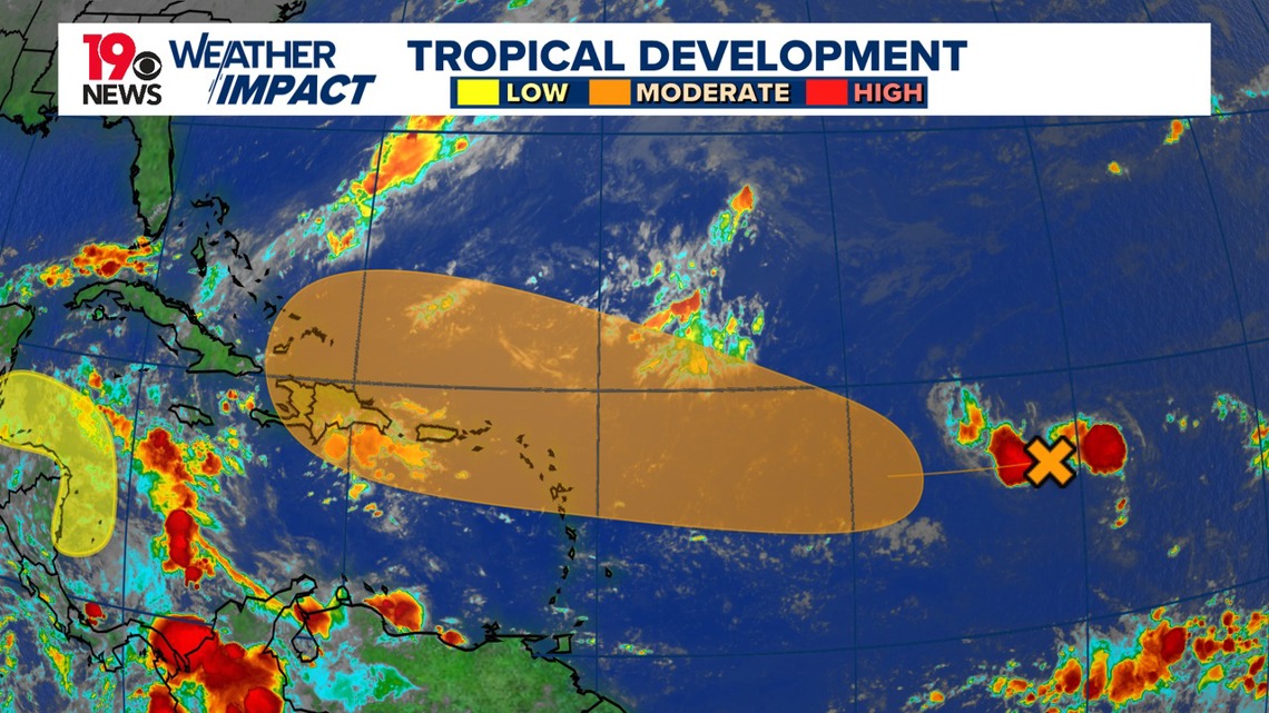
Meanwhile, a broad low-pressure area could develop over the southwestern Caribbean Sea later this week, with a 30% chance of development within seven days. Locally heavy rainfall is expected in parts of Central America regardless of development.