
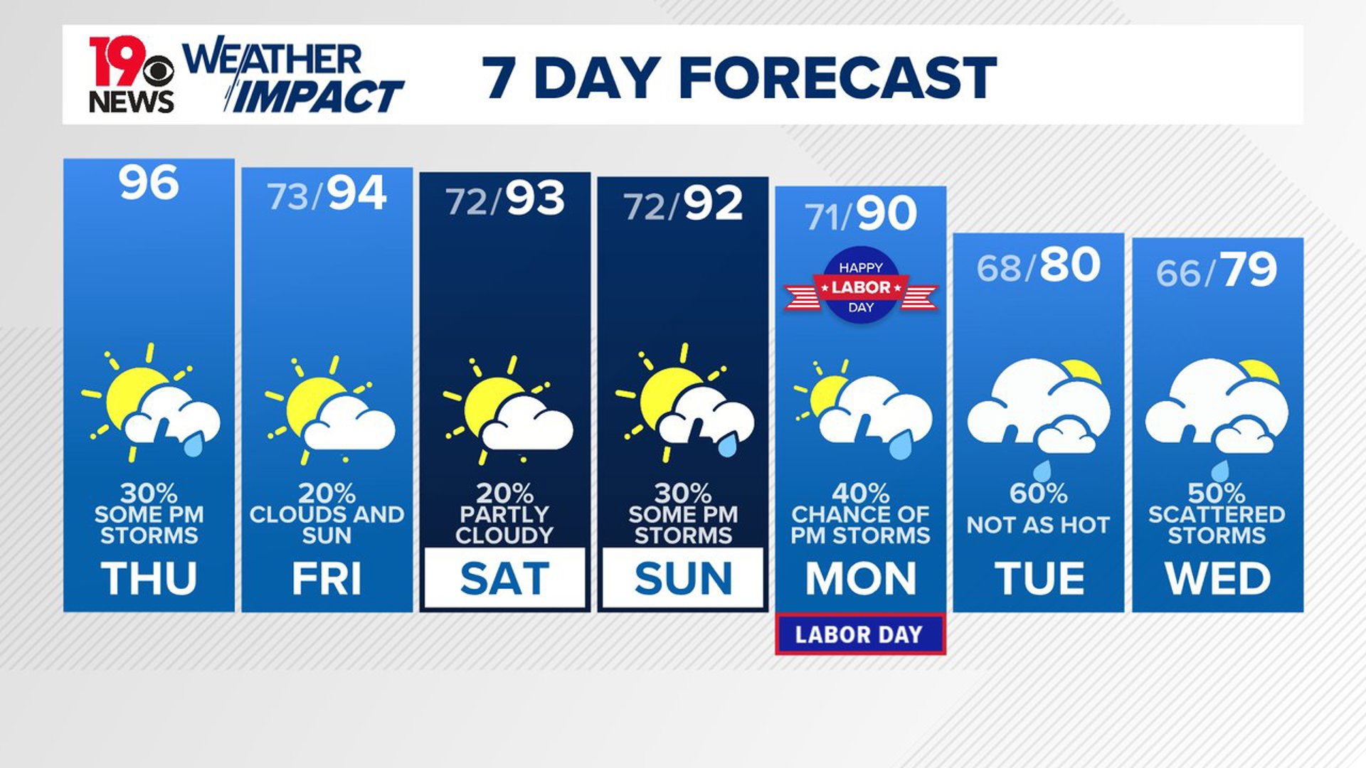
COLUMBIA, S.C. — Expect hot and humid conditions to continue as we head into the weekend. Afternoon showers and storms may pop up here and there. A cold front is on its way and is expected to bring more unsettled weather and cooler temperatures by early next week.
For today, the weather remains hot and sticky, with heat index values ranging between 100 and 105 degrees. High pressure continues to dominate the southeastern states. High pressure over the western Atlantic will keep southerly winds flowing across the region.
Although the atmosphere remains mostly stable, it is forecast to become moderately unstable this afternoon. This could lead to isolated showers and thunderstorms, especially with the moisture present in the lower levels of the atmosphere.

While any storms that do develop are unlikely to be severe, they could still bring strong winds due to the significant dry air in the mid-levels. Expect temperatures to climb into the middle to upper 90s, with heat index values reaching up to 105 degrees. Tonight, temperatures will remain mild, with lows in the lower 70s.
As we move into Friday and Saturday, the heat and humidity will continue. Temperatures are expected to stay in the low to mid 90s, with heat indices around 100 to 105 degrees. The upper-level ridge will begin to weaken, allowing for a slight cooling trend, but it will still be hot.
Afternoon showers and storms will be possible, particularly in the northern part of the area. The cold front will begin approaching from the Ohio Valley, increasing the chances for showers and storms. Overnight lows will remain in the low 70s.
Looking ahead to Sunday through Wednesday, the cold front is expected to move into the area. This will bring a much-needed break from the heat with cooler temperatures and higher chances of showers and storms. The exact temperature forecast remains uncertain, but it is clear that a significant cooldown is on the way.