COLUMBIA, S.C. — As high pressure takes control today, the rest of the workweek will be cool and dry across South Carolina. A few more clouds will be possible over the weekend. Some rain may develop Sunday.
Today - Tonight
This morning ushered in a much colder start compared to yesterday, with cold air continuing to flow into the area behind a departing front now well offshore. Clear skies dominate today, and satellite data shows minimal atmospheric moisture.
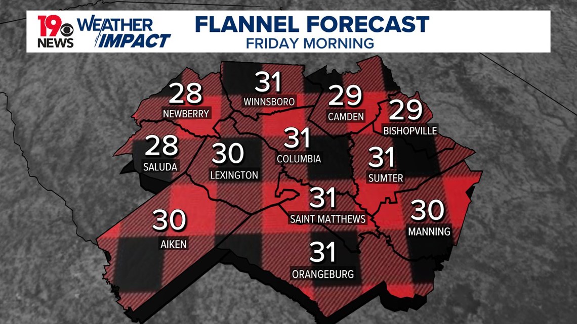
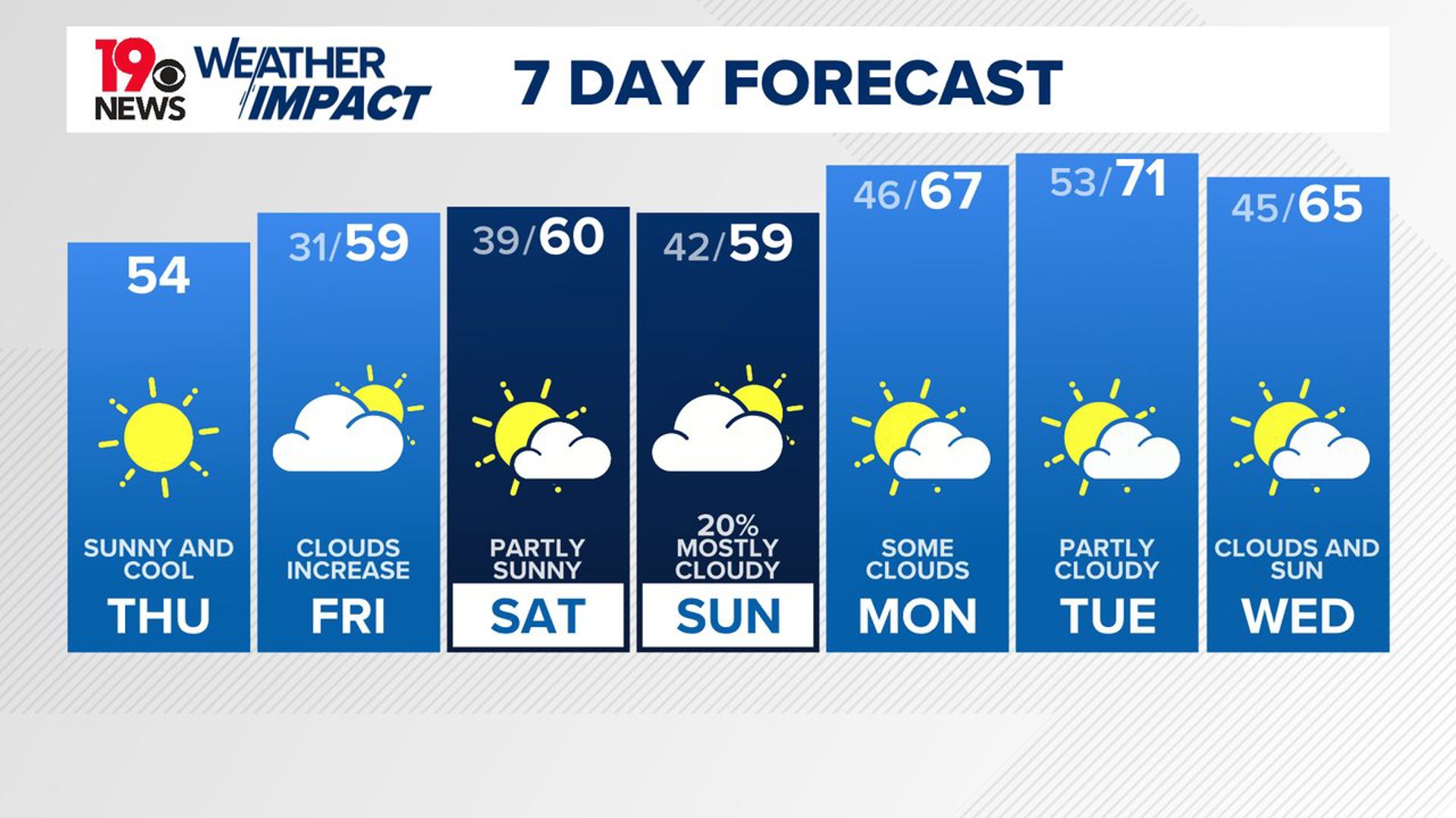
Afternoon highs will stay below average, peaking in the lower to mid-50s. Tonight, the high-pressure center will move closer to the Mid-Atlantic, creating favorable conditions for radiational cooling. Overnight lows will drop to around 30 degrees under mostly clear skies.


Friday
Friday will continue the trend of dry and cool weather. High pressure ridging along the East Coast and limited atmospheric moisture will keep the area free of rain, though increasing clouds are expected as a weak shortwave passes overhead. Temperatures will again stay slightly below normal, with highs reaching the middle to upper 50s.


Saturday - Sunday
By Saturday, a few clouds will be possible. Rain chances will begin to rise late Saturday night, especially north of the I-20 corridor, as upper-level forcing combines with weak lift in the atmosphere. Highs on Saturday will vary across the region, with cooler mid-50s in the western Midlands due to wedge-like conditions and warmer lower 60s in the southeast.
Looking ahead to Sunday and into early next week, the weather pattern becomes more unsettled. A series of low-amplitude disturbances will bring periodic chances of rain, particularly Sunday as the first wave moves through the Ohio Valley and into New England.


Monday - Wednesday
Showers will be possible over the western and northern Midlands due to northeasterly surface flow and additional lift. Temperatures will start to trend warmer by early next week as high pressure shifts offshore and southerly winds develop.

